Post #104: The Monarchs

August 5, 2021

Knowing that even at an altitude of 7,500 feet it was going to be hot in the thin-air sun and that the planned trail was on a western slope—not the place to be in the afternoon sun—we’d set an alarm (the horror) to wake us at 6:00 am so we could get an early start on the Monarch Lakes Trail. We’d read that the trail was eight-and-a-half miles long with 2,400 feet of elevation, which we put in the Pretty Serious Hike column. In the end, we also put it in the Top Five Best Hikes Ever column.

Susan bundled up in her down jacket (over shorts) and poured what was left of the soy milk into a cereal bowl--providing us with a spare water container

When we stepped out of the truck, it was 48 degrees, which made dressing for the hike problematic. It was chilly now, but later it would be sunny and warm and I was hoping not to be a pack mule for several layers of clothes that would have to be shed along the trail. Another issue was water. We’d neglected to bring our 100-ounce Camelbak water carrier so we scrambled to find something else to supplement our two usual hiking water containers. An empty one-liter soy milk carton did the trick.

After a quick breakfast we drove a half-mile up the road to a parking lot by the trailhead, already nearly overflowing with cars. There were no other people there though, as most of the cars belonged to backpackers who had been there awhile during their multi-day treks. 

The sun was still behind the mountains when we started out but soon was casting gentle light on Sawtooth Peak and then on the hillsides of the alpine cradle as we continued our upward trek.

View from the trail after dawn
The sun gradually made its way down the edge of the mountain

The Monarch Lakes Trail climbed right away into glacially carved Mineral King Valley at 7,600 feet and it wasn’t long before we were sucking air. About a half hour into the hike, a group of three young people (all college athletes judging by their shirts) passed us, huffing and puffing themselves. They were the only group of hikers we’d see heading up the trail—and they turned off at an early fork in the trail. This was a remote area and most hikers didn’t do the trails unless they were staying overnight in the wilderness. A few hours and many switchbacks later we would see some backpackers descending the trail. That was all until we reached the summit where there were a handful of additional backpackers.

This hike is gonna be great!
Capturing the morning sun

The steep but spectacular trail climbed across the mostly exposed slopes. We were happy for the cool morning temperatures as we headed up a series of very steep switchbacks.

Small but noisy waterfall in the nearby canyon
Ten feet away, this deer was unfazed by us

As we ascended, the sound of rushing water somewhere nearby grew louder. It wasn’t long before we found the source of the mesmerizing sound. After about a mile, we found a small waterfall pouring through the scrubby canyon adjacent to the trail. A deer only a few feet from us peeked out from under nearby tree branches. Perhaps we’d interrupted her plans for a cool drink.

Here comes the sun
A couple of hours into the hike with less layers . . . and still smiling

The soaring granite peaks that surrounded us were too distant to provide shade as the morning began to warm. It wasn’t long before my pack was full of the layers we’d peeled off. With the extra water, I was indeed feeling like a pack mule. 

Entering a thankfully shady forest
The seemingly-endless ascent
Approaching one of oh-so-many switchbacks

Eventually the trail crossed a pretty little creek, then brought us quite suddenly into fragrant pine forests and welcome shade. We climbed ever-higher, eventually through wind-stunted cedars and pine, knowing that in winter, many feet of snow covered this high country. Our map said we’d climb through dozens more switchbacks and as Susan counted each one out loud, we agreed that it would be better if she did so in her head. We took a break at 10,000 feet and we could tell the air was even thinner, though it was a perfect 60-something degrees and sunny.

Out of the forest again
Windswept and twisted pines

Eventually, we hiked above the tree line and back into the sun. I’d regret forgetting SPF lip balm but at least I had a hat.

View looking up from where the rocks had fallen
View looking down to where we'd fall if we weren't careful

A mile or so later, the trail crossed a massive talus slope. Though the trail leveled out somewhat, the drop-off was steep.

From our vantage of some 10,000 feet, we had a clear view of the dusty and smoky air hanging in the valley below

As we trekked across the sharp rocks on this section of the trail, we wished we’d worn our tough hiking boots instead of our lightweight hikers. 

Arriving at Monarch Lake #1
Looking back at lake #1 from the other side before beginning our ascent to lake #2

Finally, we arrived the first of two small alpine lakes, both named, oddly, Monarch Lake. Sitting at the base of 12,343-foot Sawtooth Peak, the first lake was spectacular. The deep turquoise water was set in a glacial cirque, a giant granite bowl, and a cool wind blew off of it.

Beyond Monarch Lake #1 there was a 300-foot-high shelf that hid the larger Monarch Lake #2. After a brief rest, we continued up. 

What's another 300 feet?
Where's the trail?

There was hardly a trail at all and we scrambled through brush and across huge steep slabs of smooth granite, then picked our way through boulders. 

Suddenly, we could see a fairly crude rock and cement dam. How on earth (and why) a dam was constructed there was a mystery. We learned later that around 1900, the dam was built by Mt. Whitney Power Company for power generation. Now, Southern California Edison regulates the larger Monarch Lake water flow used to feed a hydro-electric facility downstream. 

A dam???

Diving a little deeper, we learned that the whole area had eventually been opened up in the late 1890’s for lumbering by the Mineral King Road but public outcry over felling giant sequoias eventually brought the area under the protection of the U.S. Forest Service and ultimately it became part of Sequoia National Park. Aside from the crude dam and an even cruder backcountry camp, there was now no evidence of civilization.

Monarch Lake #2

At the larger lake, a cool wind blew and we found shelter behind a large boulder looking out at the lake as we ate lunch. Other than a handful of backpackers on the far side of the lake, we had this incredible place to ourselves.

We found a spot where we could walk down to the lake and test the water. It wasn't too cold by the shoreline but undoubtedly was much colder in the center

We were at 10,600 feet now and a quick check of our GPS found that we’d already hiked five-and-a-half miles, so the out-and-back trail was more like 11 miles total rather than the advertised eight. Our GPS also revealed that we’d gained about 3,000 feet rather than the advertised 2,400. No wonder we were beat from the climb.

While we rested and enjoyed the serenity of the upper lake we contemplated how we’d gotten here. We’d started at the base of Mineral King Road yesterday where it was over 100 degrees, climbed through 700 tortuous, car-overheating turns on a lousy road to get to the campground, woke at 6:00 am, then hiked five-and-a-half miles and 3,000 feet to sit in a huge glacier-carved bowl with twin lakes and treeless granite peaks surrounding us. We grinned at each other. Worth it!

The trip back was long but equally spectacular. Our speed made us watch our footing as we headed down the trail. Susan takes the lead uphill because she’s slower and I take the lead downhill because sometimes my knees make me slower. But today, we hiked fast downhill, reveling in a vanilla-scented Ponderosa pine forest along the way. 

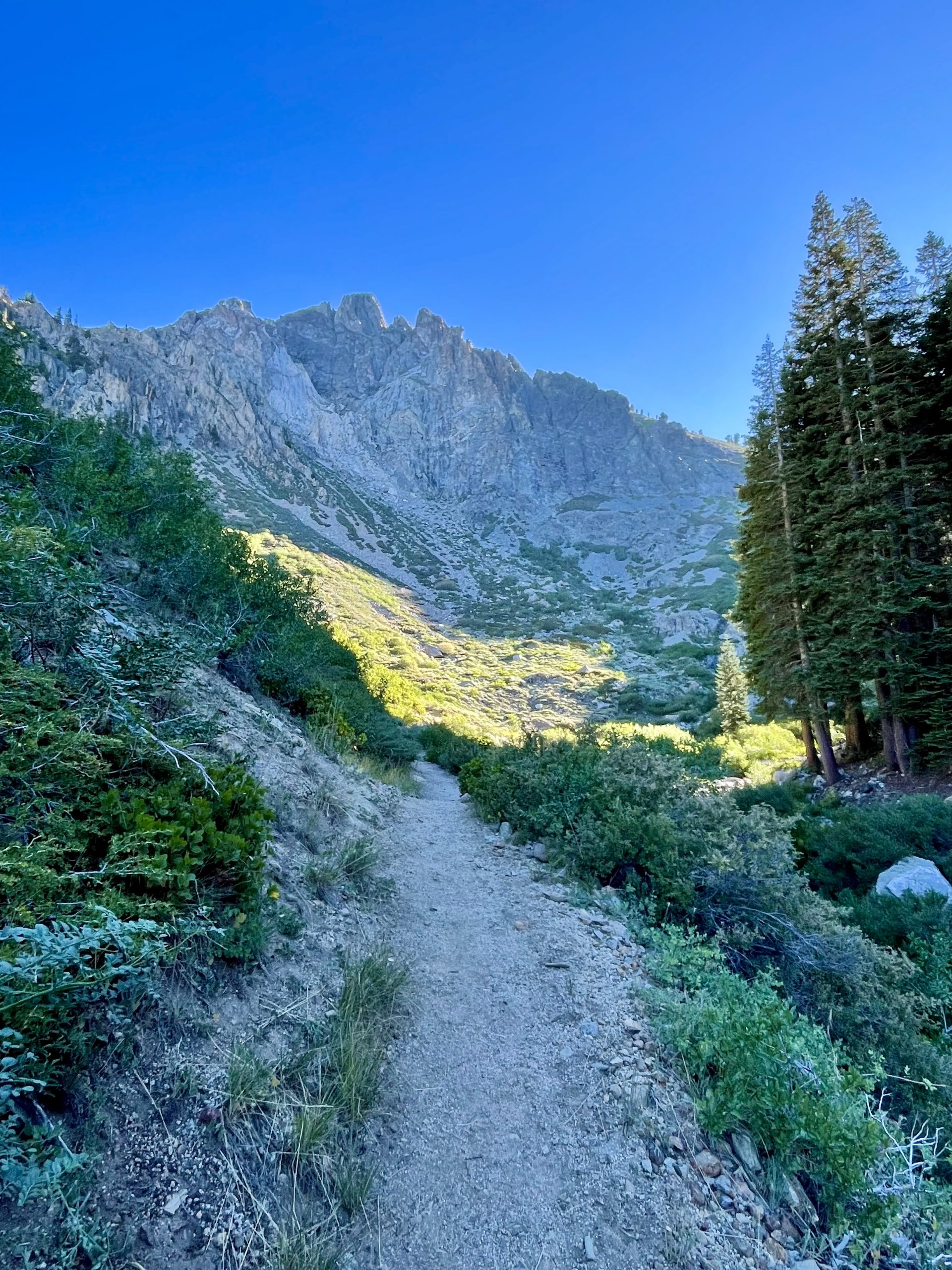
The temperature increased into the 70’s as we descended. Eventually, we left the forest again and hiked through the scrub on the sunny slopes. When we saw some other hikers struggling up the mountain in the warmth of midday sun, we were glad we’d started the climb early. 

Nope, not tree-hugging. Instead, Susan was inhaling the strong vanilla scent of the Ponderosa pine

At one point Susan passed me by saying she wanted to run downhill for a bit. I tried too but after a hundred yards, my knees told me to stop.


Finally, at the bottom of the trail, a man in a minivan in the parking lot asked me in a heavy accent if this was a nice trail. I saw his wife and two small children and told him it was beautiful but nearly six miles and over a half a mile of elevation to get to the lakes. He thanked me, said something to his wife and turned the van around.

And back down we go on the long and winding (and narrow and steep and barely paved) road

The next couple of hours were spent on the tortuous Mineral King Road, much of it descending in first gear, dodging the occasional fool who appeared around the blind turns heading right for us on the one-and-a-half lane road.

At the bottom, it was already over 100 degrees as we headed to a hotel for the night in Bakersfield. The next couple of days would be spent with family and friends in San Diego and Ventura and we needed to clean up and readjust our minds from where we’d been the last three days to being acceptably social again.

Leave a Reply

Share this post