Post #21: That is one tight ass canyon

March 12, 2020

The sunset the night before in the Alabama Hills was followed by a perfect moonrise. When I stepped out of the truck at about 2 am, the moon was throwing enough light to read a book by. I borrowed Susan’s iPhone 11 Pro and took some shots in night mode that I was sure would be too dark. 

Shimmering stars in the middle of the night

When I looked at the photos in the morning, I was surprised to see they were bright, almost as if they’d been taken in the daylight, with some unusual coloring and shadows. They were stunning in a way I’ve never seen, as moonlight was lighting the snow-covered peaks as well as the hills around us.

The colors kept changing as the rising run bathed the western mountains

Later, we woke to a killer sunrise as the snow-covered mountains were clearly intent on showing up the dramatic desert. Susan couldn’t stop taking pictures of the ever-changing view. The full moon had not yet set as the sun climbed over the eastern hills and glowed on Mt. Whitney to the west, first in a pinkish hue, then bright orange, and finally white. The Alabama Hills remained in shadowy light in the foreground.

We broke camp and went to the small town of Lone Pine, 15 minutes from our campsite. We had a surprisingly good breakfast at the Mt. Whitney Restaurant. I had the daily egg special and half of Susan’s oversized platter of pancakes. It was a classic western-style diner whose walls were decorated with photos from old Western movies. 

Chilly morning high above Death Valley

After, as we drove south, the mountains faded and became smaller before we turned west off the main highway to another road that would take us to Death Valley. A beautiful two-lane road with almost no cars wound its way up and down small valleys and then landed us above Death Valley, where we stopped and hiked up an overlook of the vast, dry valley below. 

The road then wound down the hills and finally deposited us on the large valley floor. From there, the straight highway rose away in the distance to nearly a mile high into the heart of the park.

Remains of a gold mining operation
An aerial tramway was used to transport the gold ore

We decided to begin our exploration of Death Valley by checking out some of the historical sites. First, we drove down a rough road to the remains of the Keane Wonder Mine. The remains of the old gold mine, mill, and aerial tramway included decaying wooden structures and rusting equipment. We hiked up a steep hill to the structure and then walked on a narrow path around the periphery where we came across shards of old glass and other debris as well as crumbling tunnels and shafts that were nominally protected by metal nets.

Remains of concrete buildings in the ghost town
This was once a bank
A house made of glass bottles is one of the few standing buildings

After leaving the mine, we visited the ghost town of Rhyolite—another remnant of California’s gold rush era. Rhyolite felt odd – rather than a few run-down wooden structures like other ghost towns we’ve seen, it had been built in the early 1900’s to last with two- and three-story concrete buildings. Up to 5,000 people lived there at one time. The gold boom town soon busted and the buildings began to fall apart after the residents left, except for a small house whose walls were built from glass bottles, bottom side facing out, a train station complete with a wooden caboose, and the crumbling concrete of numerous other structures. All in all, the town lasted a scant 15 years.

We decided next to tackle the toughest road since we drove to Agua Verde in Baja Mexico – Titus Canyon Road. Driving the road was said to be “an adventure for high clearance vehicles only, preferably with 4wd.” How could we not? The 26-mile dirt road started with a simple washboard surface but changed quickly into a one-lane rock-strewn trail that slowly climbed thousands of feet. The views of the surrounding mountains were nice, but nothing could prepare us for the inside section. 

Red Pass on Titus Canyon Road
One of many twisting switchbacks

Titus Canyon Road kept climbing and twisting until it finally reached the top at Red Pass, so named because of the sudden red clay that colored the rough gully-filled road. Climbing up, the temperature dropped from 78 to 60 degrees. The road down the other side of the pass was even trickier than the way up, with steep drop-offs at sudden sharp rocky turns, washouts and large rocks accompanied by an occasional muddy crossing, all the while taxing the truck’s brakes with a 10-20 percent grade. We wound slowly and tortuously down. Driving downhill in low gear, twisting and turning on a rough gravel road with contorted rock walls of nearly every hue, it was hard to decide where to look. 

We saw only two other vehicles, both Jeeps, and they seemed surprised to see a three-ton SUV lumbering along the tough trail. At one point, the road passed the ghost town of Leadville, much smaller than Rhyolite and with an even sadder story. Three hundred people were scammed into buying into the gold rush town that lasted only seven months before everyone left, leaving behind a few fallen down buildings and many more broken dreams.

Eventually, the road descended to a wash at the foot of the canyon where two- to three- hundred-foot high walls hemmed in the road, at some points less than twenty feet apart, and where the twisting turns made me consider folding in the truck’s mirrors. So tall were the walls that sunlight could reach the bottom for only minutes a day. The wall textures ranged from smooth, where the huge torrents occasionally flowed, to loose rocks higher up waiting to fall from the rotten cliffs. It was hard to watch the road or look for the resident bighorn sheep.

For miles, the road snaked down through the canyon, at times narrow, then a hundred feet wide. I began to feel like I was in a video game, wrenching the steering wheel first left, then hard right, riding the brakes, looking ahead for more turns.

Once again, we stumbled upon petroglyphs

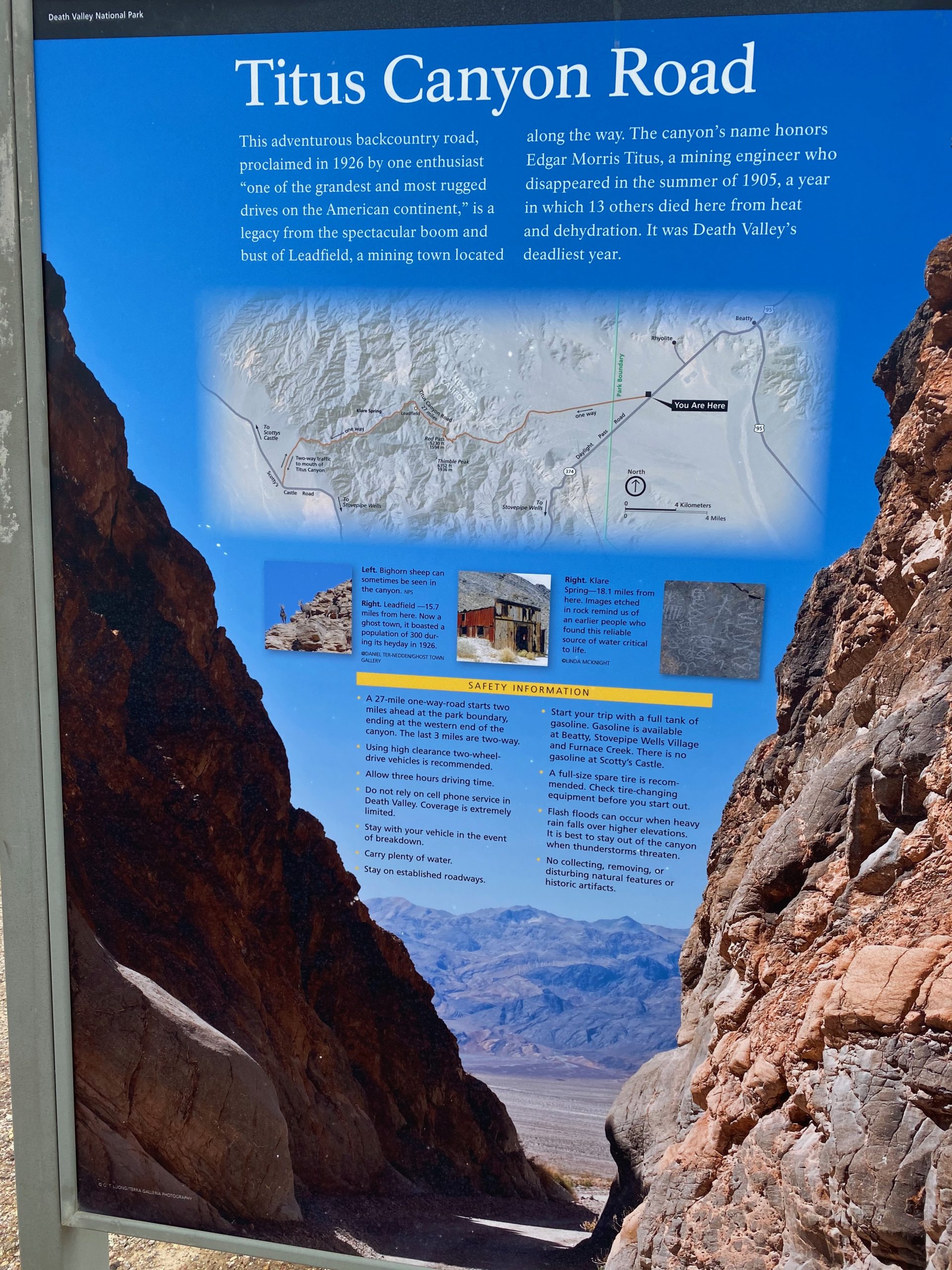
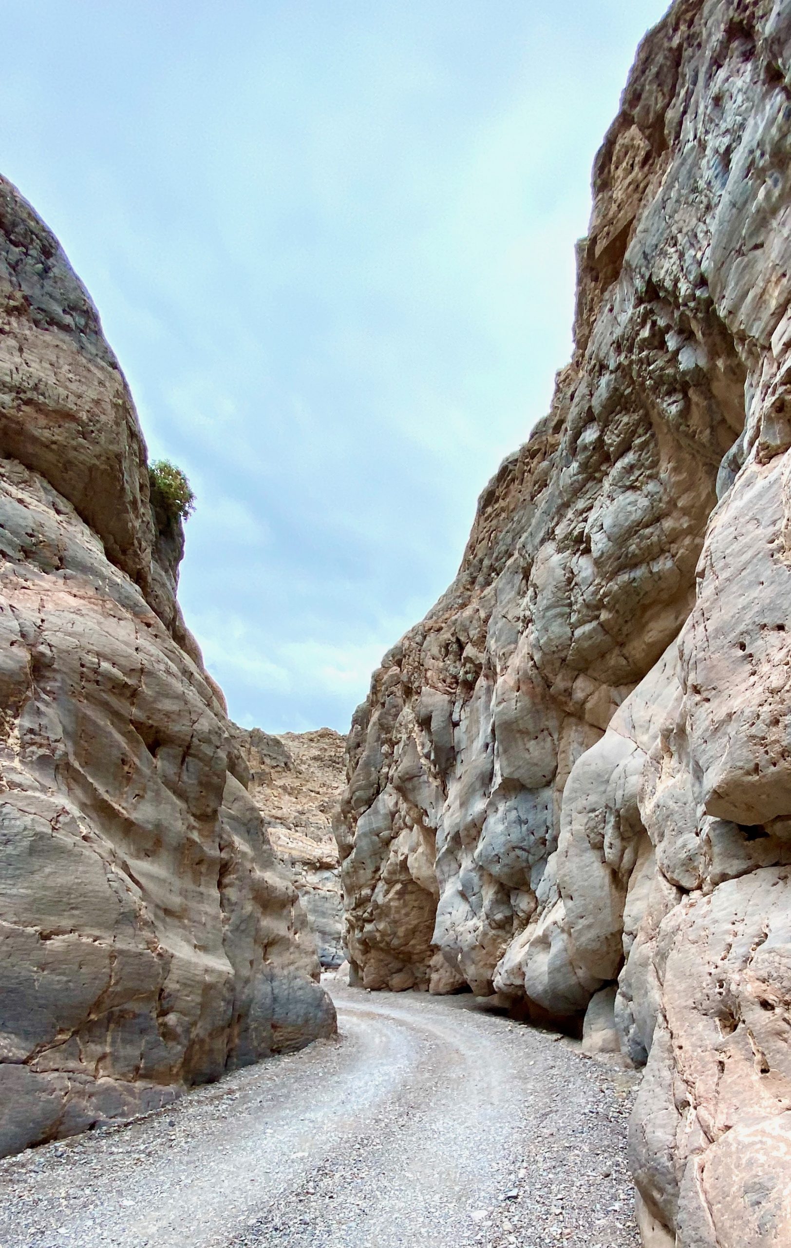
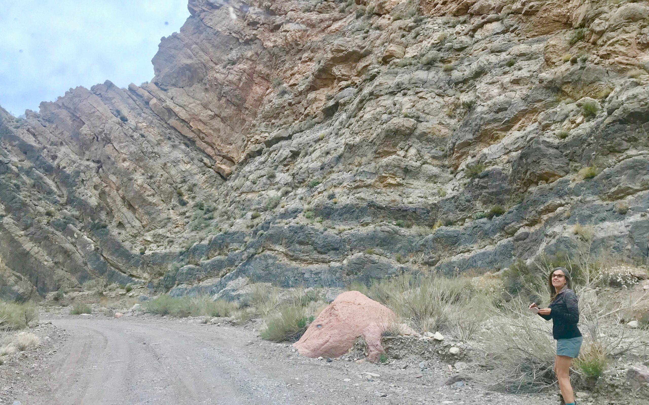
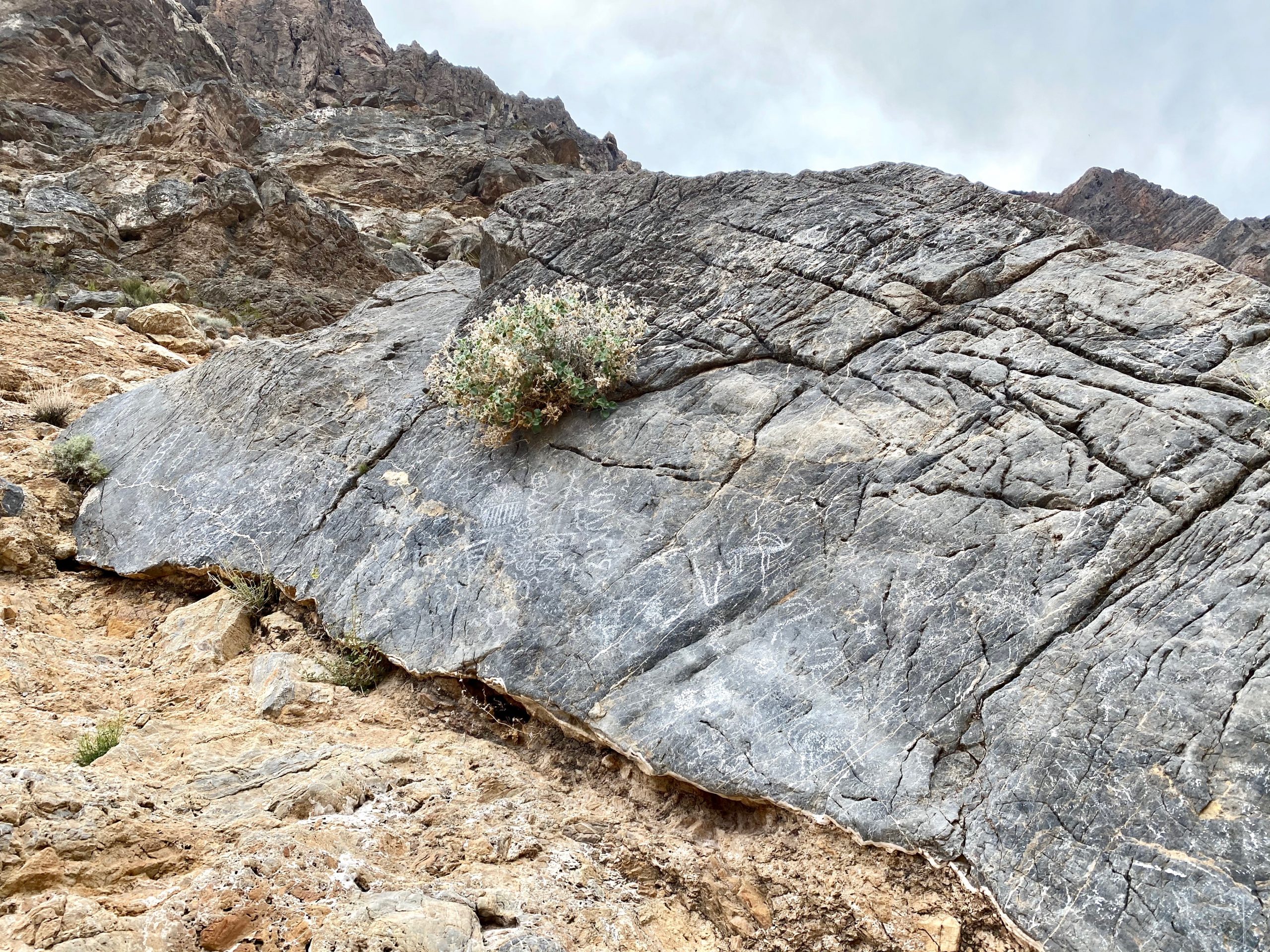
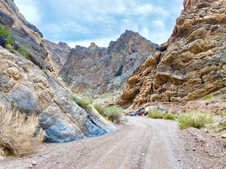
Susan, ever the lover of slot canyons, was beside herself, getting to drive through one. We stopped so she could get out to take pictures and, once again (just as we had on our drive through Baja Norte), we stumbled upon petroglyphs.

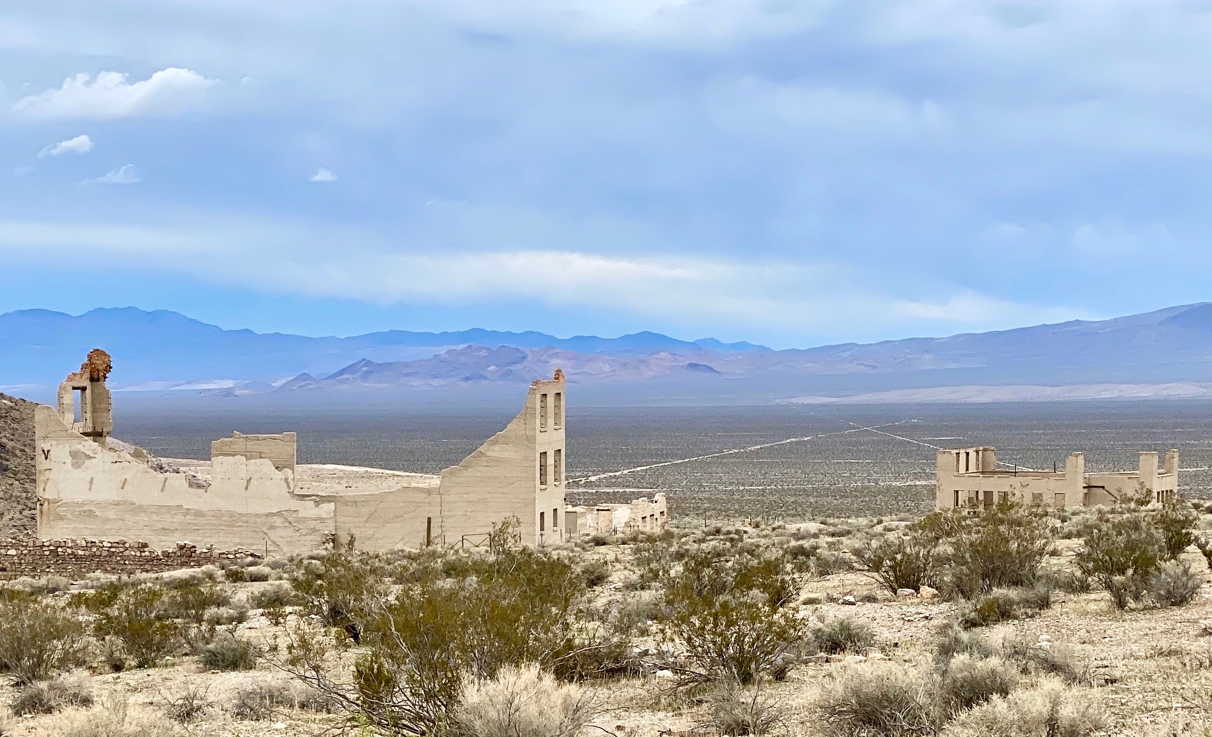
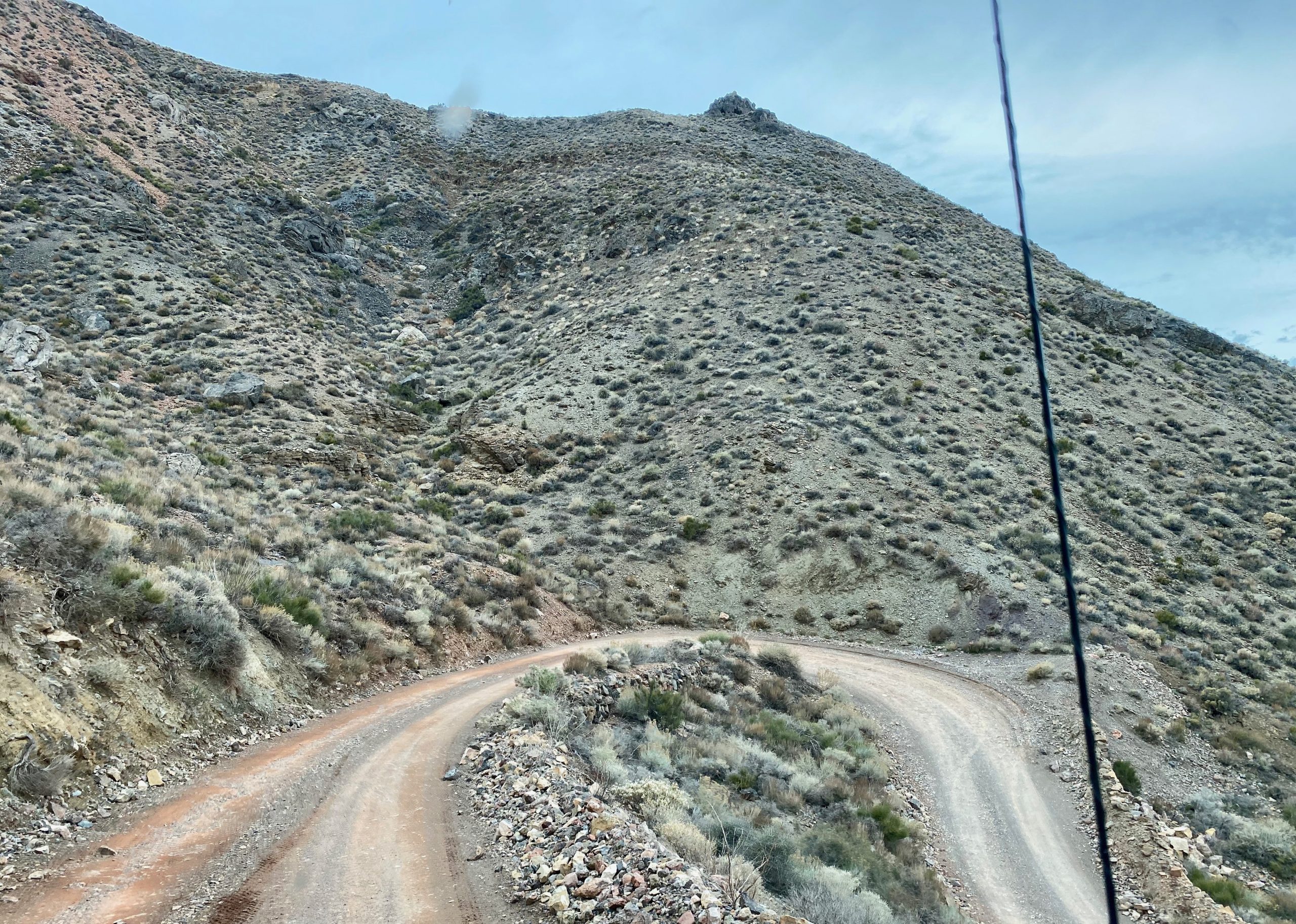
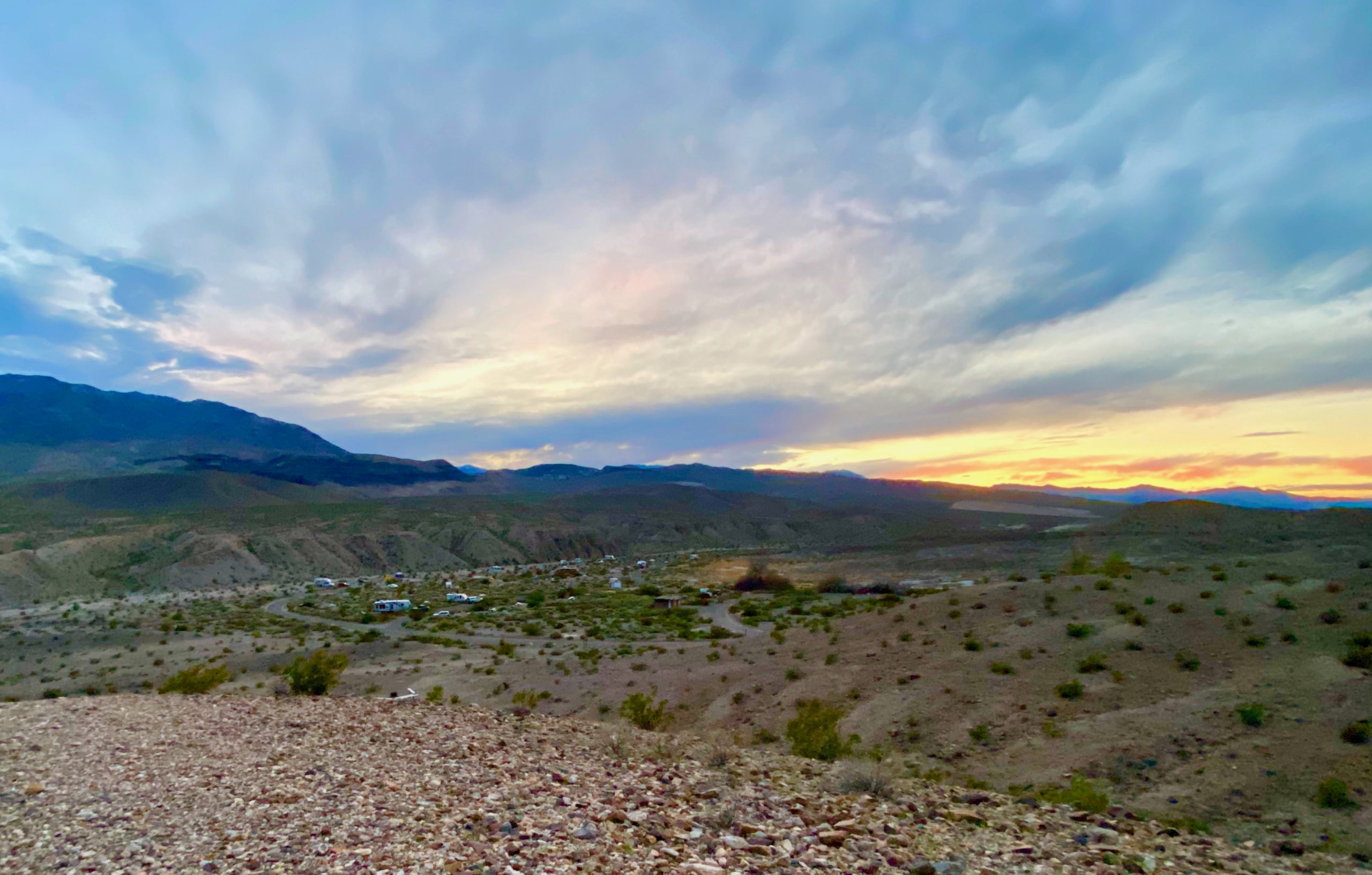
Finally, the temperature increased again and after three hours driving 26 harrowing miles, we were suddenly spit out of the canyon and deposited on a giant floodplain that flowed to the valley floor below. As we left the canyon, with its super narrow slots, Susan remarked, that was one tight ass canyon.

Within a couple of miles of the exit, we were deposited on a 55-mph super smooth road that seemed unreal after the slow jostling of Titus Canyon. 

Sunset view of the campground

We followed it for twenty-five miles or so to a small campground along a wash called Mesquite Canyon. Susan’s new senior pass halved the $14 fee and we stayed in the quiet campground, chattering like kids about what we’d seen. After dinner, we climbed a steep nearby hillside and watched the sun set over our campground.

One Response

Leave a Reply

Share this post