Post # 29: Leaving the heat behind

May 7, 2020

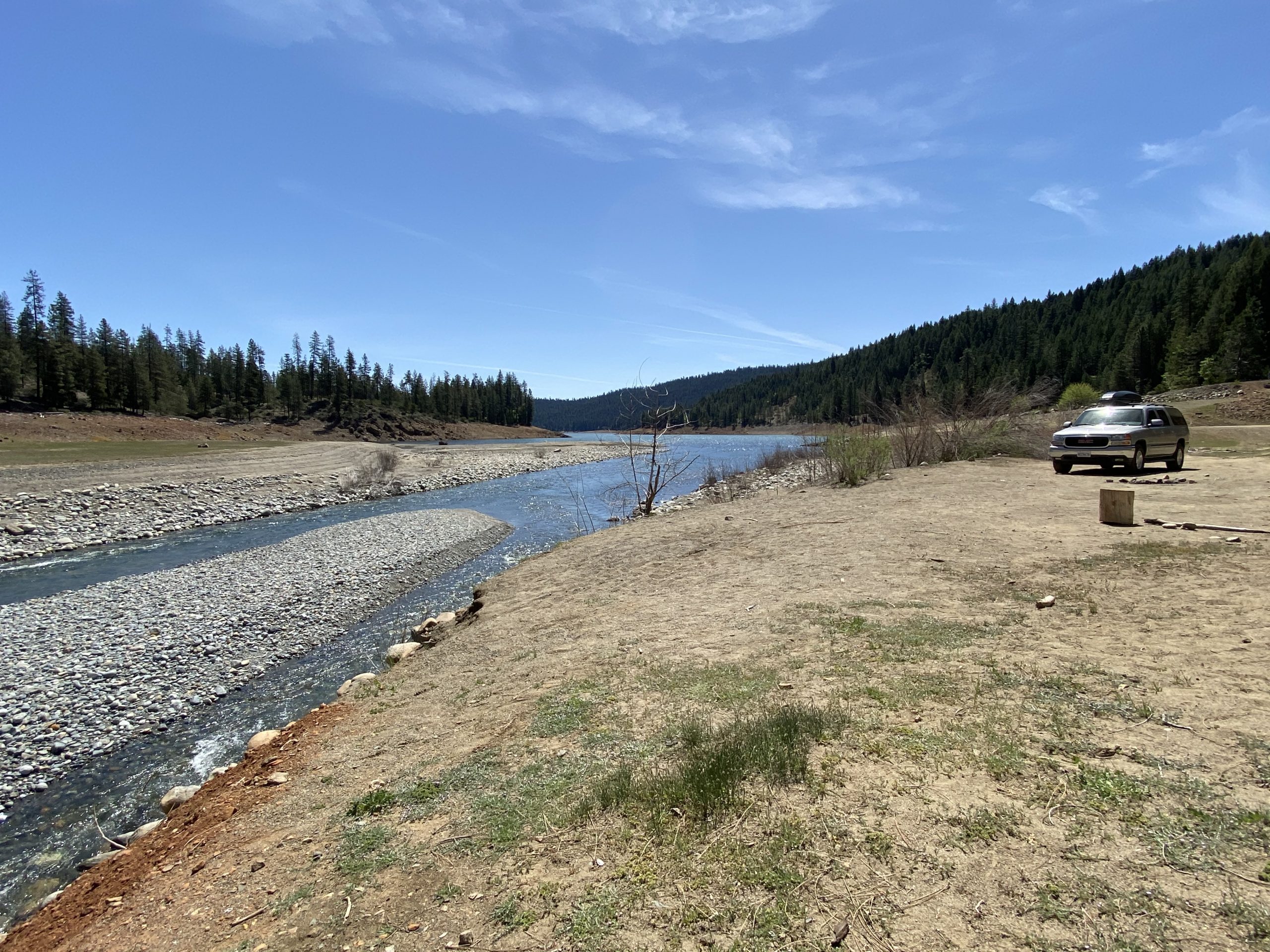
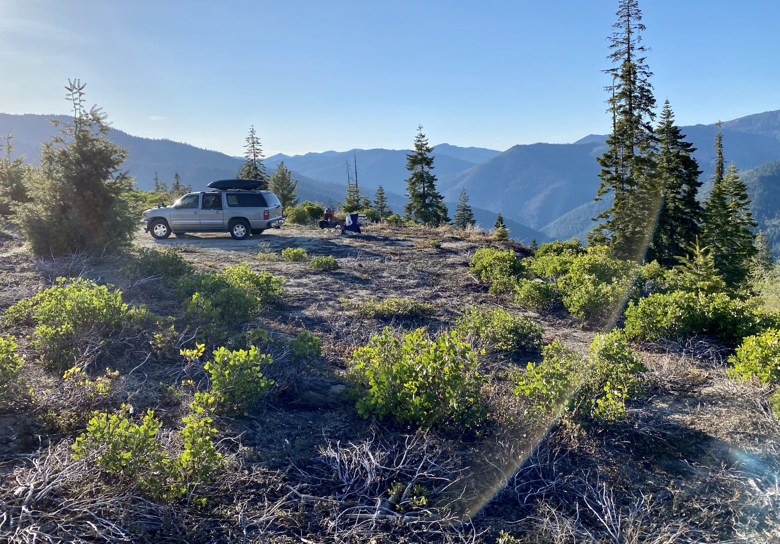
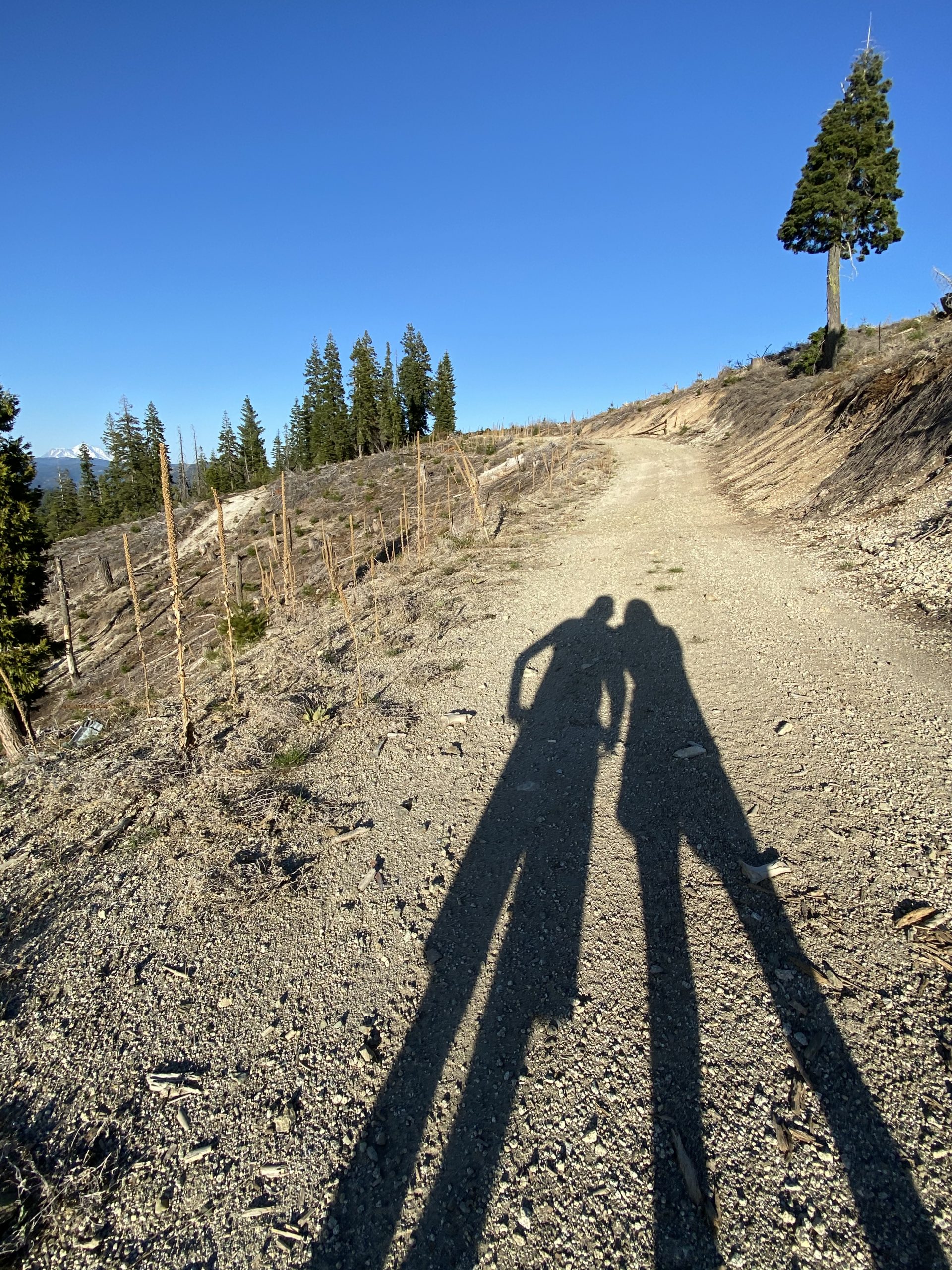
We left the house at about 9 am, heading north and west to escape a coming heat wave and find some places to hike at higher elevation. We’d packed for four days though we only planned to be out three. Most of the country was in the grip of the coronavirus and we, like many others, needed to get outdoors, still respecting social distancing. I’d put on the Yakima Skybox roof top carrier so we could store our chairs, table, food, and hiking boots “upstairs” and have more room for us in the truck.

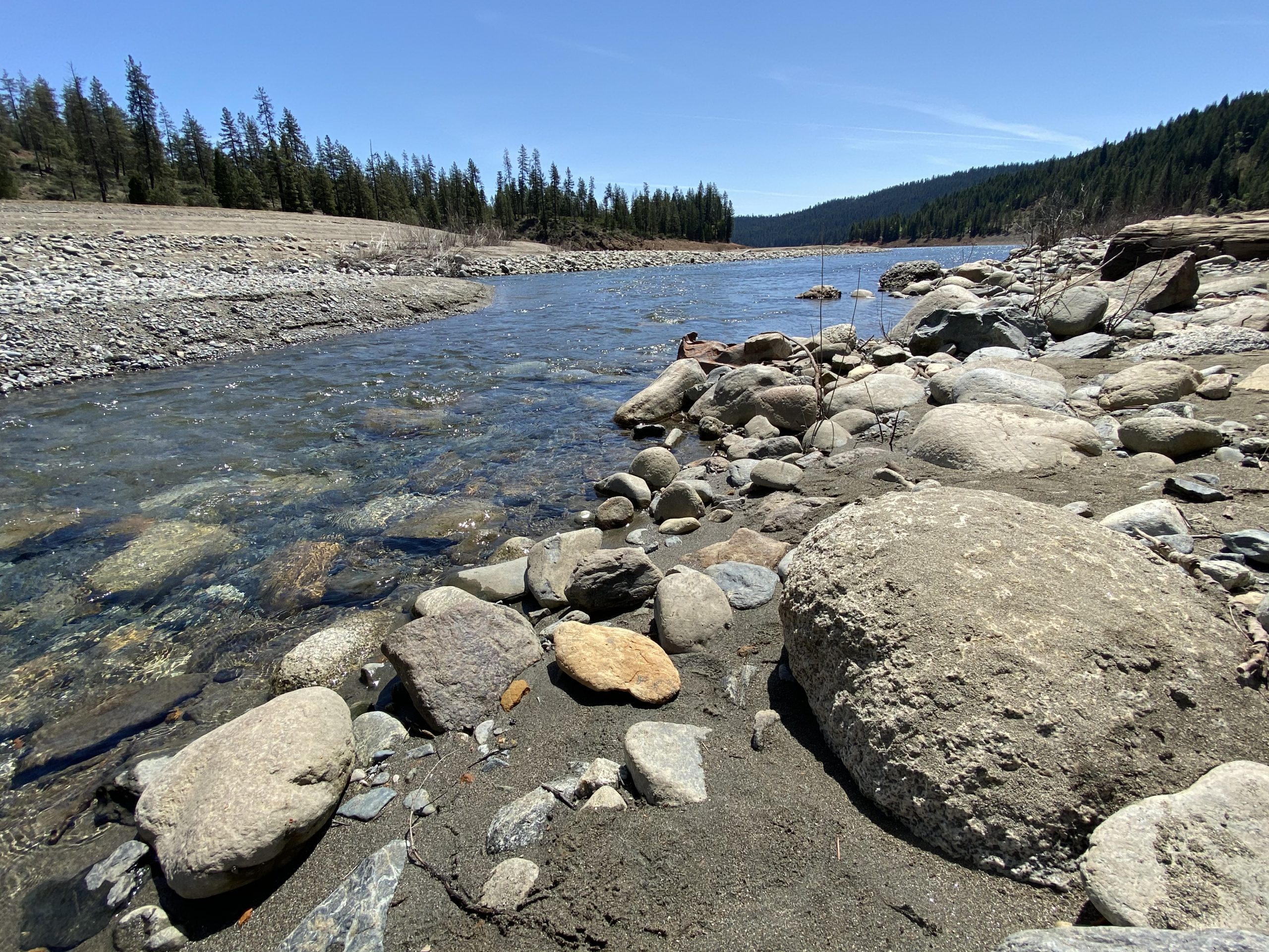
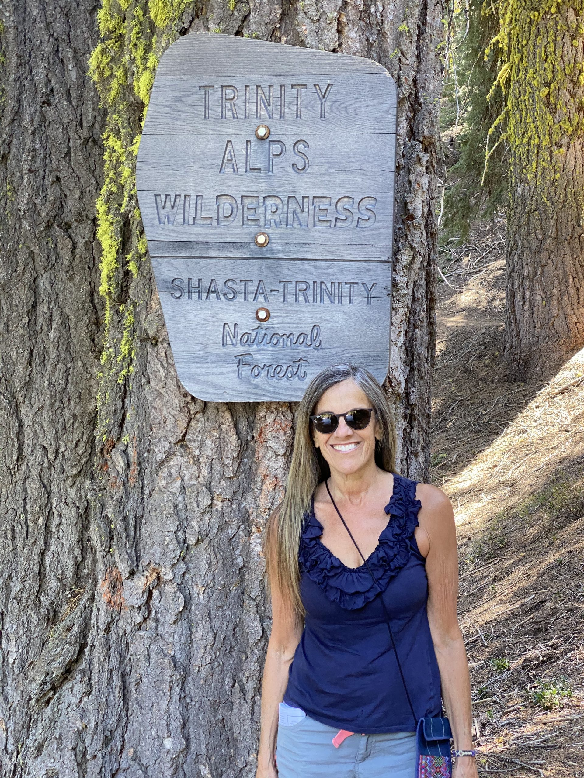
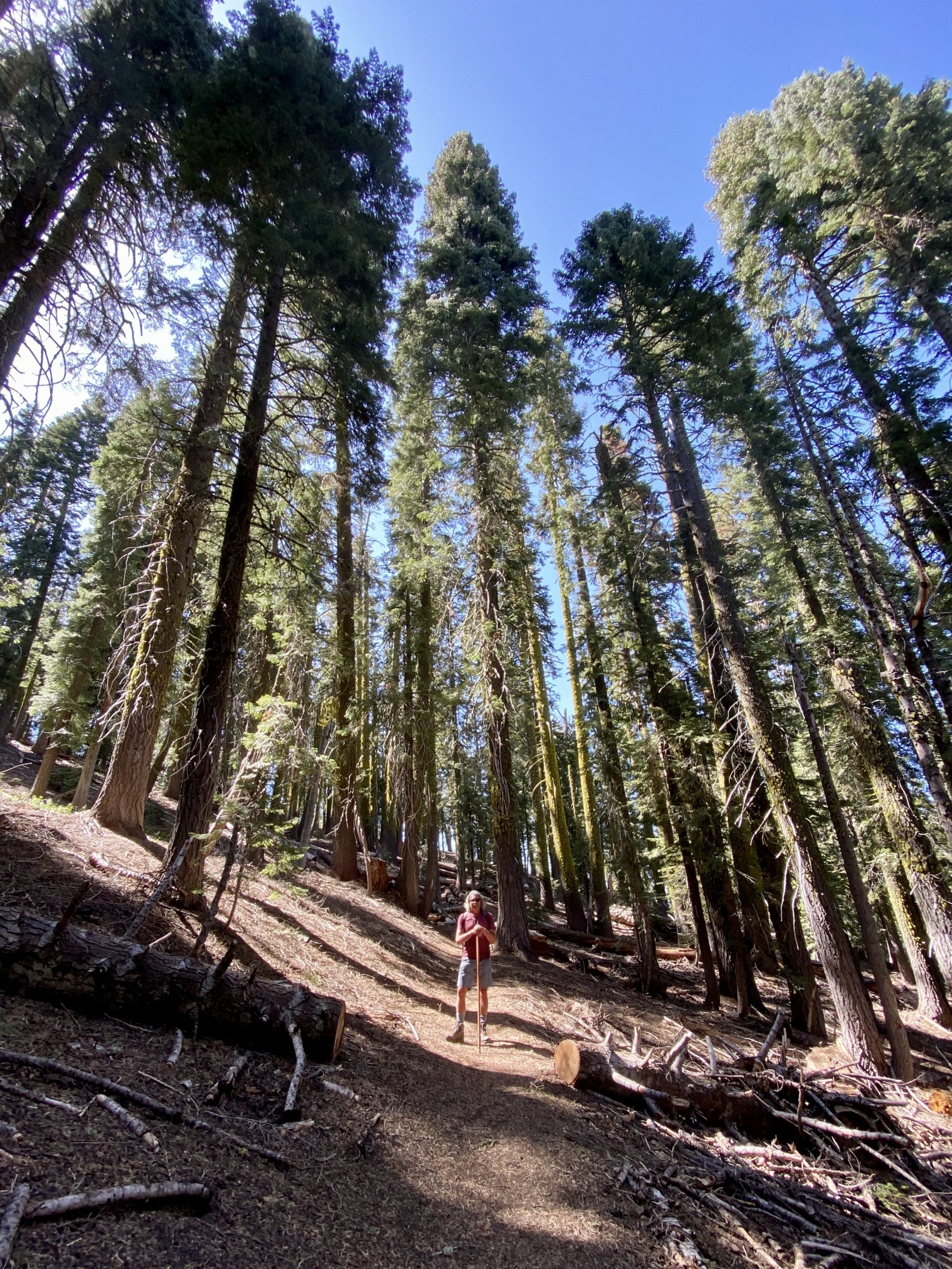
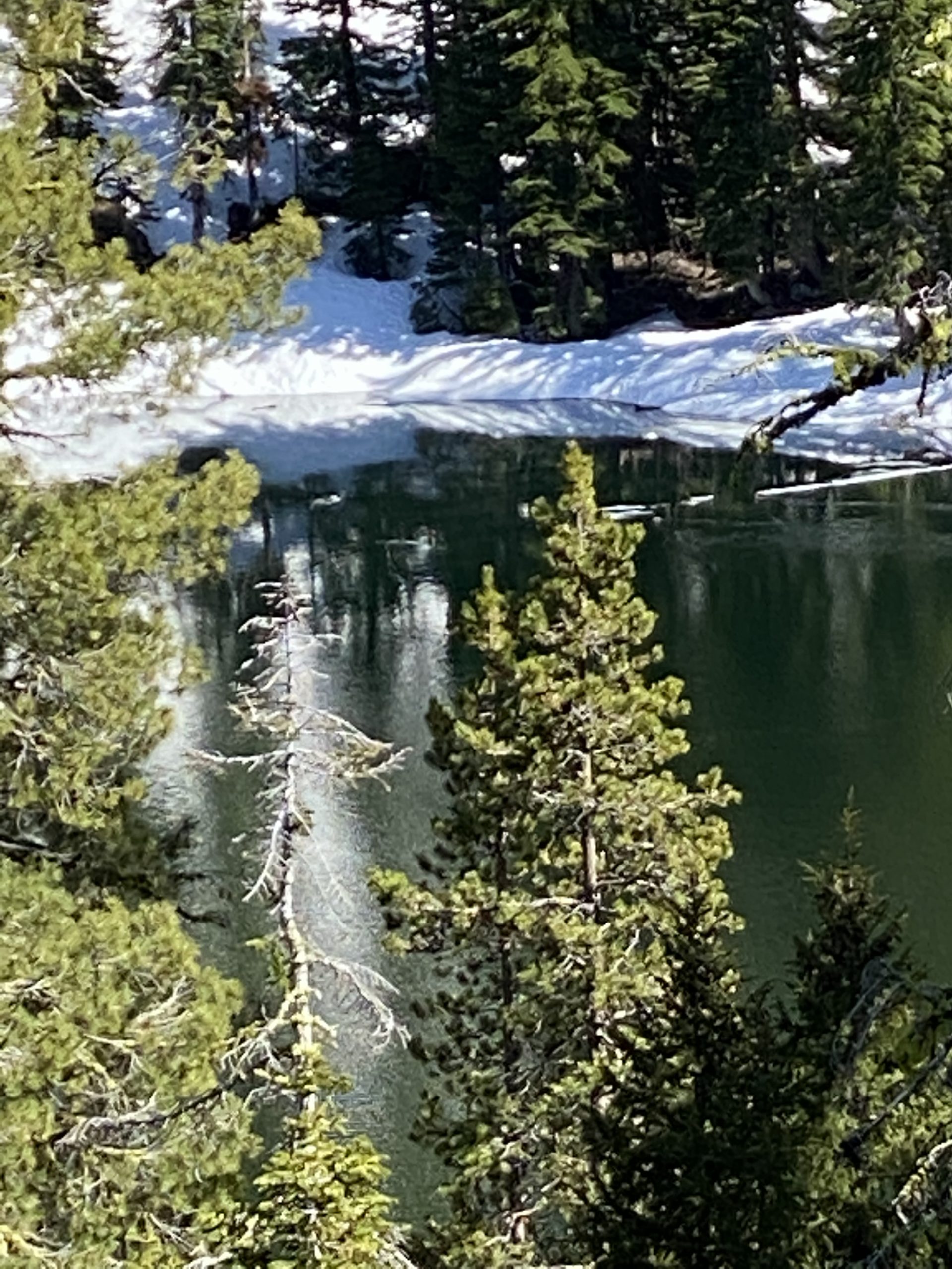
Our goal was the Trinity Alps, so called because that part of the Trinity National Forest includes sharp and rugged peaks along with contrasting green hills and valleys like the Swiss Alps. We’d wanted to go there since moving to the area two years ago but had never had the chance. Without looming work responsibilities, we had the time – and thanks to the coronavirus, the price of gas was half what it was only a couple of months before.

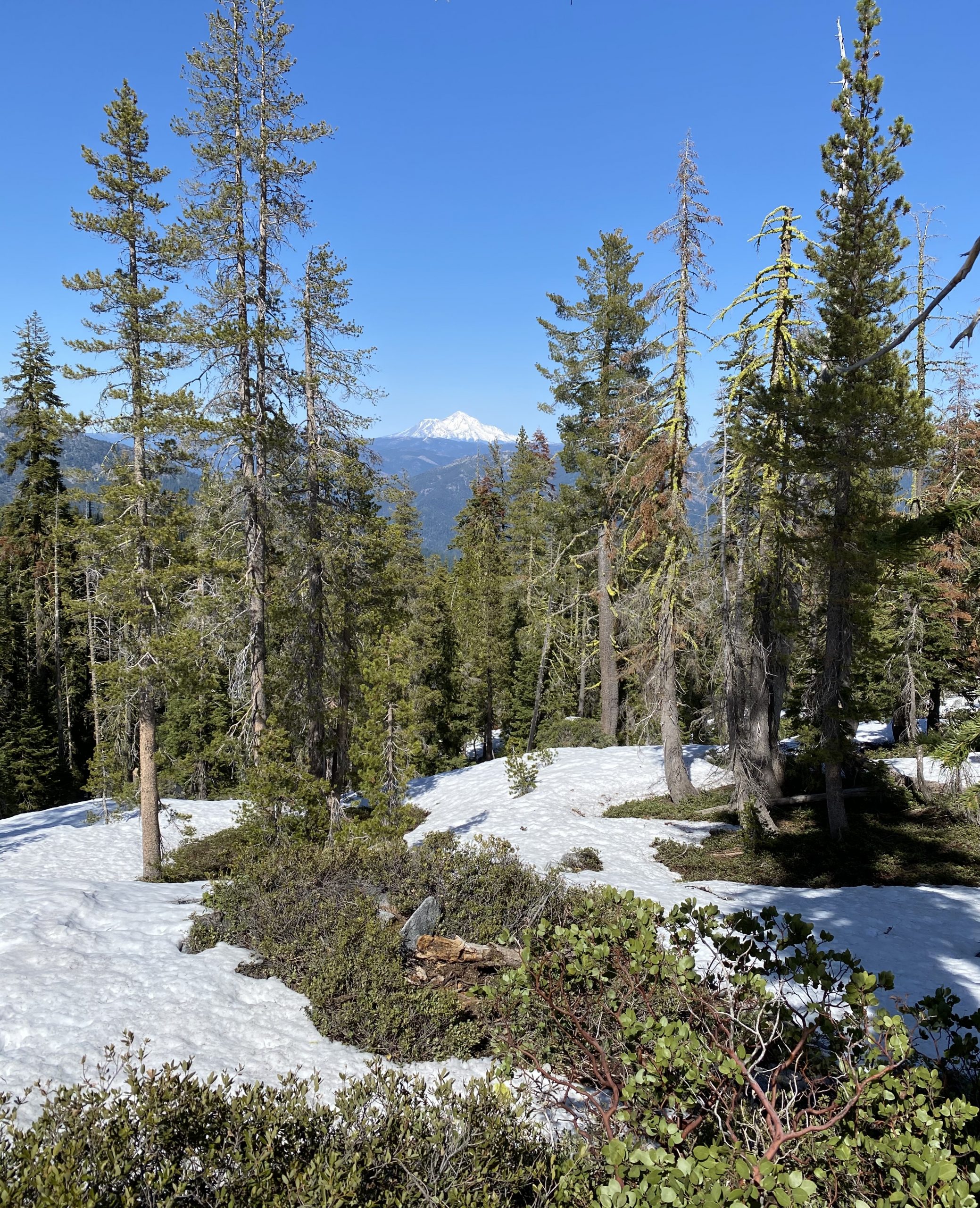
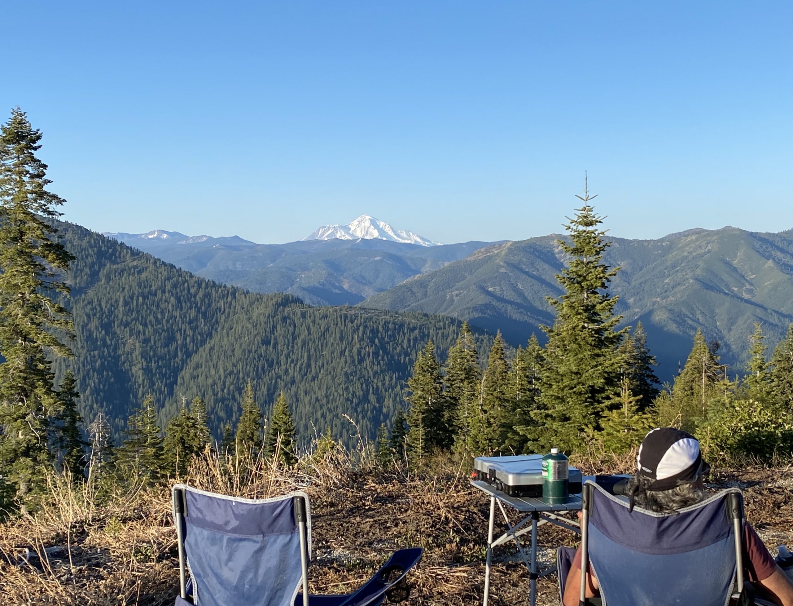
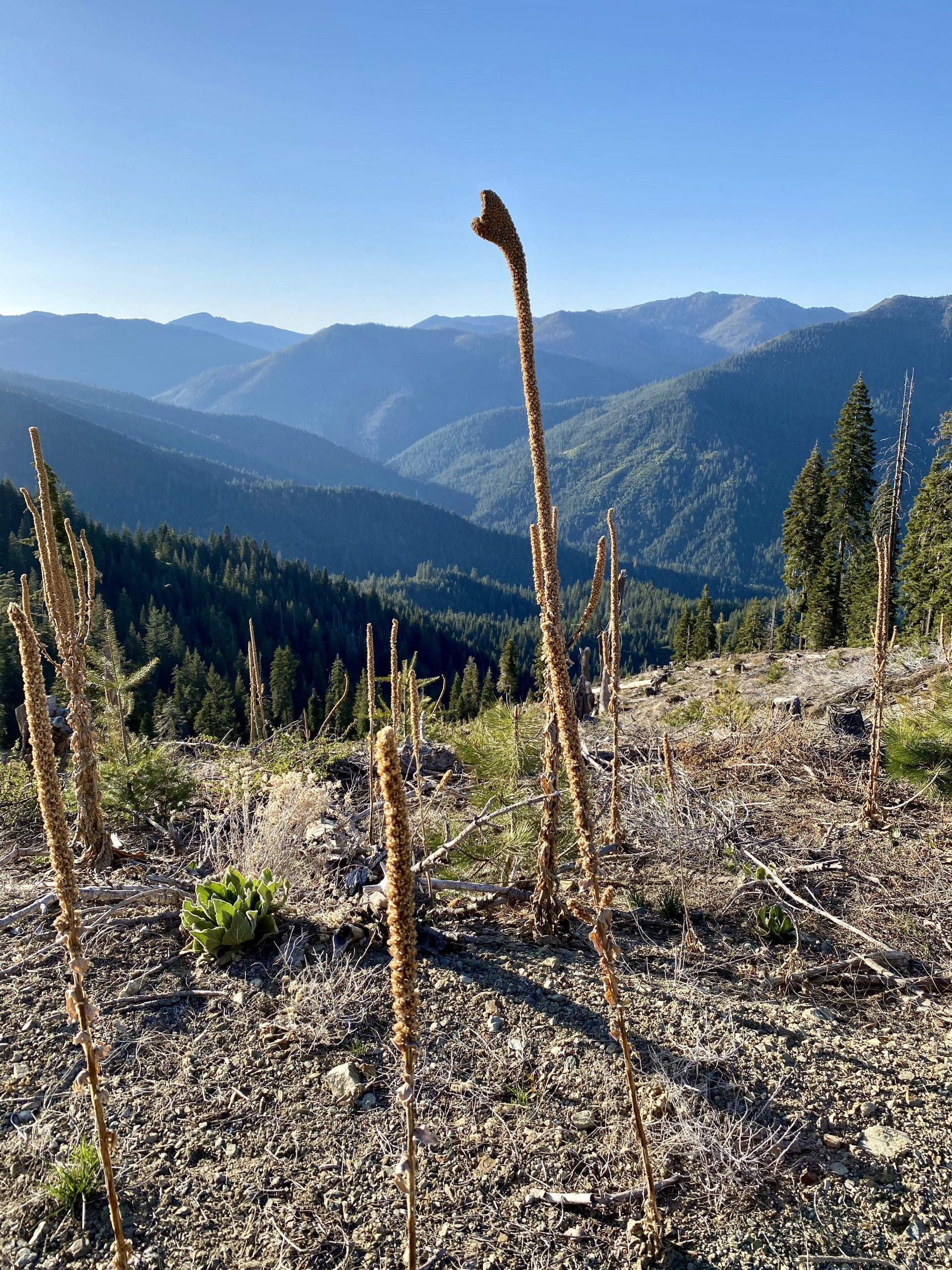
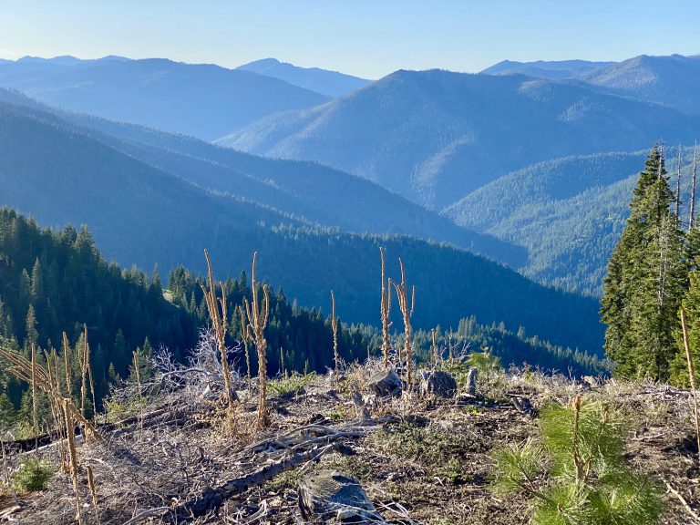
Driving north on Interstate 5, eventually Mt. Shasta began to loom to the north. Once you realize how long it takes to get closer, you realize its scale. It dominates the area, a snow-covered 14,000-foot high peak. Near the town of Redding, we turned west and began to climb into the mountains, leaving Shasta behind us. We passed by beautiful Whiskeytown Lake, sadly marred somewhat by burned trees from the 2018 Carr Fire. 

Pulled off along the banks of the Trinity
We marvelled at the clarity of the river

Shortly after, we turned north on CA 3 which passes Trinity Lake and then runs along the Trinity River. We stopped briefly for a stretch break along the crystal clear waters of the Trinity.

Back on the road, I marveled about the quality of the road – pool table smooth. Just then we came to a stop and had to wait while repairs were being made to one side of the road. If this is what it takes to keep these roads like this, it’s a small price to pay I thought. As we sat, the sun came through the sunroof and warmed us. It was climbing into the low 70’s but we knew it would not be nearly as hot where we were going as it would be at home, where 90’s were expected. Eventually, we turned onto a dirt road that headed higher up. It was rough but not nearly as bad as a Baja Mexican road. Soon, we turned onto another smaller dirt road and followed it for 45 minutes. A few miles up, Susan pointed to a pile on the road and said that horse poop meant that at least other people came up here. As we passed it, I smiled and told her it was bear poop.

Eventually we turned and headed up an empty dirt road for about 7 miles looking for a small parking area where there was supposed to be a trail to an alpine lake. Rounding a bend about 6 miles in, we were surprised to see two young women in matching company pickups (the only people we’d see that day) that had stopped on the side of the road. We waved and kept climbing. Our odometer said we had to be close to the trailhead. Around a bend, suddenly we were faced with a patch of snow across the road that extended for about 50 feet and was about two feet deep. Uncertain if we might have missed the trailhead or if it were beyond the snow, we backed down the narrow, curvy, steep dirt road a quarter mile, pulled over, and looked at our GPS and the printed trail information we’d brought.

Just then, the young women passed by on foot and we asked them if they knew where the trailhead was. They didn’t, but produced an iPad they used in their botany survey work. It confirmed we were in the right area but since we hadn’t yet come to a parking area it probably was beyond the snow. I told them we were going to try to get over the snow that had stopped us and one of them excitedly told us that if we got stuck, she had a tow strap in her company truck and could pull us out. Apparently, they didn’t get a lot of visitors during their work. We thanked them and drove back up to the snow, determined to get through.

"Looks like you'll need to go back up and over the snow"

I put the truck in 4WD and drove onto the snow bank. It was warm enough out that the snow was rotten and three tons of truck simply sank to into it, all four wheels spinning. I backed up and tried again, this time in 4WD low. Same.

I knew from many years of driving in snow in Montana that I could eventually get through the patch, but it would take a lot of back and forth. Instead, we backed down and parked on the side of the road and decided to go on foot to see if the trail was near.

We’d both brought our heavy hiking boots rather than the light hikers we often use, thinking this might be a difficult trail. Good thing we did. After crossing the snow, we walked until we came to another snow bank across the road, then another and another. The last one had snow three feet deep and I was glad I hadn’t tried to drive the truck any farther – we couldn’t have gone more than a couple hundred yards.

We walked for almost a mile and finally found the parking area with a helpful sign that said absolutely nothing. But at least we knew where we were and it meant we could continue our hike, so we started up the trail.

Hopefully, it didn't say "Danger! Giant rabid bears in area!
Stylishly entering the wilderness
Towering trees surrounded us

Soon, an actually helpful sign told us we’d passed into the Trinity Alps Wilderness Area. Behind us was National Forest land that had been logged long ago. Ahead of us was old growth forest with massive redwood, pine, fir and spruce trees. The sudden grandeur was breathtaking. Where the forest had been logged, the trees were small and spindly and the undergrowth was almost impenetrable, but here, nature didn’t allow such underbrush, as the giant old trees — some easily 15 feet in diameter — cast huge shadows. We continued up the trail listening to the stillness and a slight whisper of wind high in the trees.

At least there's not as much snow here as on Mt. Shasta

At one point, the forest opened up and we saw the ever-present Mt. Shasta in the distance. The trail was unmarked and already pretty hard to follow but as we climbed higher there were patches of snow all across the forest, including the trail. 

Eventually, based on our GPS, we figured the little lake we were seeking was only about a mile away, so we kept going through the patches, sometimes sinking a foot or more. As we gained elevation, the snow patches became larger and deeper. It was obvious that we were a few weeks too early for this trail. Still, only another half-mile away lay the lake so we trudged on. 

Not dressed for the occasion
All that yoga really helps with balance

Before long, the snow fully blanketed the forest and we had to imagine where the trail would be under us. The snow was now three to four feet deep, despite the temperature being close to 70 as we neared 6,500 feet. We looked at each other and giggled – we were both in shorts and short sleeves, trudging through deep snow and getting shovelfuls of it in our boots as we sank deep into the slowly melting snow. 

Progress was slow and we kept losing the trail only to find it again. Our GPS said the lake was just around the bend so we pressed on, now completely in snow.

Finally, the pretty little lake appeared a hundred yards below us, surrounded on two sides by steep snow-covered granite hills. But by now, the snow was deep everywhere and there was not even a semblance of a trail. We could see the lake but were too early in the season to actually touch its frigid waters. A couple of ducks mocked us.

I scouted as best I could, stumbling through deep snow, back and forth but there was no use as without the trail we’d have to bushwhack through a snow-covered boulder field. This was as close as we’d get.

Several feet of snow over large leg-breaking boulders stopped us just short

We warmed ourselves on a sun-heated boulder for a while. Then began the trek back. As we headed down through the deep snow patches, I thought that at least this was cleaning all the dust off of my boots from the last hike. 

Our home for the night
The view from 6,000 feet up

When we got to the truck, we backed down the road again and turned off onto a small dead-end dirt road we’d seen coming in. It looked like it had been used long ago as a logging road, but ended in a natural cul-de-sac that happened to be facing Mt. Shasta, shimmering a few dozen miles away. This was where we’d camp. We relaxed for awhile, in awe of the views.

The near 360-degree views were stunning, with layers of velevety green mountains marching into the distance and forest stretching as far as the eye could see. It was probably the most remote-feeling campsite we’d had in the US.

Ready to scan for mountain goats or Sasquatch. Neither appeared
The long shadows of evening in the mountains
Dr. Seuss-inspired flora

After an easy one-pot dinner, we took an evening stroll along the logging road. The views were exquisite and the shadows long in the evening sun. 

Once the sun was behind the mountains the air became cooler and we climbed into bed feeling a bit tired from the unexpectedly exhilarating hike through the snow.

One Response

Leave a Reply

Share this post