Post #87: Rockin’ Red Rock Country

March 22, 2021

Neither of us slept well last night because our room was directly over the busiest intersection in Prescott and loud trucks and motorcycles passed by frequently. Opening the window for fresh air had been a mistake. Being downtown is fun but can have its issues.

After lugging our ¾ full five-gallon water jug up to our room, I filled it in the bathtub, put it, our clothes duffels and Yeti cooler on a luggage cart, and then checked out of our room. I figured we must really look like bumpkins carting a cooler and water jug from our room, especially after we asked for ice from the closed restaurant.

It seemed like most of the men in the restaurant wore suspenders
It was a little awkward dining with an angry bear looking down at us
We were surprised the local restaurants didn't have "Prescott biscuits" on the menu

After loading up the truck, we walked a block to an outdoor store to get more JetBoil fuel, then another block for breakfast. Only some of the patrons there had suspenders and cowboy hats on though it seemed like we could have been there 100 years ago and it would have looked the same. We ordered biscuits just so we could say we had Prescott (pronounced press-kit) biscuits. I thought about getting the brisket too but was afraid I’d hurt my tongue trying to order Prescott brisket biscuits.

Decent chow later, we hit the road north toward Sedona. As we drove off from Prescott, we talked about the area and agreed it was one of our favorite small towns to visit. Between the physical beauty of the area, the genuine Western ambiance of the town, and the nearness to beautiful mountains and hiking, it had exceeded our expectations.

The road from Prescott to Jerome and then Sedona

The road to Sedona crossed an entire mountain range and did so with style. Twisty and steep, the road was entertaining, slow and beautiful as it climbed, then descended the mountains.

On the way to Sedona, we stopped in Jerome, Arizona, an old mining town that became a ghost town that became a tourist attraction/semi-ghost town. 

Jerome as seen from the road toward the mines
A (small) section of the land post-mining

Built on the side of a steep mountain, Jerome existed so the mining companies could rape from the land hundreds of thousands of tons of copper, thousands of tons of silver and over five tons of gold. The unimaginable wealth from that incredible bounty stayed with the mines’ far-off owners as the town eventually died.

Jerome's main street
Some charming-looking little eateries
This building is on the same street as the open shops and restaurants. Just needs a little paint?
Lodging is avaialable at the Ghost City Inn in this quasi-ghost town

Now, as a result of tourism, parts of the tiny downtown seemed to be thriving once again, but there were still many dilapidated buildings in Jerome among the newly refurbished ones. 

We took a walk to see some of the old mining equipment but chose not to go into the historic, but sad, mining museum with its old hydraulic water jet nozzles that caused such extensive environmental destruction sitting outside as if nothing happened.

This colorful 2700 pound azurite/malachite (a copper mineral) rock was on display outside
As the sign explains, this was used to haul men and supplies

The road from Jerome wound down the mountain and eventually brought us to Sedona, a place some say is spiritual and others say is a bougie and crowded place where the wealthy come to stay in pricey hotels and visit exclusive spas. Crystal shops rub elbows with vape shops, wine boutiques and real estate offices. Many visitors claim they’ve felt rejuvenating energy from the earth at certain spots (vortexes) in the Sedona area. 

But we were there for the hikes, which are unlike those found elsewhere. Susan’s foot was slightly better and we hoped to hike no more than a couple of miles today so whatever was wrong with it could continue to heal. Outside of Sedona is a 25 square mile section of the Coconino National Forest known as Red Rock Country that has nearly one hundred trails. The scenery is beyond breathtaking with rocky red cliffs and spires partly covered in green and silver vegetation that soar over the juniper- and pine-filled landscape. If it doesn’t feel spiritual, it certainly feels special.

Charles crossing Devil's Bridge in 2018 before it was a overrun with crowds. It would have been impossible to cross the bridge alone today
Susan crossing Devil's Bridge in 2018
Camping near Sedona three years ago during our cross-country moving trip. Our truck still had Virginia plates

I’d been to Sedona once before, and Susan had been there twice. We’d already been to the most popular trails, like Devil’s Bridge, three years ago. 

As we drove toward our planned hike, we passed hundreds of cars parked on the road as far as a mile from the Devil’s Bridge trailhead, along with officers directing traffic. We were glad we’d already been there during the much less crowded and crazed pre-Covid days.

This time we wanted to go to a lesser-known place in Sedona called “The Birthing Cave,” though we didn’t know exactly where it was or even exactly what it was. Our Apple Maps GPS brought us to a crowded trailhead parking lot where we saw several poorly-marked trailheads and chose the only one, Boynton Canyon, that appeared to go in the direction of the cave.

The Boynton Canyon trail climbed through a wide canyon beneath towering red rocks
The well-traversed trail had the flattened, hardened red soil found throughout the area
The contrast of the red rocks and the blue sky was stunning

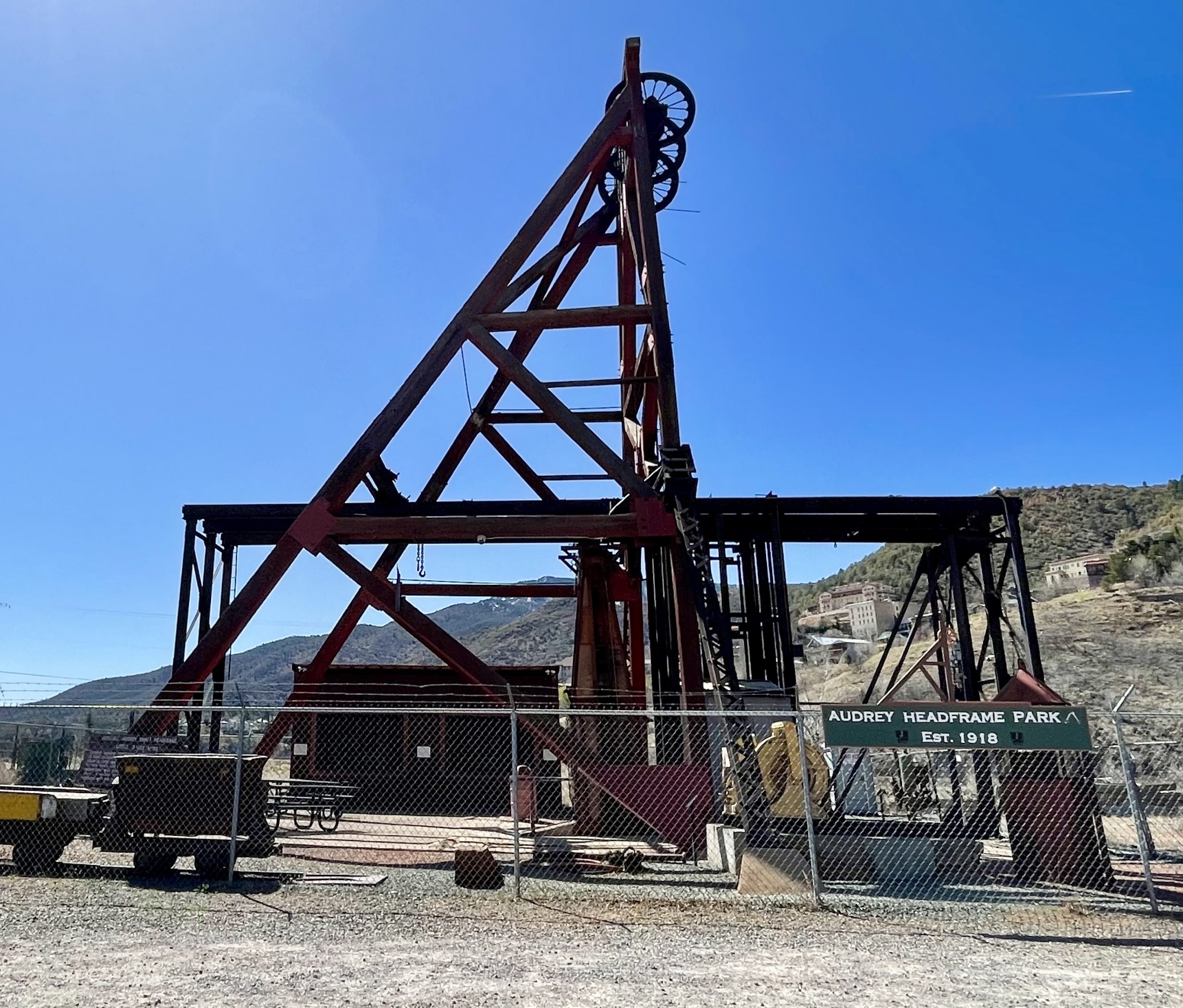
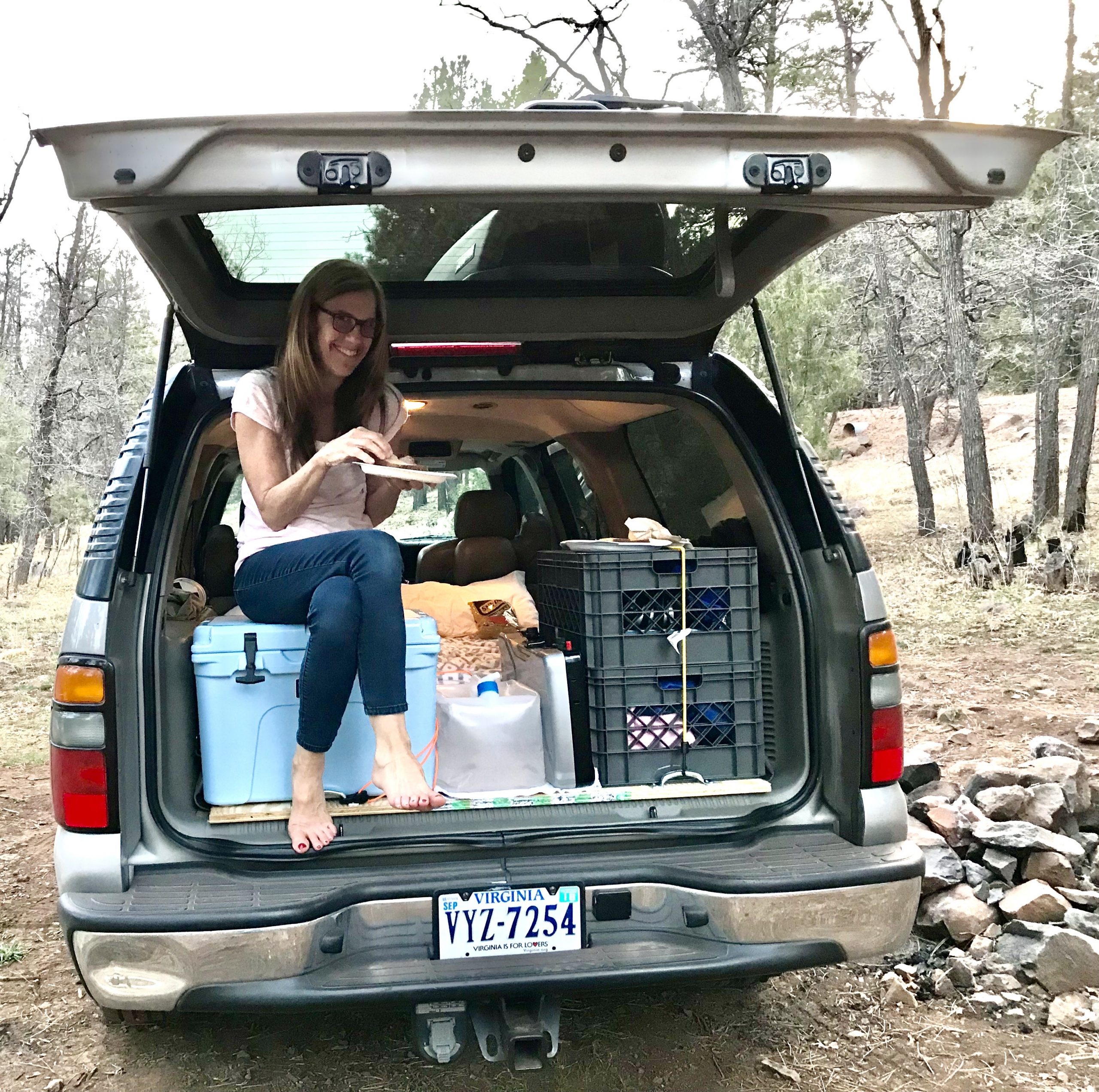
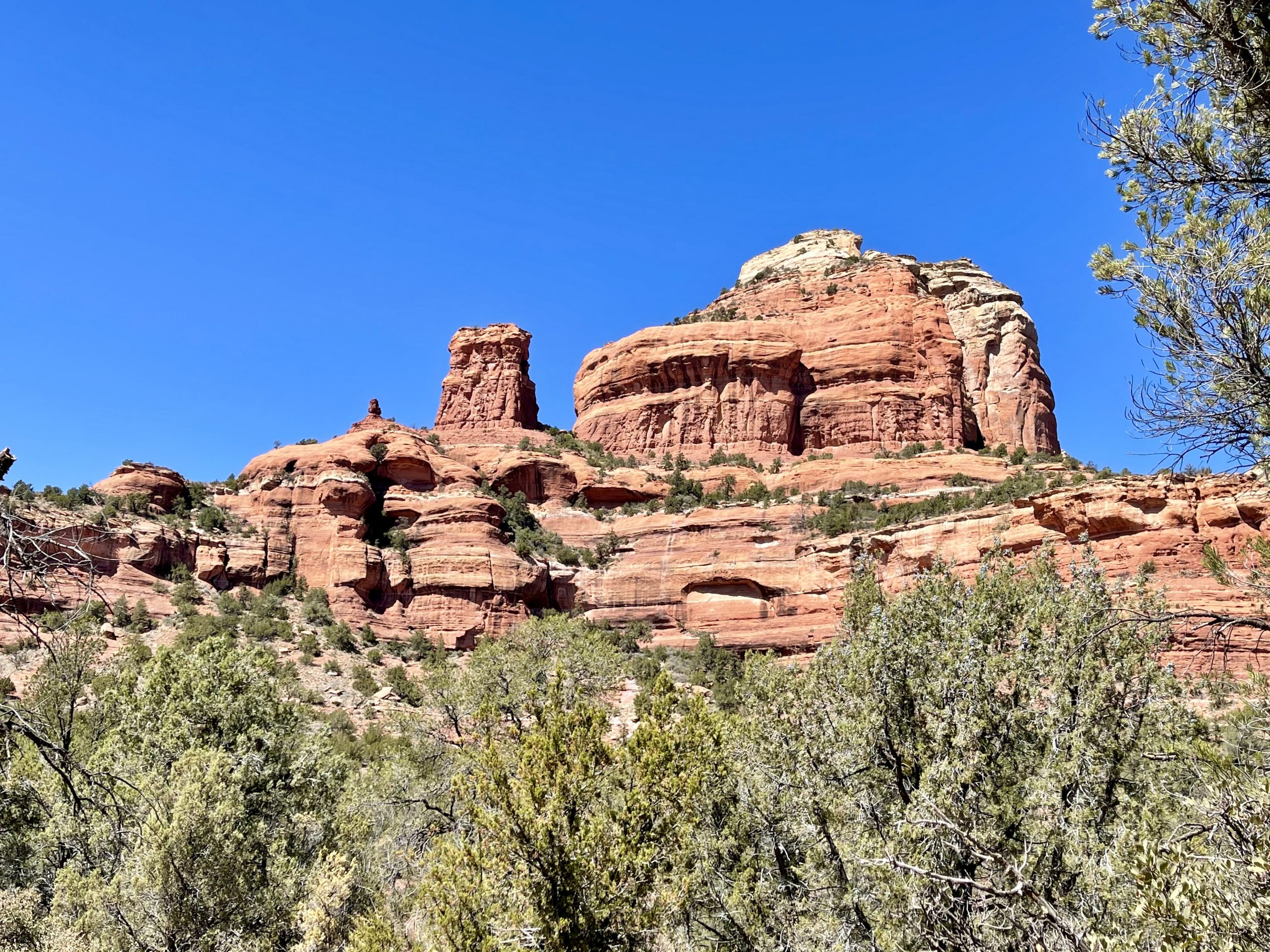
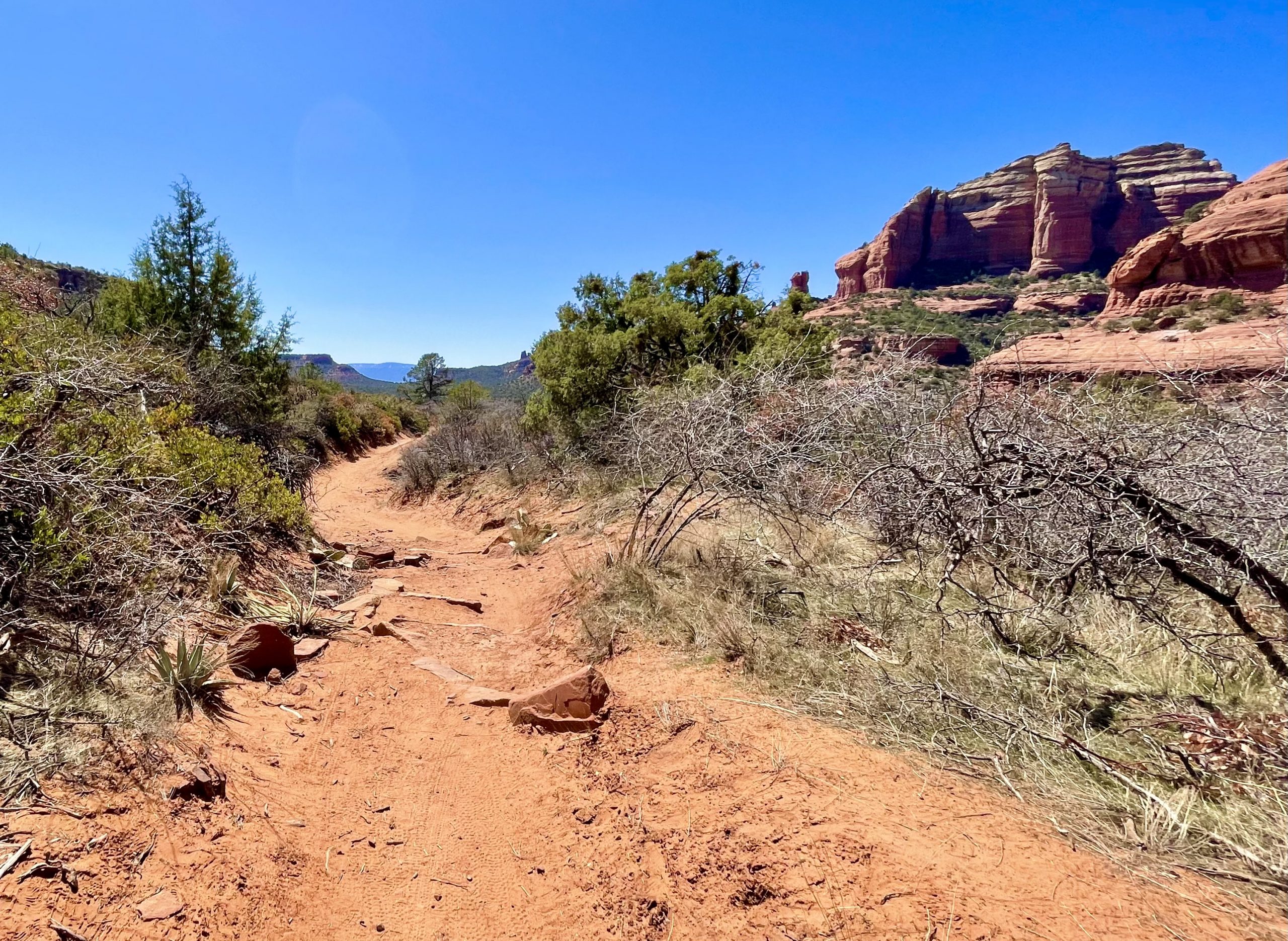
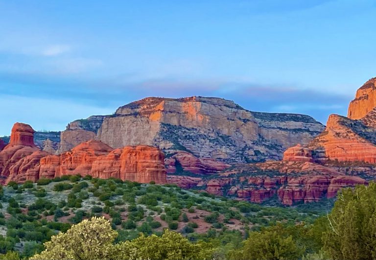
The trail, like many in Red Rock Country, was worn so deep that it had a culvert feel to it, but the red packed dirt and limited amount of rocks made it easy to hike. The beautiful trail brought us through a canyon at the base of tall red rock formations. After a mile or so, we reached a Y in the trail and weren’t quite sure which direction to go. Just then, an older man came toward us from the path that came from our left, so we asked him if he happened to have come from the Birthing Cave. He told us he too had been searching for the cave, had hiked for two hours, scrambled up sharp boulders until he was bloody, and never found the cave. So, we headed down the path to the right, even though Susan was nearly certain we were not heading to the cave. After another quarter of a mile, we decided that we were probably on the wrong trail altogether and turned around. After a total of two and a half miles, we arrived back at the truck. Though we’d taken a different hike than what we’d planned, we’d ended up on a wonderful trail. We later learned that Boynton Canyon is one of Sedona’s spiritual vortex spots. 

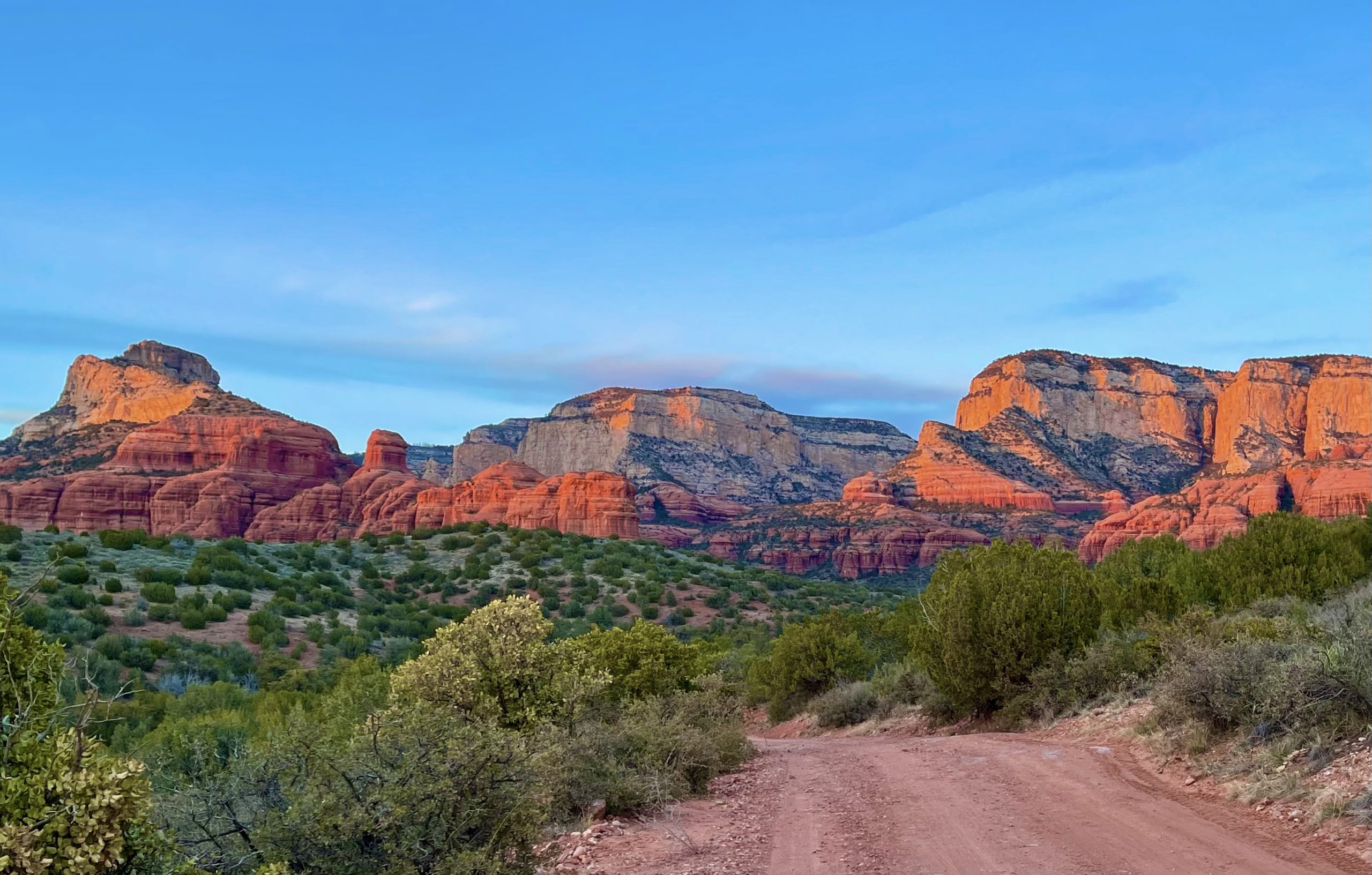
Susan remained determined to find the Birthing Cave, so when we returned to the truck we decided to search online until we found the proper trailhead. There was no internet in the parking lot, so we drove into Sedona, about ten minutes away. Once there, we confirmed that the GPS had guided us incorrectly and the pretty trail we’d taken would never have led us to the cave. Armed with new knowledge, we headed back into the hills on the road we’d just come from, but turned off it much sooner, and it wasn’t long before we discovered the benefits of Susan’s resolve.

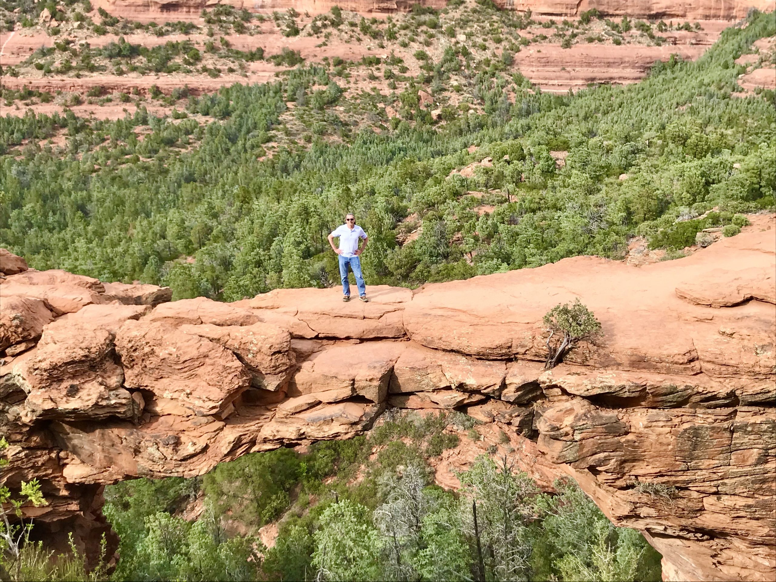
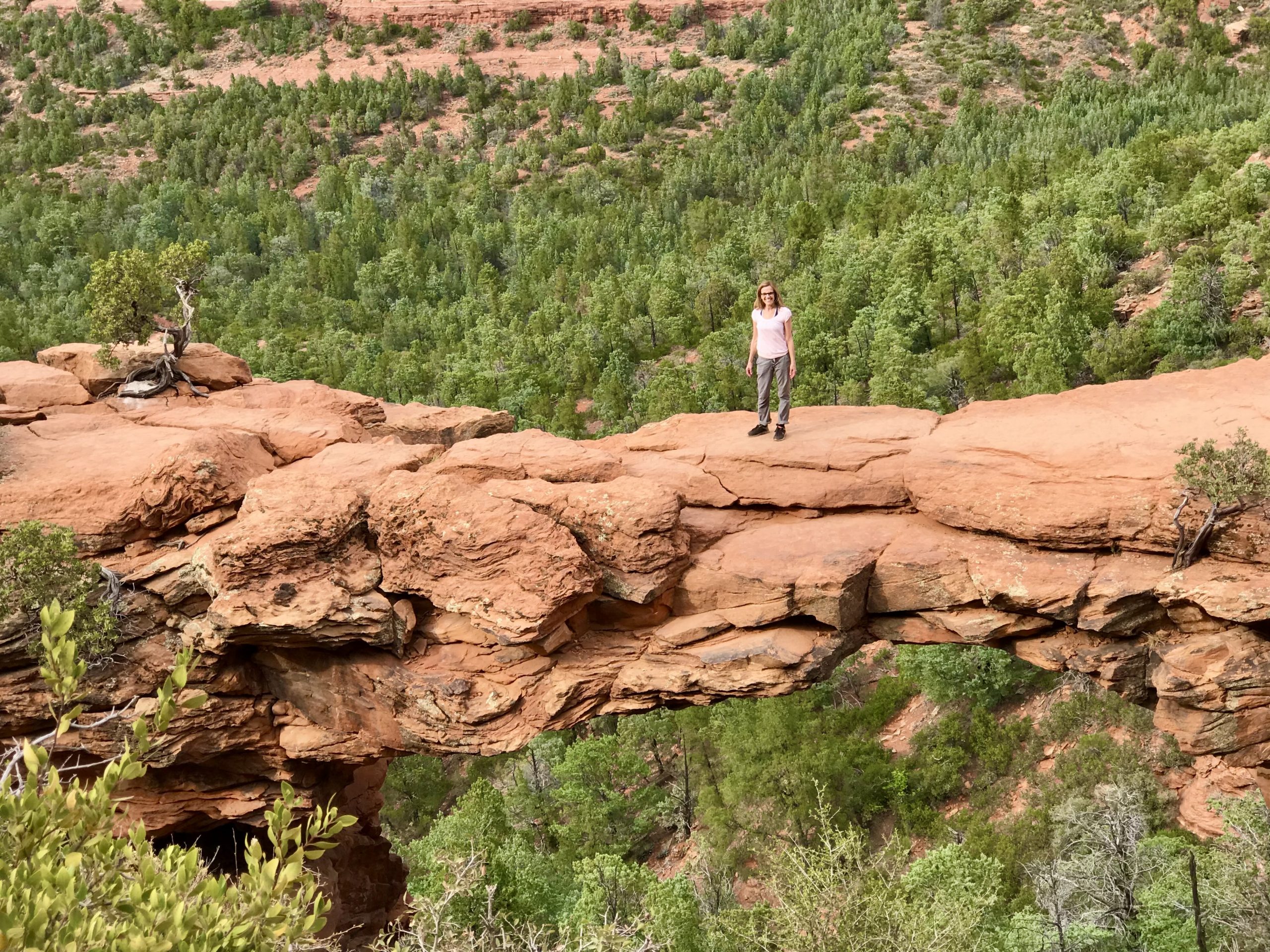
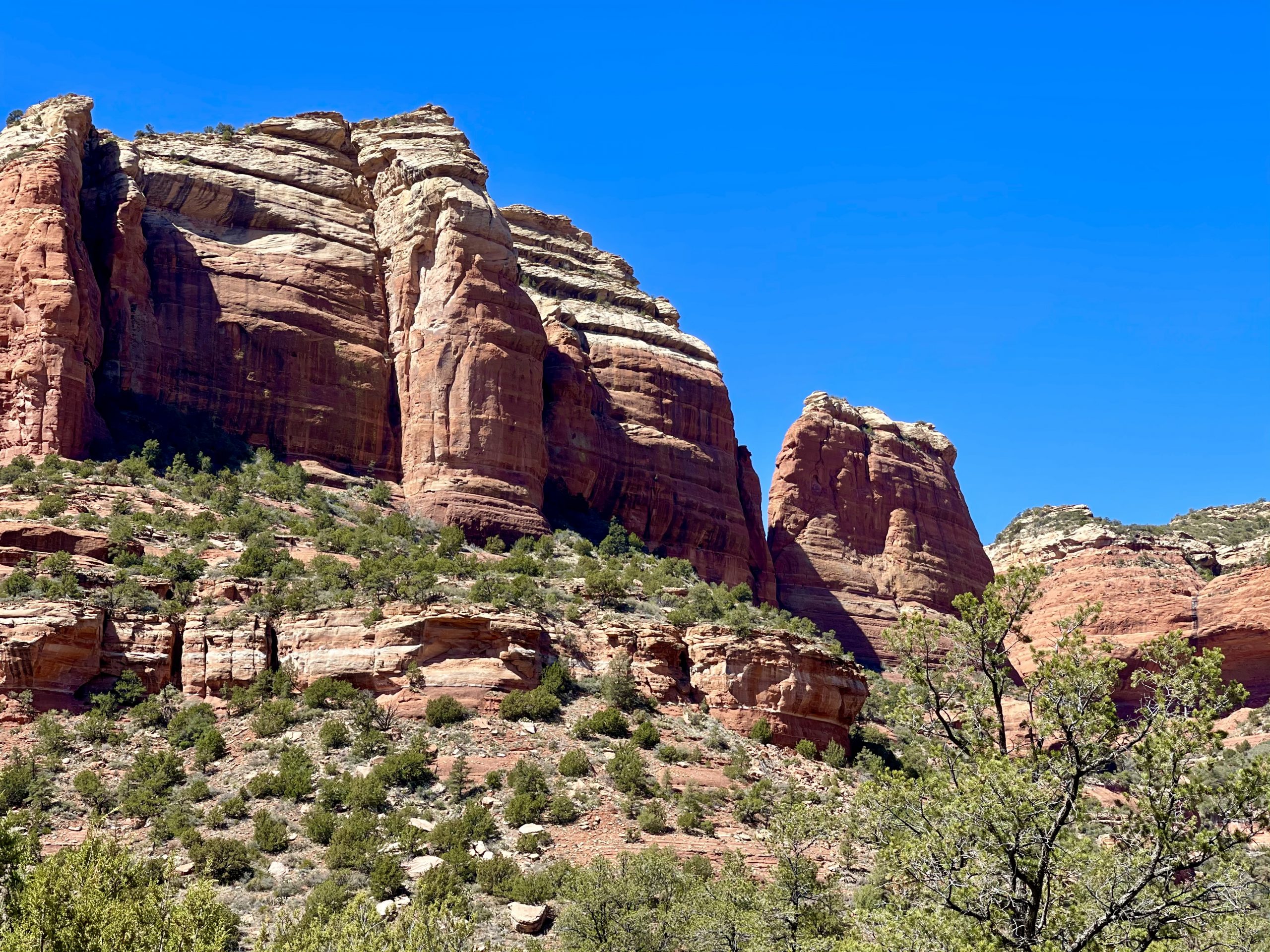
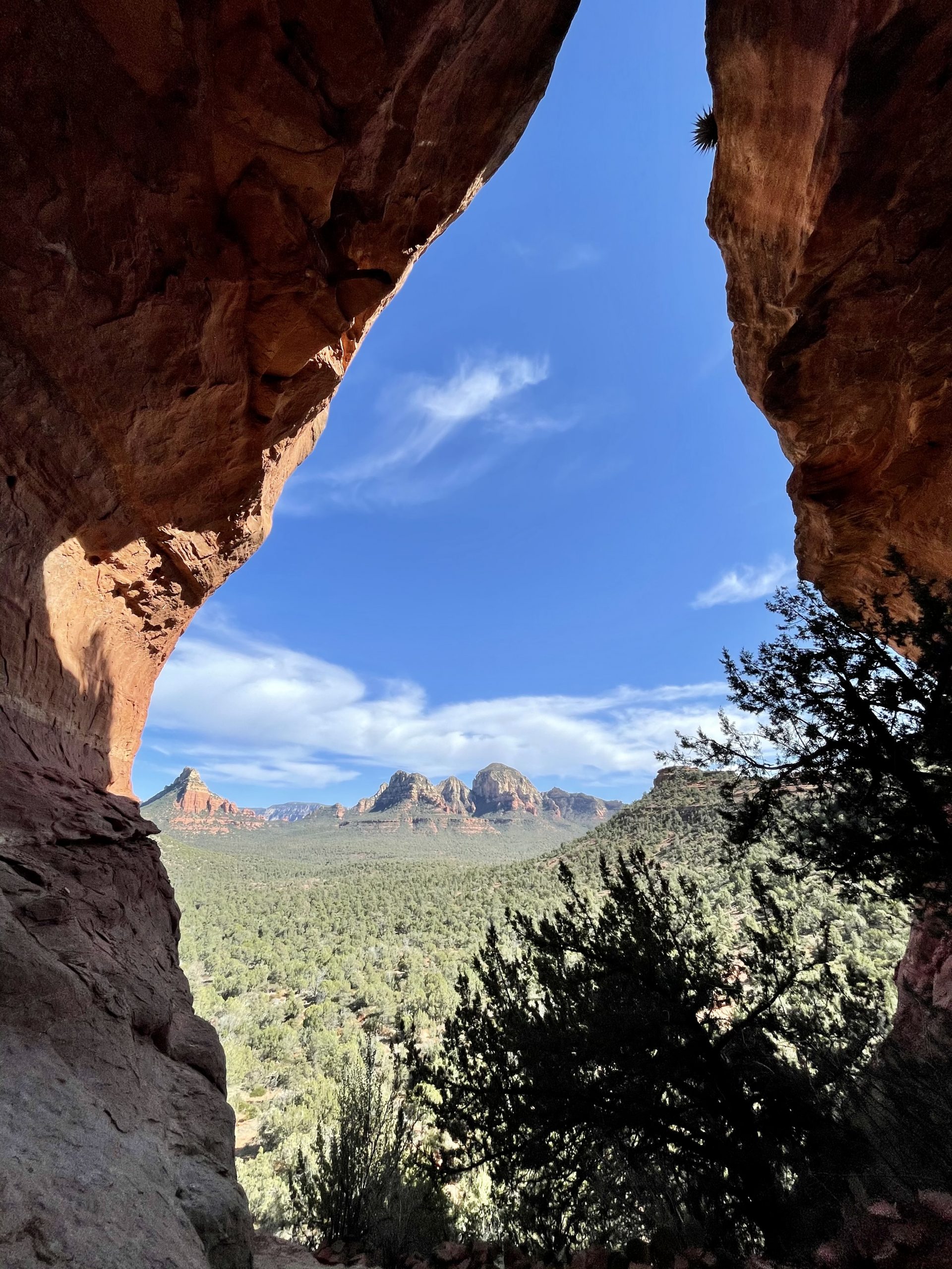
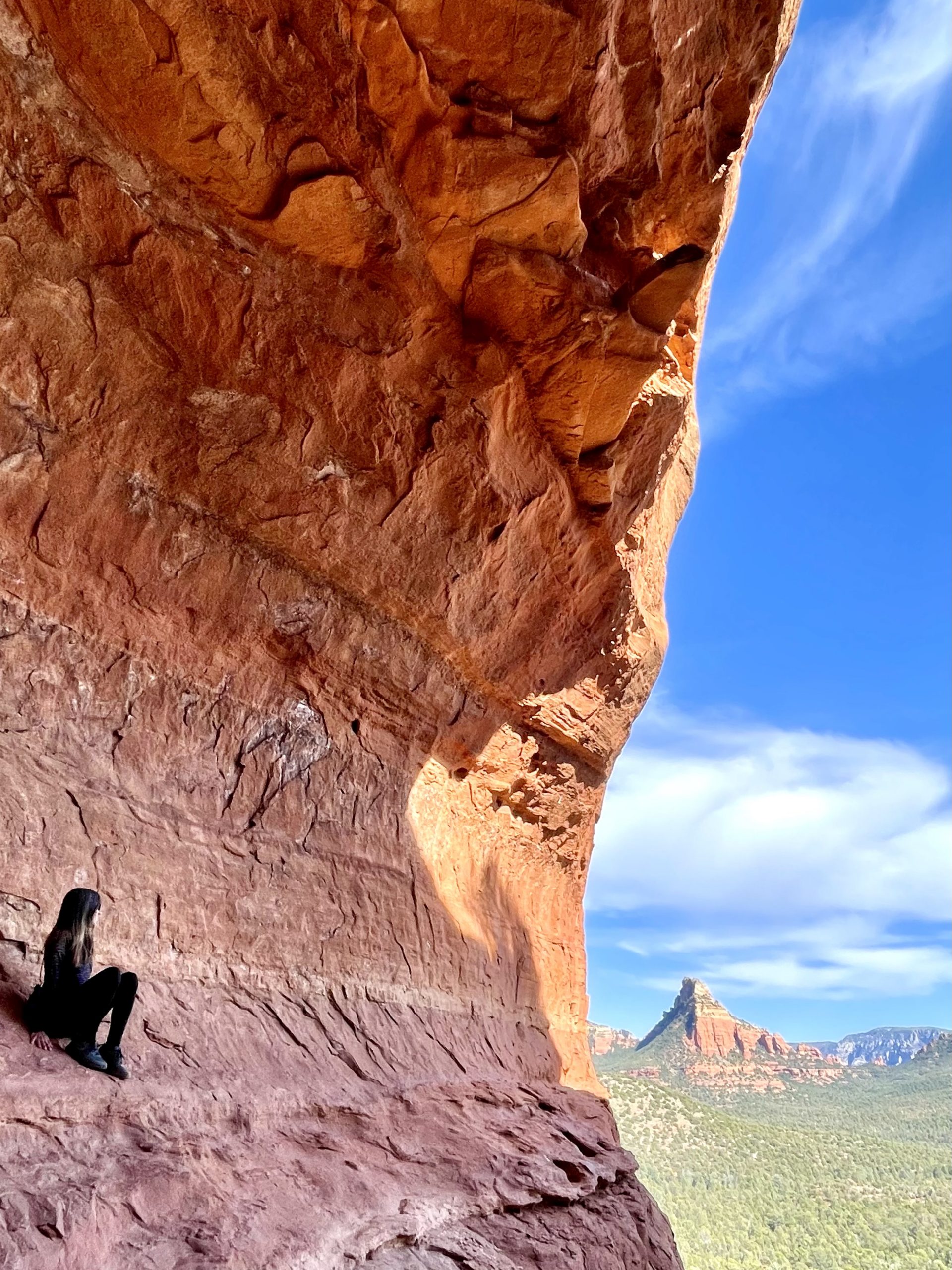
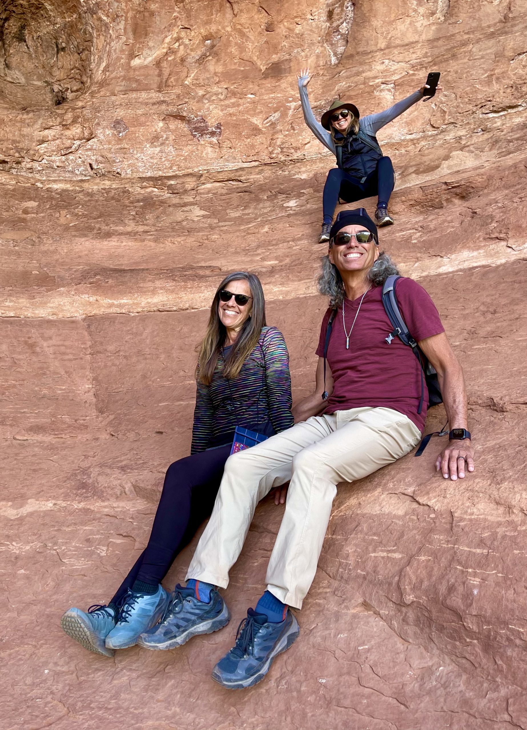
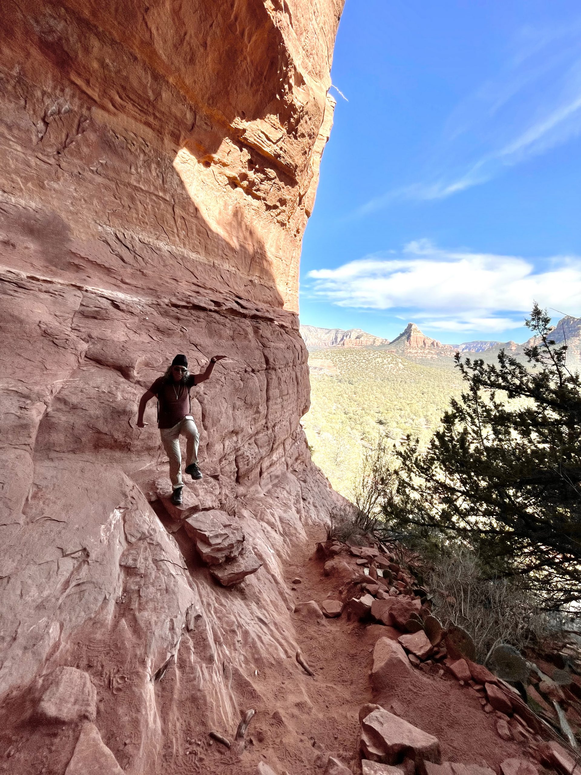
At the new trailhead, we were joined by others also looking for the elusive cave. Now armed with exact GPS coordinates and a clear description, we headed up a winding trail, around junipers and cacti until we scrambled up a steep sandstone section, suddenly finding ourselves in a natural covered amphitheater large enough for a hundred people to climb into.

Looking up from inside the cave

Looking at the V-shaped opening at the top of the cave and the teardrop-shaped opening at the side of the giant rock, we could see why it was called the Birthing Cave.

Looking out from the cave into the valley below

Being in the cave was like being inside a womb. Legend has it that this was a sacred place for Hopis, who sent women there to give birth. Always practical, Susan said that giving birth in the steep cave would not have been easy and the steep hike down afterwards with a newborn may have been even harder. Today, New Age spiritual types often make a pilgrimage to the sacred cave to climb into the womb of the cave then come out of it reborn.

Susan perched high up on the nearly vertical cave wall
We were photobombed by the sister of the woman who took this photo
The Sedona Karate Kid in the Birthing Cave

The view from inside the giant cave was spectacular, with the distant red and white mountains sloping a mile away. Inside, several other people were jockeying for pictures while we were trying to get our own. Sadly, several left after taking a few quick Instagram-worthy snapshots without spending a moment to feel where they were. We lingered on the steep floor, taking in the view and the feeling of where we were before heading back down, happy to have finally found what we were looking for.

The forecast called for rain tomorrow in Sedona and areas to the south toward Phoenix. We’d hoped to head southeast to Montezuma Castle National Monument in Camp Verde, AZ and then to the Superstition Mountains where there were several trails beckoning, but those ideas didn’t look like they’d work out too well in the rain. We briefly considered going to Flagstaff, 45 minutes to the north, but the forecast there was for snow. For now, we decided to find a place to camp to the south of Sedona, and come up with a new plan of some sort in the morning.

So, we headed south just past Sedona until we found a wide, dirt forest service road we knew we could camp off of. Hundreds of others beat us to it. It was amazing how many RVs, trailers, tents and truck campers there were along the road. It began to remind us of the packed Uintas-Wasach National Forest roads we’d encountered outside of Salt Lake City last June. We quickly realized we’d have to go much farther up the road, where we hoped the road would become rougher and steeper so fewer people would venture there. 

Eventually, we turned off the main dirt road onto another much smaller one, which soon became rougher with gullies and sharp rocks that made us slow to a crawl. We assumed there would be fewer people on this road, yet every turnoff had a tent or truck in it. Finally, Susan spotted a faint narrow track that appeared to go beyond where a van had set up camp and lead to at least one more site. 

Another campsite with a view
Getting ready to cook dinner

There we found a pretty spot in steep terrain surrounded by juniper trees that necessitated 4wd to get to. We leveled the truck with rocks under the low side wheels and were glad we found our campsite for the night as the sun cast long shadows. In full view from the truck was a range of soaring vermillion hills dotted with green growth. 

Sedona sunset

After dinner, we took a walk to meet our van neighbors but found that they were already tucked inside. We continued our walk out to an open area along the nearby road and watched the setting sun light up the hills just before the clouds started moving in.

I was a little nervous knowing that the steep section where the truck was would be impossible to get out of when the rain came, as it would turn the whole area into a slippery mess of red clay mud. The forecast had the rain holding off until about 9:00 or 10:00 am so we planned a sunrise departure. Still, I wondered how much a rescue tow would cost if the forecast was wrong.

Leave a Reply

Share this post