Post #31: Susan says, “it’s a gorge-ous day”

May 9, 2020

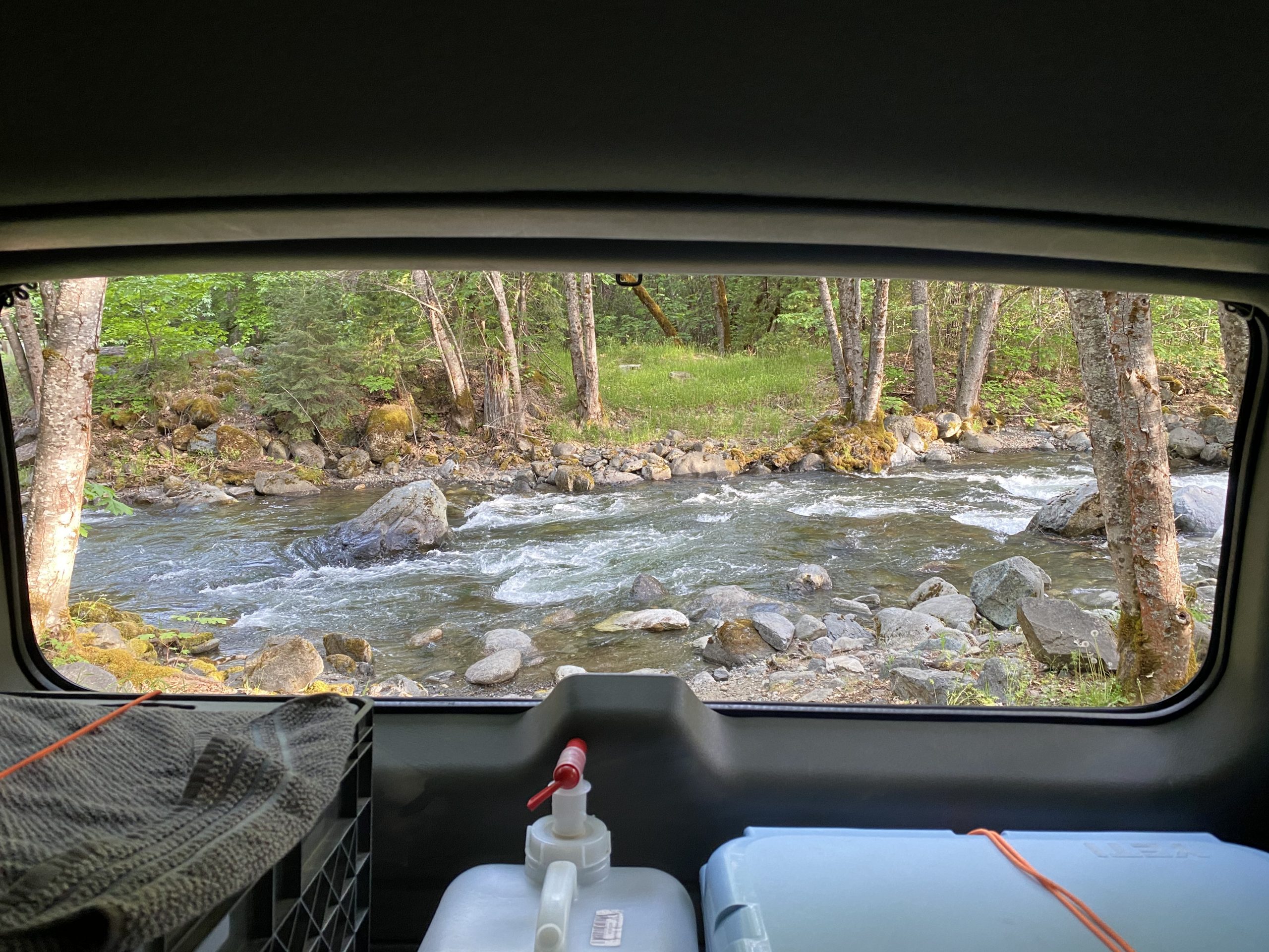
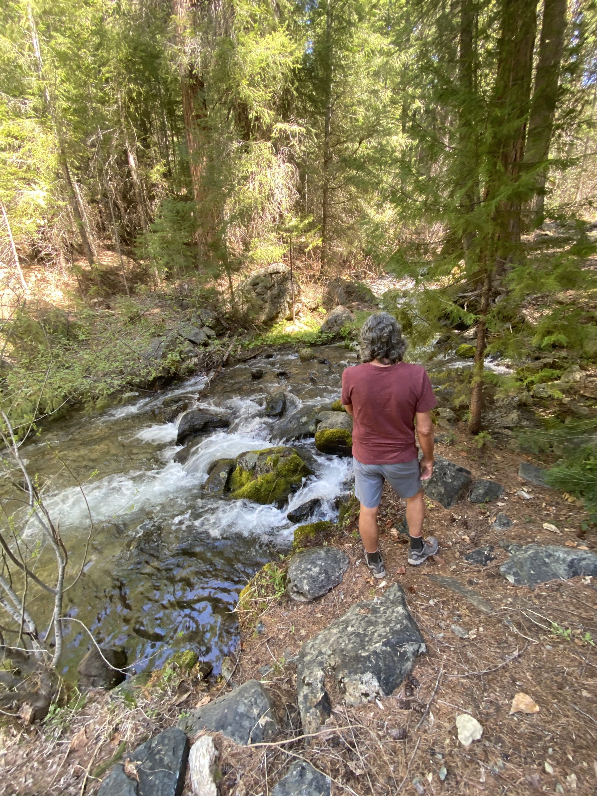
We woke to muted sun low through the trees, a chill, a faint pine scent, and the ever-present smile-inducing sound of Trail Creek. All night, it lulled us to sleep, sometimes woke us, but always lulled us again. We lingered a while, and I looked up out the windows at the huge trees and couldn’t even see their crowns. We were in a forest of giants and they weren’t even close to the biggest trees California had. We got up to make coffee and eggs and toast. The campground was beautifully serene with no other people and only the occasional call of a crow. We lingered over breakfast too, not wanting to leave this enchanted place, but we knew there was more to see.

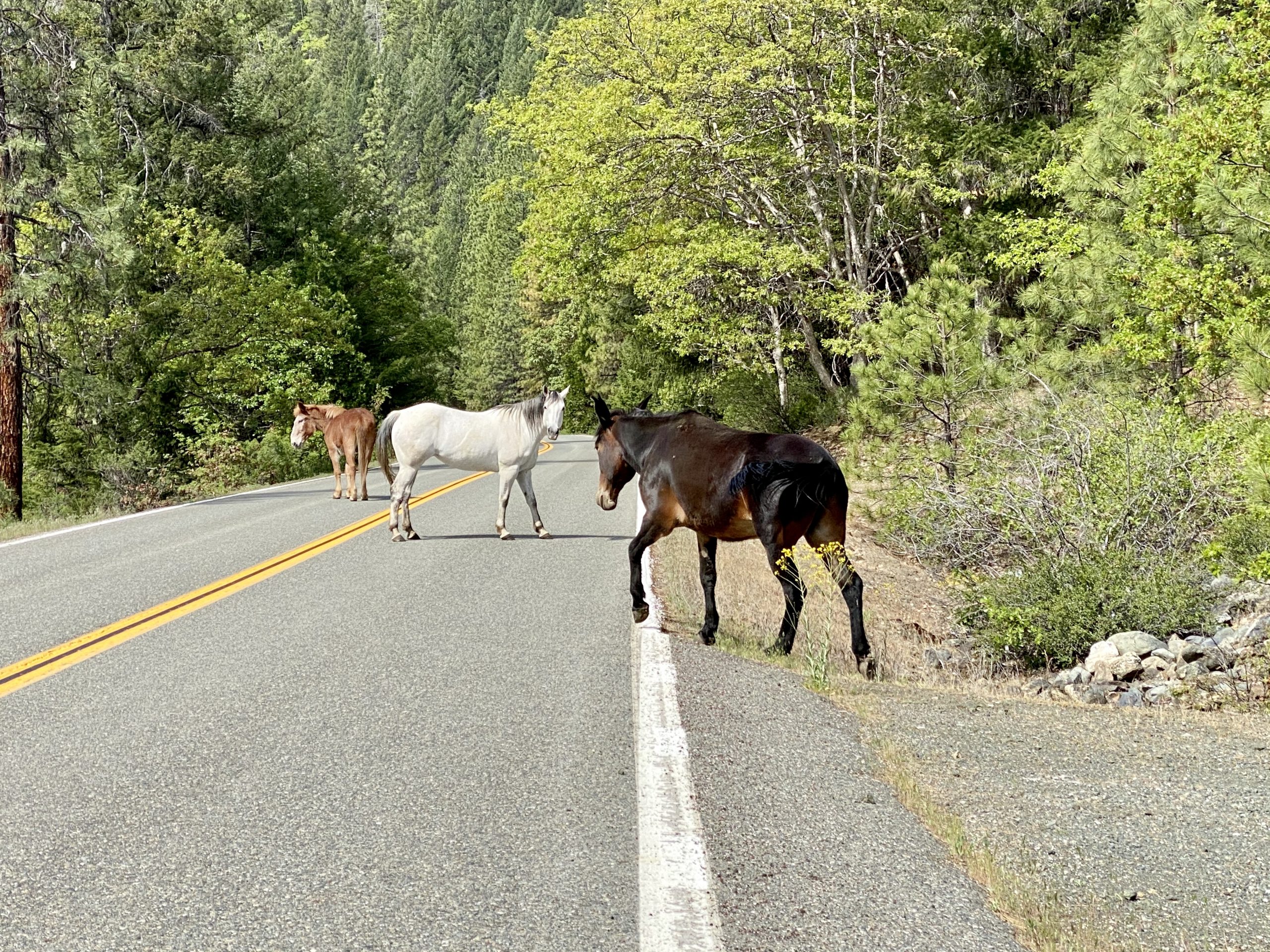
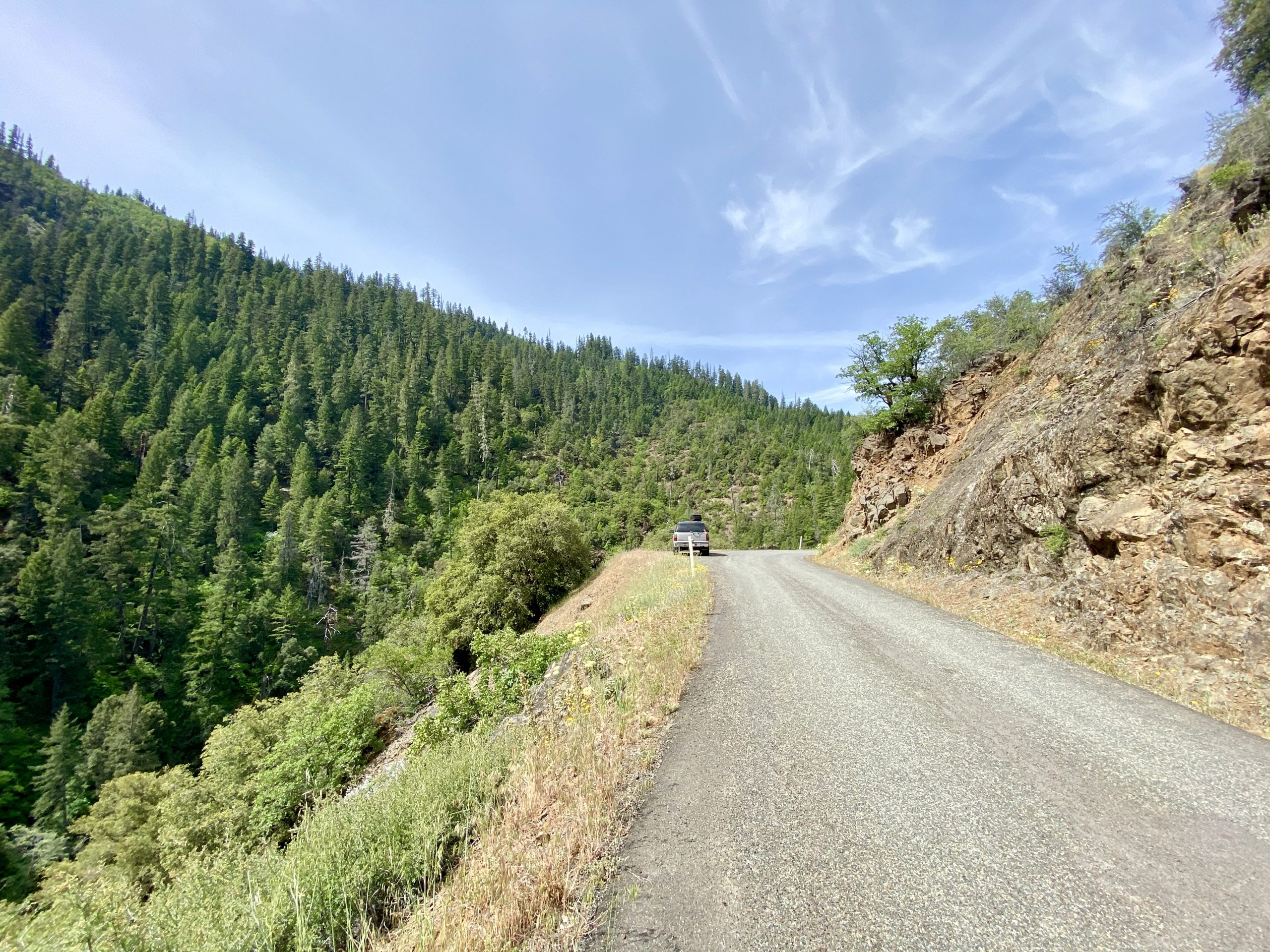
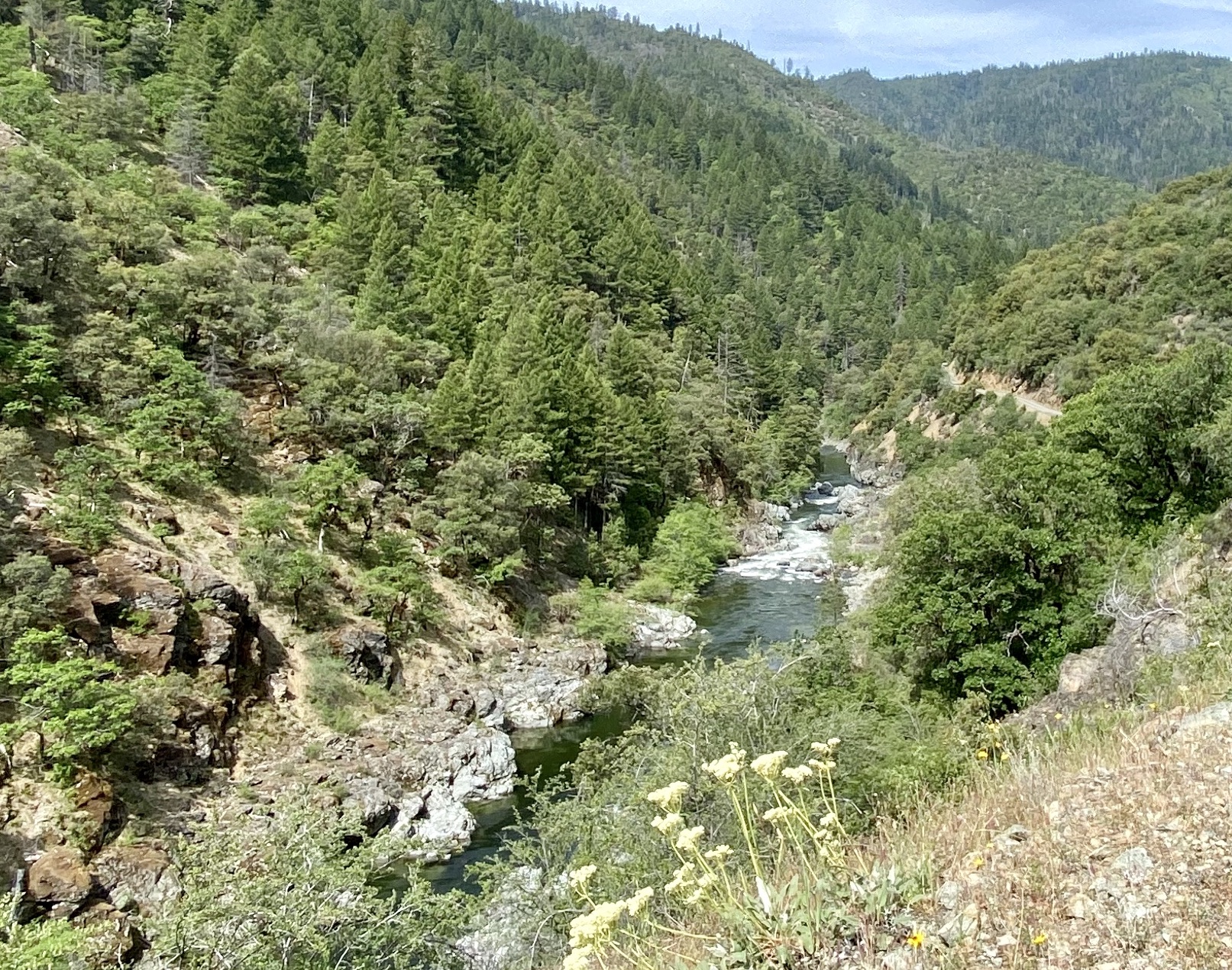
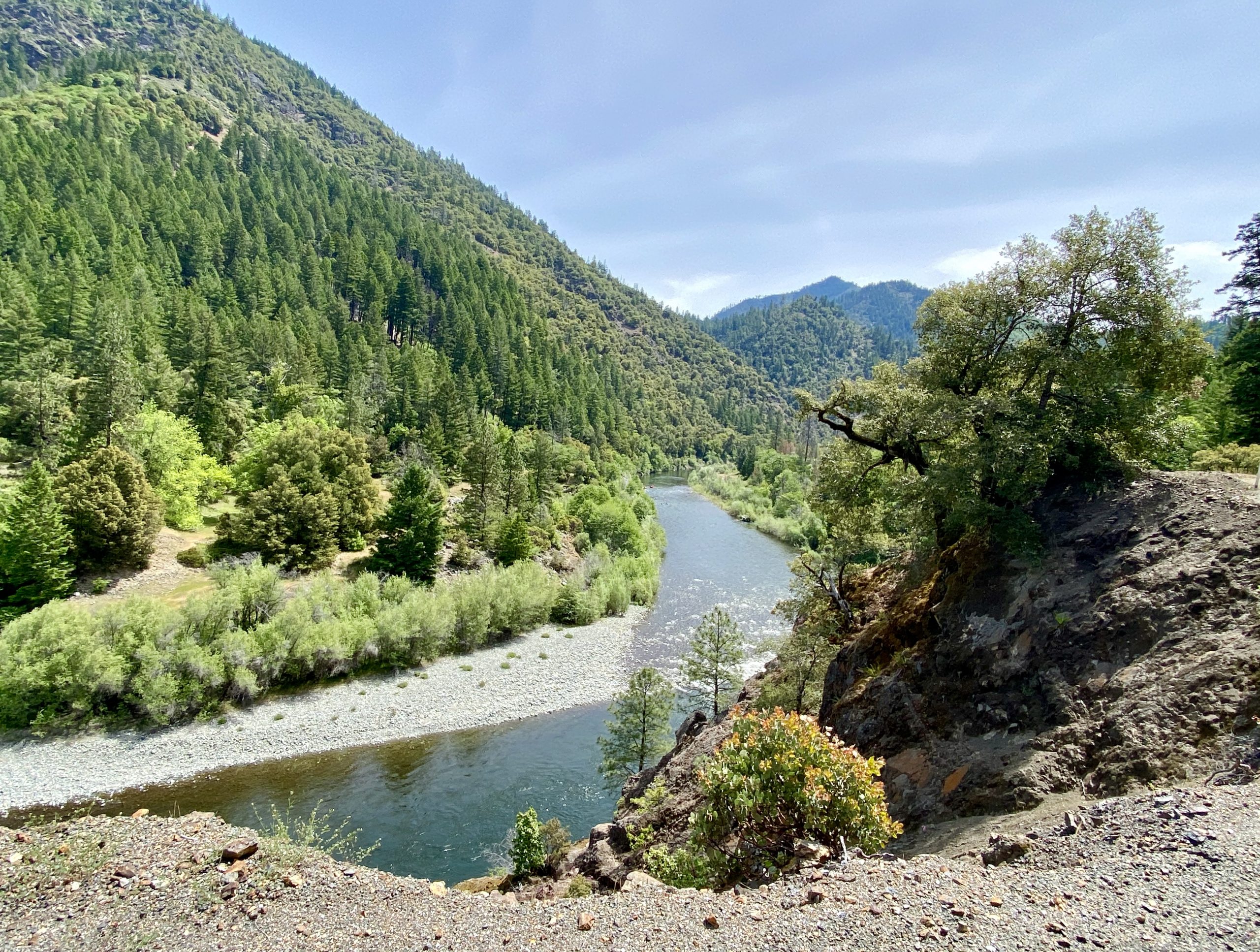
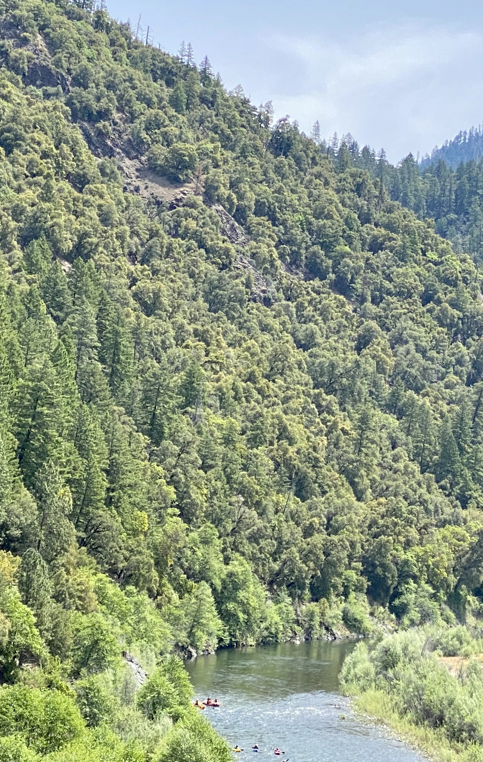
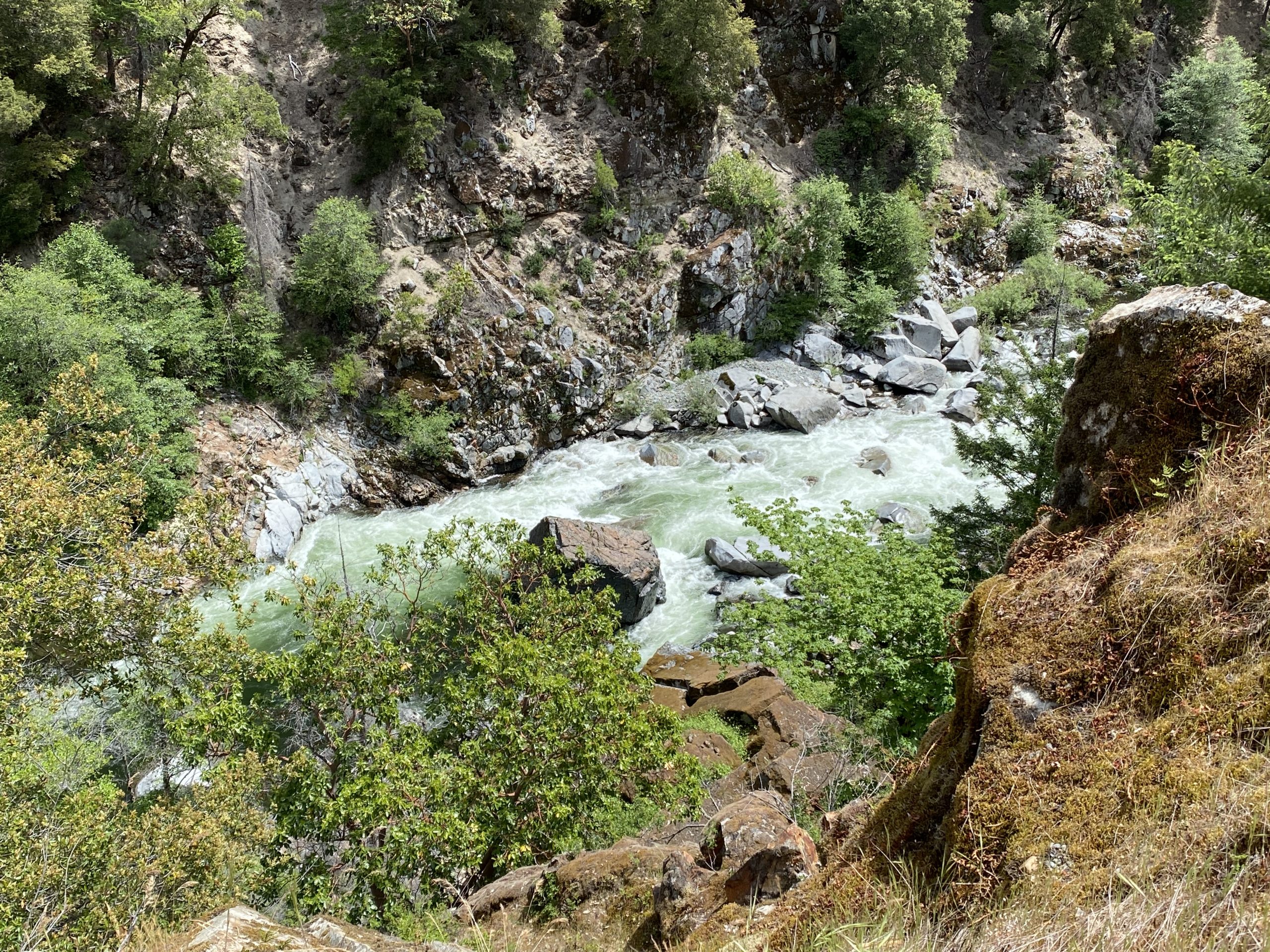
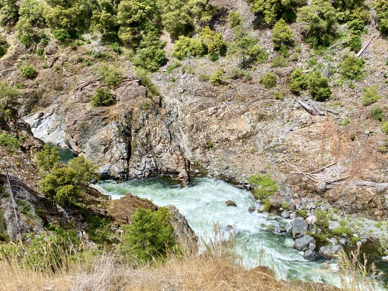
Several routes presented themselves, including to the coast (where it was cloudy and mid-50’s), but we eventually decided to head up CA Hwy 93, continuing in the direction we’d been going when we found last night’s most perfect campsite. The road was marble-smooth and lovely the way it followed the Salmon River as we climbed.

As we approached the tiny community of Cecilville (pop. 718), we had to stop for three horses that were ambling down the road, unattended. So far, the horses outnumbered the cars. 


Driving up the hill out of Cecilville, the road changed dramatically and without warning. It suddenly went from a fabulous two-lane highway to a single lane (but still two-way) rough paved road with no painted stripes or road signs. It was perfect. 

The closest thing to a pull off was the edge of the road above the steep cliff
And this is what was over the cliff

We twisted up high and then even higher above the steep river gorge, stopping in the road every time Susan saw a great photo. The road continued to follow the wild Salmon River, at times nearby and then climbing three hundred feet above. It was as sinuous and narrow as any road we’d been on, at times barely wide enough for the truck to squeak between the steep drop-off to the left and the crumbling cliff-side to the right. The road felt like something from a developing country, not California. Every mile or two was a turnout, but otherwise there were few places two cars could pass. It was hard to fathom how this could even be a named road, let alone a highway. We saw just one car on the entire narrow section that stretched for 75 miles. I was in as awe of the skill of engineers who built the road as I was at the balls of their managers to allow traffic on it.

The tiny post office stood alone at a turn in the road in the middle of nowhere
Really? A pay phone – with phone books?
The town's namesake Salmon River

We went through another tiny town, this one aptly named Forks of Salmon (pop. 126), as it is located at the confluence of the north and south forks of the river. The town had a post office and a working pay phone which could be useful given the lack of cell service after driving for hours. If we had some quarters.

We wondered if the kayakers, peacefully enjoying the Salmon River below us, had any idea what lay ahead

Far down below in the Salmon River we saw kayakers. They seemed to be peacefully enjoying the calm section of the river, perhaps encountering Class I, or at most Class II, rapids. As we drove about one mile farther, the river turned wild as it passed through a narrow section of the rocky gorge. We wondered if the kayakers were aware of what lay ahead. Even highly skilled kayakers might not be able to pass through the whitewater of what were probably Class V rapids by then.

Not for the faint of heart

After many stunning, twisting, steep miles on the single-lane road above the river gorge, we finally reached our turn-off and headed north onto another scenic highway that went along the Klamath River. We were now out of the Shasta-Trinity National Forest and instead in the Six Rivers National Forest. The new road would eventually take us back east over the mountains through the Klamath National Forest. That would be three national forests in the span of half a day.

We didn’t really need gas but I didn’t want to continue farther up in the mountains without more, so when we reached the little town of Happy Camp, we stopped to fill up at an unattended gas station – using hand sanitizer before and after.

Happy Camp was a quirky old west town that consisted of a few closed stores from the 1800’s, a small bustling grocery store, the afore-mentioned gas station, a few other buildings, some houses, and a life-size statue of Bigfoot.

This part of Happy Camp looked like a ghost town-in-the-making
He's at least 12 feet tall and does not look happy

From there, we headed mostly northeast, now driving alongside the Klamath River most of the time. Then we saw a sign leading to a place that we’d seen on the map. It was another gray-line highway (like the one lane road we were just on, versus the colored ones that were main roads) and we thought we ought to explore it since the map said it ended up close to the same place we were heading. It went gently up, following the Scott River and passing some old houses. Then, it too suddenly became a single lane two-way paved road, winding along a canyon with the river below. I never knew California had anything like these roads, and here was the second one in a day. 

We started seeing a few cars parked at turnoffs in the road and saw that they were fly fishermen, likely trying for trout along the rushing river below. By now, we started looking for a place for the night. As long as we were in the national forest or on BLM land, we could camp pretty much anywhere, but the road went in and out of public land and options were limited. We were driving slowly and turning off any likely looking road scouting for a place to camp, often having to back up a steep narrow road that lead nowhere. 

Finally, as we were following the river, we saw a Forest Service road and tuned off. It quickly led to an old wooden bridge over the river, then to another single-lane bridge that crossed a healthy creek that fed into the Scott River a couple hundred yards downstream.

Our truck weighs about 3 tons, so we should make it across. If we don't speed

Just across the bridge was a turn off into the woods to an amazing little single-site campground with a sign designating it as Forest Service. Better yet, 40 feet from where we stopped the truck was rushing Canyon Creek, and we had it all to ourselves. 

Another amazing view from our home-on-the-road

Yep, this is where we’ll sleep tonight, we quickly agreed. We backed the truck up to where we had an incredible view of the creek. Once again, we’d hear the sounds of a rushing creek during the night.

Surveying the creek
These moss-covered rocks resembled a dog enjoying the peaceful scene
Susan perched on a boulder in the creek

We climbed around on the rocks in the creek and noticed how much moss there was. It felt more like Oregon or Washington than California, which made sense given that we were only about 30 miles as the crow flies from Oregon. 

After dinner, we brought our chairs down right by the water, feeling the suddenly cool air hit us and listening to the rushing water, both of us zoned into our own thoughts, relaxed and content. Some days the journey is the adventure, and today had been one of them. We’d traveled at an average speed of maybe 25 mph through three national forests on steep, twisting, narrow roads above deep gorges, traversed along three wild rivers, went through tiny mountain towns, and landed on the banks of a roaring creek. No wonder we love road trips.

Leave a Reply

Share this post