Post #153: The world’s most beautiful lake?

August 11, 2022


It was much colder last night than it had been, about 47 degrees – no more 100-degree days. The heat wave actually was still going on, but in the Canadian Rockies that meant wearing shorts was fine as long as it was accompanied by a flannel shirts and puffy vests till midday. 


We woke early and left by 6:30 to get to the very limited parking area for Lake Louise. On the way, we saw our first black bear of the trip, grazing along the roadside, ignoring us.

An early riser like us

Susan told me Lake Louise was the most beautiful lake she’d ever seen when she visited the park about 45 years before. I told her I’d seen a whole lot of beautiful lakes in my days and it would have to be something really special to be prettier than some of those.

Lake Louise was as stunning as Susan had remembered
Charles agreed with Susan--most beautiful lake he'd ever seen
A lone fisherman and a few kayakers were also there to enjoy the peaceful lake at sunrise

We snagged one of the last US$10 parking spots before the lot filled up and walked the quarter-mile to what must be The Most Beautiful Lake in the World. Period. It was stunning and took our breath away with colors that were almost too spectacular for words. At the far end of the lake was a soaring peak with a giant glacier on it, the sunrise now dancing on its flanks. Other peaks surrounded the lake and the water was a milky sapphire from the glacial silt. Our jaws dropped. Other people were standing near us talking reverently in hushed voices and taking picture after picture. I would have to change my lake-grading criteria.


It was only about 7:30 am and we had the serene lake and trail mostly to ourselves
Along the trail other mountains marched to the shore but the glacier mountain stole our eyes

We took a trail counterclockwise around part of the lake that began near the iconic Fairmont Chateau Lodge, about 10 stories high, whose best rooms looked at the glacial mountain reflected in the water. We hiked along the lake for a mile and a half, most of the trail only a few feet from the silty yet clean water. The smell of firs and pines warming in the sun filled our nostrils. 

On our way back, the chateau was the view as the sun rose behind it

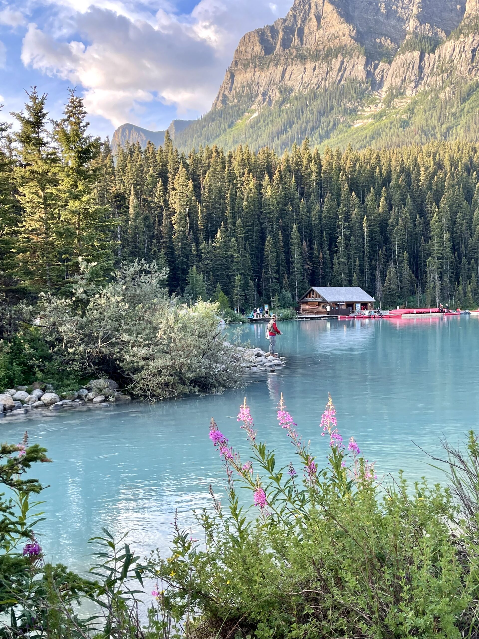
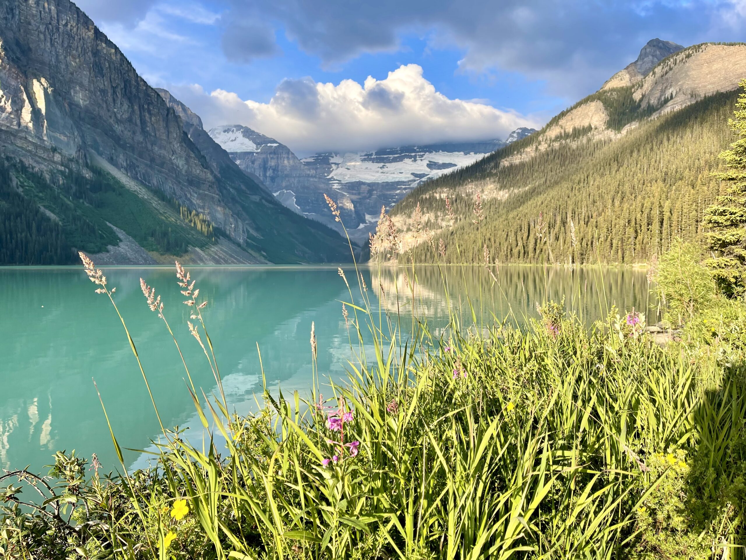
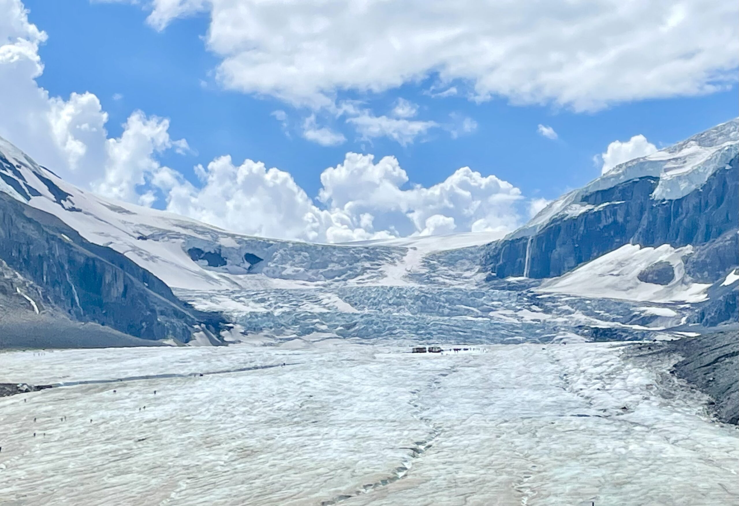
We knew we were someplace special and glad we’d arrived early enough not only to get parking but also avoid the crowds that started building as we returned on the trail. When we got back to the chateau, we went inside for coffee but there was a very long line so we left and instead made coffee using our Jetboil back at our parking space. We’d hoped to go next to nearby Moraine Lake, but the road there was closed since all parking spots in its even smaller lot were now full and all shuttle bus passes were sold out for the day so we left our treasured parking space. By now, the Lake Louise lot also was full and someone would be very excited to get our spot.


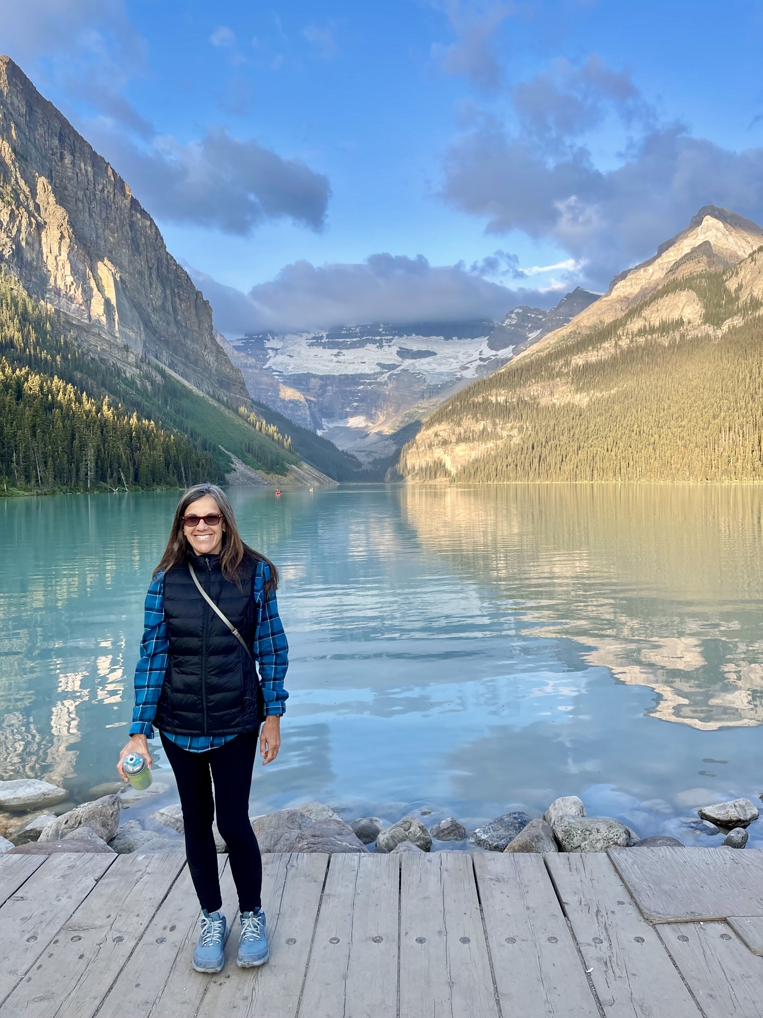
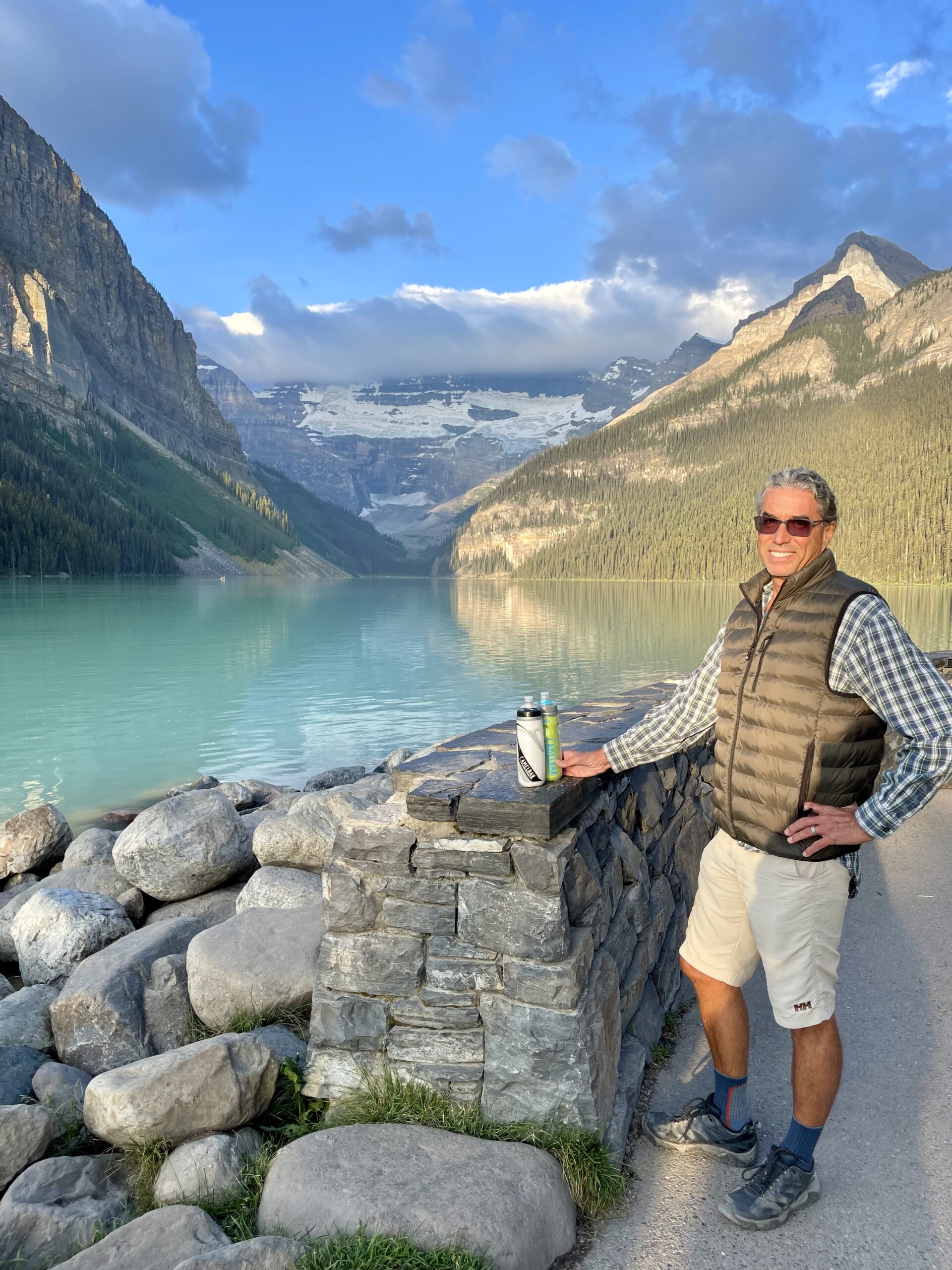
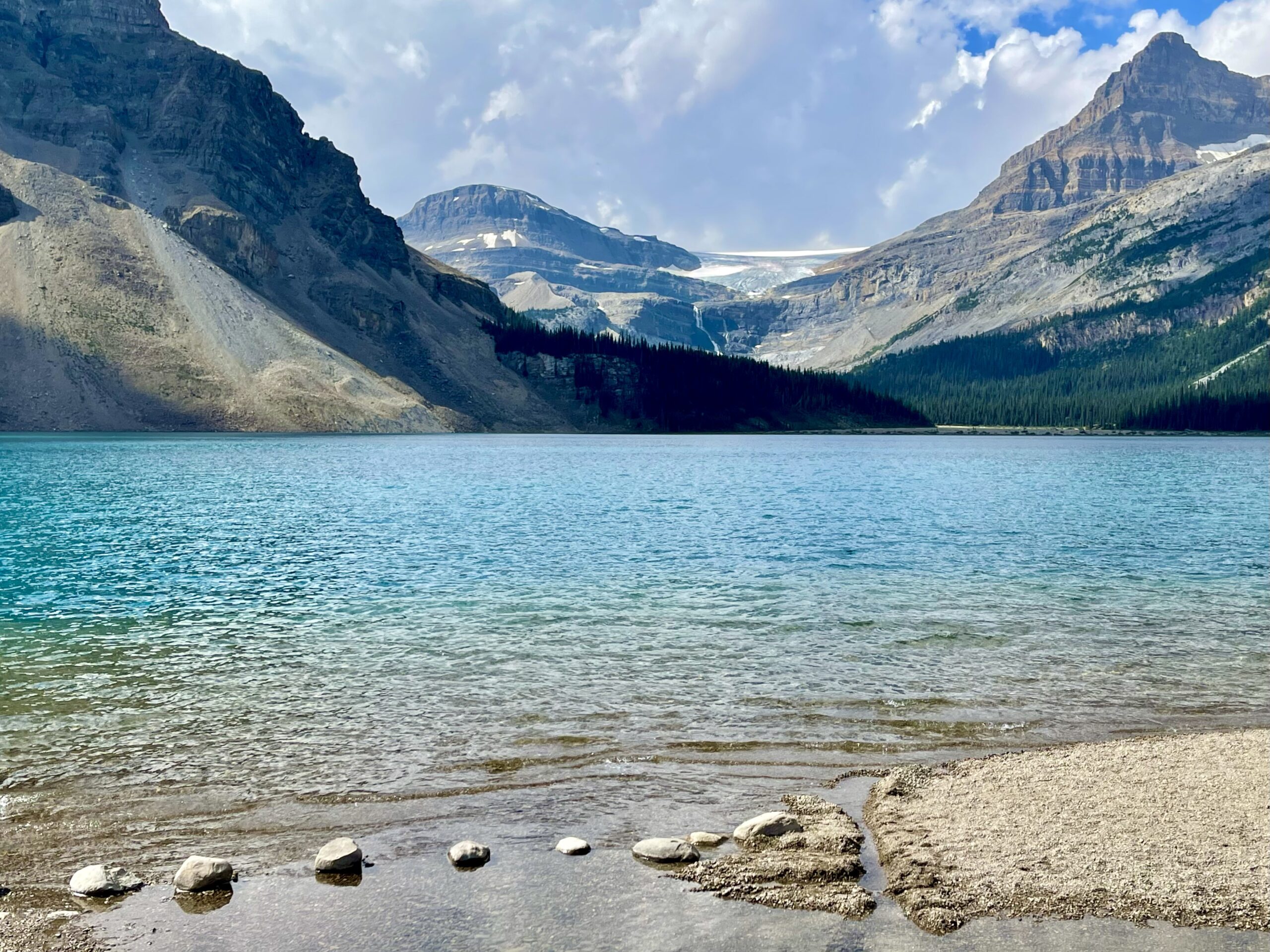
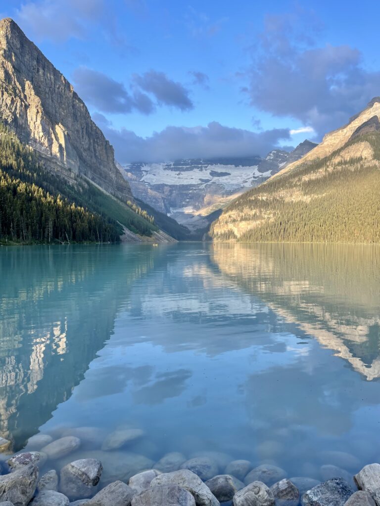
We drove to the nearby visitor center where we found a picnic table near the river that emptied from Lake Louise. I enjoyed granola and Susan finished her coffee as we reflected on the what we’d just seen. It’s hard to imagine any body of water more perfect or more beautiful.


Leaving town, we filled up with our first expensive Canadian gas. To figure out the price in denominations we’re used to, we had to multiply the price in liters times 3.8 to get gallons, then multiply that by the US exchange rate of .73. Eventually we stopped doing the math and just accepted that it was not cheap.

Within minutes of leaving Lake Louise we were on the Icefields Parkway
It was hard to know which way to look, as stunning views greeted us in every direction

Half a mile later, we were on the Icefields Parkway, which promised to be as beautiful as its name. The 232-kilometer (144 mile) parkway begins in Banff National Park and continues into Jasper National Park. We hadn’t gotten far when we both literally exclaimed, “Wow!” 

The air had warmed to 75 degrees but this woman was incredibly brave to enter this glacier-fed lake along the Icefields Parkway

The parkway goes deep into the Canadian Rockies from 4,500 to almost 6,500 feet in elevation and passes by one incredibly beautiful glacier after another. This far north the glaciers are massive, some crowning the peaks with ice that was over 200-feet thick and slowly melting in the now 75-degree summer day.

One of many tall waterfalls that appeared on the face of a steep mountain along the side of the parkway
Exploring a short trail with magnificent views along the parkway
A full-on waterfall at a pull-off

Rivulets, streams and full-on waterfalls dropped from the steep rugged peaks, collected in rivers, then flowed into lakes. All of the water was milky turquoise-colored from the glacial silt. We must have stopped a dozen times in during the first 130-kilometer (80-mile) stretch of the parkway to gaze at a lake, a waterfall, or a view or to take short hikes.

Bridge over Saskatchewan River
We spotted this dirt road that went down to the riverbank

After crossing a rusty bridge over the wide and spectacular Saskatchewan River, I spotted a narrow double-track dirt road leading down a bank toward the river. I whipped the truck around and followed the road a couple hundred yards down to the river where a couple in a jeep were sunning themselves by the wide translucent water. 

It was a beautiful spot and we’d found it only because of our boondocking radar—our habit of scanning for dirt roads off the main road for places to camp.

Tiny islands in the milky turquoise Saskatchewan river
Susan enjoying the sunshine along the banks of the Saskatchewan River, with one of the area's many glaciers in the background

A little while later as we continued up the parkway we saw a truck randomly slowing down and we were pretty sure we knew what it meant. So we slowed and pulled over. 

Right next to us was a black bear grazing, close enough that we could see individual hairs on his head. He paid us no mind as he sauntered by, a few feet away.


Our last stop along the parkway was something we were both looking forward to, a hike to Athabasca Glacier, accessible because the highway had been steadily rising in elevation and we’d reached the level of the glaciers that climbed the mountain peaks. 

Athabasca Glacier is one of the six principal toes (lowest parts) of the vast Columbia Icefield—an area of 325 square kilometers (125 square miles) with ice at a thickness of between 100 meters (330 ft) and 365 meters (1,198 feet).


We parked in the nearby lot and headed down the trail to the glacier’s toe, hiking over a large old glacial gravel mound deposited years earlier.

From the parking lot, the massive glacier loomed in the near distance

Susan was disoriented when we started out because she’d visited the glacier when she was here some 45 years earlier and didn’t recall having to hike a trail to reach the ice. Instead, she had a clear visual memory that the path from the parking lot to the toe of the glacier was at most a couple hundred feet long. 


Soon, signs along the trail revealed the reason for Susan’s bewilderment. The signs marked where the glacier had been 40 and 100 years ago—sadly, global warming has severely shrunk Athabasca Glacier.

Susan was last here a few years before 1982. The glacier has melted very much since then, and continues to do so
To show the massiveness of the glacier, the arrow points to people we could see walking on the ice as we headed down the trail to join them
We were surprised to see vibrant magenta wildflowers growing in the gravel as we approached the glacier. Perhaps another sign of global warming?

After scrambling over more glacial gravel, we made it to the toe. A sign said hiking was prohibited on the glacier without a guide but we followed others who also wouldn’t let a sign stop them from a once-in-a-lifetime adventure. 

At the base of the toe there were ponds of melted blue glacier and past that there were piles of gravel the melting glacier had carried
As if a little sign would keep us off the ice...

Though it was 75 degrees in the parking lot, as we approached the ice the temperature dropped considerably and we both wished we’d brought our puffy vests. A sign explained that katabatic winds were the culprit. The winds cooled as they swept off the cold ice, accelerating until we faced a strange summer wind that was 30 degrees cooler and made us shiver.

Water melted from the glacier into a small river. We crossed a flimsy wooden plank someone had laid down and suddenly we were on the ice. 

We slowly made our way across the gravelly ice
Even after all the melting, Athabasca Glacier is massive. It covers an area of about 6 km2 (3.7 square miles)
Walking uphill on the ice wasn't too slippery because the ice was mixed with gravel
Katabolic wind, rather than pregnancy, caused Charles "bloated" belly while he held up a large chunk of ice

The ice wasn’t as slippery as we’d expected because glacial sand and small rocks were imbedded in the ice, getting released as the end of the glacier melted. Along the edges, we could see the clear raw ice where chunks of the gravelly ice had broken off. I picked up a blue-tinted piece and cracked it in half, exposing clean (and sharp!) ancient ice.  I called over to Susan, who was about 30 feet away, and asked her to come over to where I was so I could show her the chunk I’d picked up.

Heading toward me, Susan stopped midway, listening to the sounds of ice and rocks detaching and rushing down the rivulets under her feet. After hesitating briefly, Susan soon found a safe way around.

"Please take the photo quickly before the so-called ground below me disappears"

Walking on the glacier was a surreal experience and we realized just how dangerous it could be with the older, thinner ice at the edges of the toe melting from underneath. We surmised that 45 years earlier Susan had probably gazed up at the ice we were now walking on, which would have been a few hundred feet farther up. 


Eventually we were too cold to stay on the ice any longer and returned down the trail. Back on the road, we marveled at more glaciers almost everywhere we looked. Traffic was light now that we were heading northwest, away from Calgary and farther from heavily-visited Banff.

We pulled into a campground in Jasper National Park, hoping to get a campsite for the night but figuring we’d probably have to drive beyond the park and boondock (not permitted within the park boundaries) since it was already past 5:00 pm. Luckily, we scored one of the last two sites and, for about US$30, we also got free hot showers and pre-cut firewood. 

We cooked up a nice dinner, enjoyed the hot showers and relaxed until the sun set on our day of stunning scenery and adventure. The partially cloudy skies of the last couple of days were now gone and it looked to be a cool night, perfect for sleeping.

Leave a Reply

Share this post