Post #91: The old and the new west

March 26, 2021

The wind died overnight and no critters visited (that we knew of). We were underway by 7 am. We drove back down the rough dirt road until we came to The Gully, which looked much worse than the day before. I went over it slowly and dragged something in the back as we were coming up. A few more miles of deserted dirt road brought us to a paved road that was suddenly and rudely not deserted as cars streamed from feeder roads, their drivers rushing to get to work. There was an Air Force base nearby and we assumed many of the commuters were heading there.

A Safeway suddenly appeared and we both felt jarred at how quickly we went from desert camping to civilization. But, it was convenient so we stopped at the Safeway for coffee and picked up a few grocery items. Back at the truck, I inspected for damage from the gully and noticed the stout metal trailer hitch light connection was no longer where it was supposed to be. I’d have to fix that back at home. As we left the shopping center, traffic stopped at a railroad crossing for one of the longest trains I’d ever seen, complete with a helper locomotive in the center and two pusher locomotives at the end. There would be some uphill travel for it soon.

The OK Cafe was just okay
Our first view of the historical reenactments

Then, we set a course for Tombstone, Arizona and arrived an hour later. We had breakfast at the OK Cafe, which unsurprisingly had few healthy options. As we sat by the window eating, a horse-drawn stagecoach trundled slowly by. It was cool out, in the mid-50s and breezy, but the sun was up in the clear sky. 

Out for a morning walk through town
Stagecoach outside the original O.K. Corral
Bed, breakfast, & bordello
Big Nose Kate's Saloon-cum-chachka shop
Doc Holiday's Saloon--still a saloon
25 cent whisky! With a side of hot peppers? Sadly, the whisky price was no longer accurate
Quaint cabin with wagonwheel rockers

After breakfast, we walked a half block to Main Street, which was pretty much just as it was in the 1880’s—a dirt road used only by pedestrians, horses and wagons. Many of the buildings lining Main Street were the same ones from the gunfighter era, including the famous O.K. Corral, and some still sold cowboy stuff, while others sold frozen yogurt and “old timey” photo ops. 

Wyatt Earp and Doc Holiday
These dapper gentelmen seemed to be in a rush to go somewhere
A madam outside one of the bordellos
This well-dressed man was hawking customers to come inside for a gunfight show

A couple of unsavory types lounged at the end of the street, whom we soon identified as Wyatt Earp and Doc Holiday, let us take their picture without shooting us. Here and there others were dressed as cowboys, saloonkeepers and madams. Some hawked shows, mostly about the gunfight at the OK Corral, made famous in movies and re-enacted several times a day here for paying customers.

We wandered back streets and dusty lots where old mines and the town jail had been and chose not to spend $10 a person to see the gunfights, some of which were at Boot Hill cemetery. But we made a note to watch some of the old movies filmed in Tombstone when we got home. It was fun to see the town even if it was a bit kitschy.

Old mining equipment
Jail next door to a church and next to that another saloon.
$5,000 rewards for Billy the Kid and Johnny Ringo, an enormous sum in the late 1800's, equivalent to about $130,000 today

In the late morning, we mounted up and headed south for the quirky town of Bisbee, Arizona. 

Like Jerome, Bisbee's an historic hillside mining town. But unlike Jerome, Bisbee avoided becoming a ghost town

Where Tombstone was an old west town trying to remain so, Bisbee is an old mining town that remade itself as a destination. When the last mine closed in the 1970’s, Bisbee became a magnet for artists and hippies who discovered dirt cheap homes for sale and came in droves. 

The town appeared to be reasonably prosperous with inns, restaurants, antique stores and boutique clothing shops. Motorcycle riders (nearly all on new and very expensive Harleys) from California and Arizona were everywhere. We went into a few shops, including a mineral/jewelry store that beckoned us with a going out-of-business sign–Susan bought a silver necklace for half price. 

There were hundreds of beautiful paintings along the steep alley
We thought about the amount of work required to take the paintings down in inclement weather, and later rehang them. Maybe they just leave them up until the late summer monsoon season?

Scattered throughout the town are numerous art galleries and studios. And there’s a steep alley with hundreds of paintings hanging along outside walls.

Bisbee is mostly built on the sides of steep hills and we walked up and down the hilly streets and climbed some of the claimed 1,000 stair-steps scattered around the town. 

Buttons decorated this doorway
Giant, solid copper barn-style doors with pick-axe handles. Copper may have been easier to come by than wood in the desert
An ecclectic collection of random (and a little creepy) stuff in this window display
Stickers on the entrance door to this club included one that reflects the town's liberal politics--including a picture of bigfoot with the caption "Antifa Is Everywhere"

Throughout the town there were interesting architectural features, shops selling oddities and hippie wares, and stickers that reveal Bisbee’s left-wing political leanings.

Murals decorate buildings and decaying walls. The whole place felt more like Haight Ashbury in the 1970’s than southern Arizona in 2021. Unsurprisingly, Bisbee has adopted the moniker “Mayberry on Acid.”

While we window-shopped in front of a tiny and very busy pastry shop, Patisserie Jacqui, a couple waiting in line at the outdoor take-out counter told us they were from Mesa, AZ (three hours away, near Phoenix) and every time they came to Bisbee they spent at least $75 at the patisserie. On Saturdays, they said, the place often ran out of goodies by 10 am so they had to place their order in advance online to be sure to get their favorite items. Note: a shared chocolate pastry with Bailey’s cream filling later, we wholeheartedly agreed their money and efforts were well spent. 

Heading out of town we passed one of the open pit mines, almost a mile long, a giant gash in the earth stripped of copper and silver, closed only 45 years ago and now a toxic cleanup site. 

Mining for metals was (and often still is) environmentally disastorous

There’s no doubt that 100 years ago the country desperately needed copper for phone and power lines, refrigeration coils and pipes to help it grow, but the environmental damage done for the huge profits that made mostly owners of corporations rich seemed to be a high price to pay.

A right turn would have been the wrong turn since the border was closed due to Covid.
A border detention facility
Mobile cameras and sensors alongside the road near the border

Leaving Bisbee, we drove east toward New Mexico. Bisbee is just 11 miles north of the Mexican border and the route to New Mexico brought us close enough to the border that we caught glimpses of The Wall. We also passed by one of the infamous razor-wired border patrol holding facilities for immigrants caught escaping to the U.S.

Lonely view ahead of us
Lonely view behind us

When we then turned north on Highway 80 we found ourselves on one of the loneliest highways we’d ever been on. And that’s saying a lot, given the places we travel. Mile after mile of desert lined the road and we saw less than a half-dozen cars in two hours. 

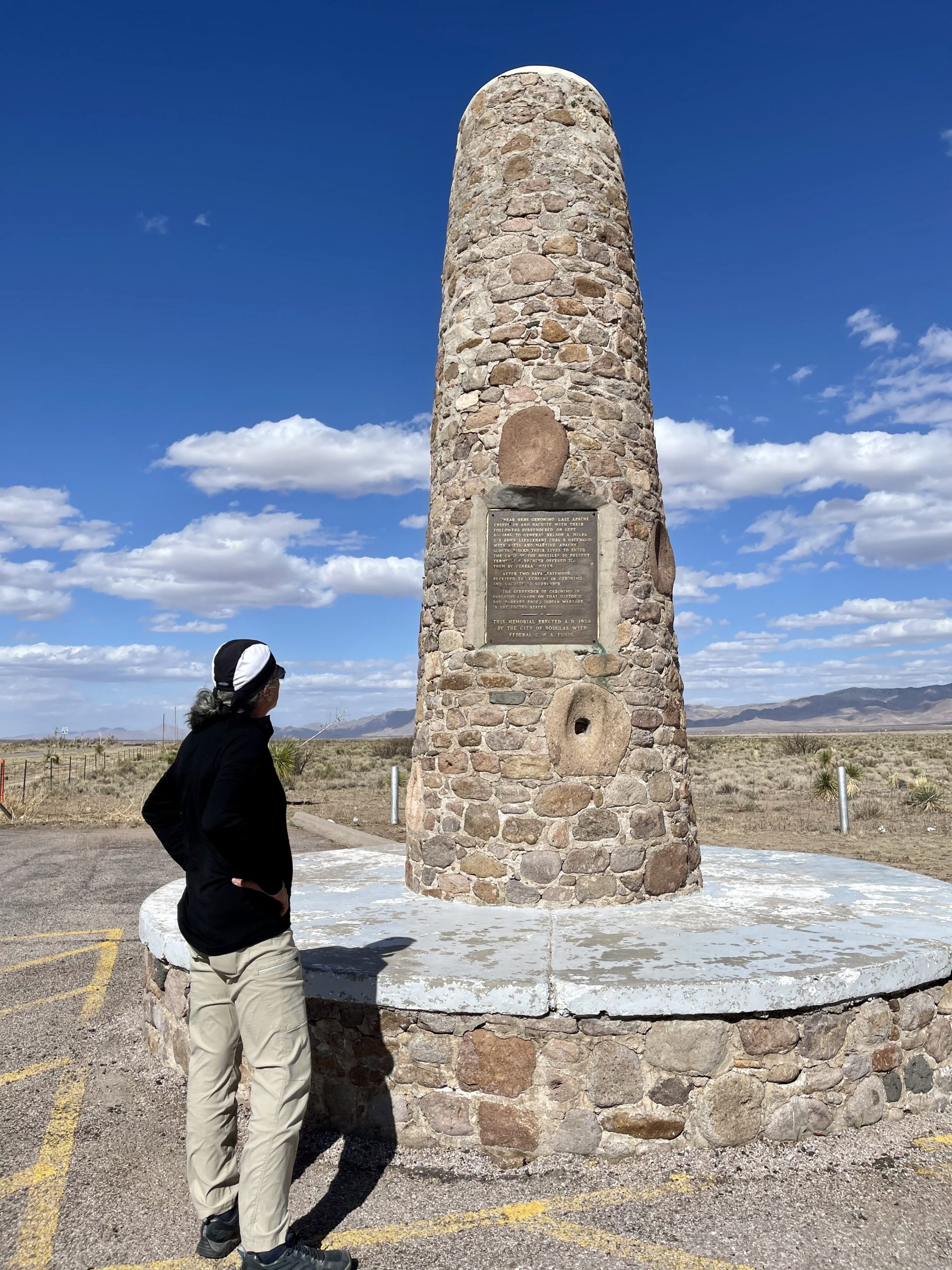
Near Douglas, AZ, we pulled over at an historical marker because it was a large obelisk instead of the usual small sign. The site marked the surrender of Geronimo, the famed Apache leader, which pretty much ended the wars between the US and Native Americans. It was a lonely marker on a lonely road with a sad story.

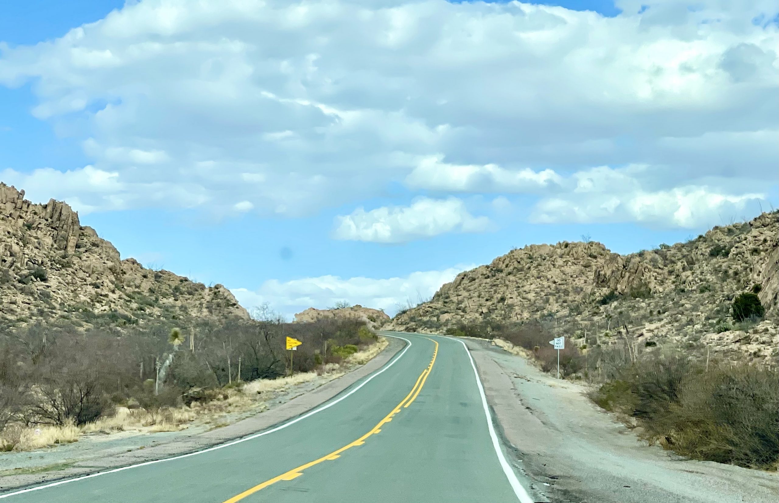
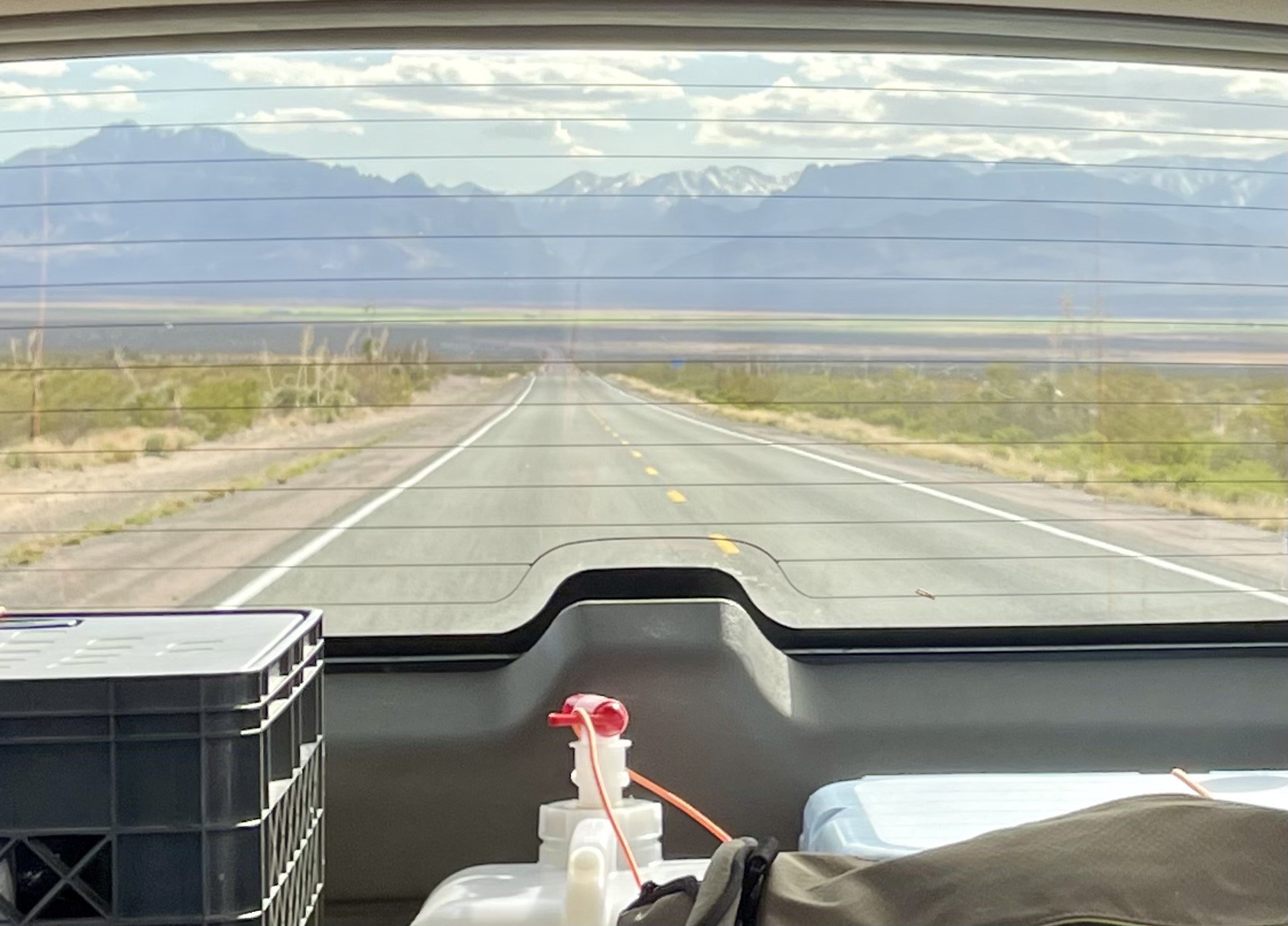
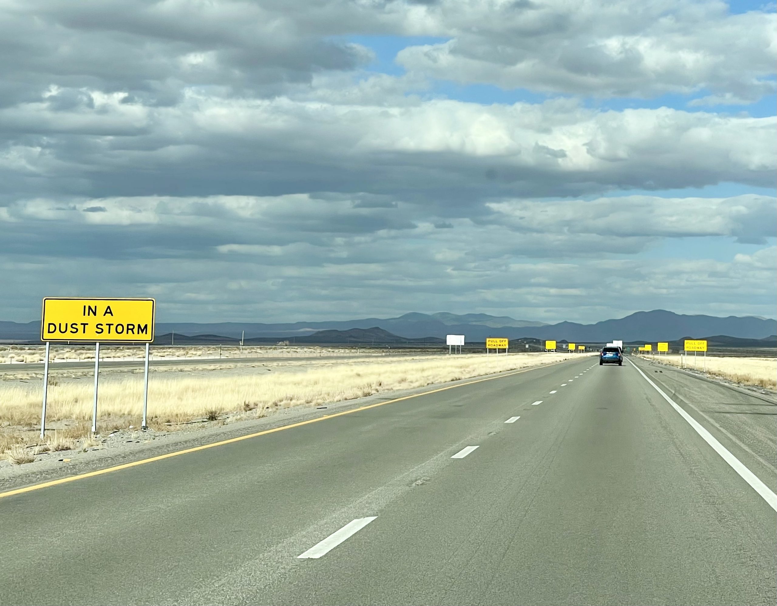
Eventually, we turned onto Interstate 10. Driving on the lonely road to the big highway, we had a better appreciation of all of the hundreds of exits along interstates that seem to go nowhere important. But each of the roads has a personality of its own, a history, and always a story to tell.

Signs instructing us to pull off the road in a dust storm
Fortunately, the dust was not yet at storm level

Soon, we passed into New Mexico and watched our watches change time zones. New Mexico and Arizona are both in the Mountain Time Zone but Arizona (wisely, we think) chooses not to observe Daylight Savings time. Large yellow signs along the interstate instructed drivers to pull over in dust storms, where visibility can easily drop to zero. The wind had picked up and dust swirled along the side of the road, but it wasn’t impairing driving so we continued. After about 10 miles on Interstate 10, we exited, heading north with a strong tailwind toward Silver City, New Mexico.

After a few miles, we found ourselves in the Gila National Forest and saw a sandy road off of the highway that led to a pretty, circular campsite under an old oak tree, some of the first real trees we’d seen for days. The elevation was close to 7,000 feet. Normally, we like to go a little farther off the highway, exploring for better campsites, but there was no need this time as there was almost no traffic on the road.

In this very lightly traveled area it was easy to find our large, private, circular campsite

We settled into our campsite, took an exploratory walk farther up the sandy road, made dinner, watched another magnificent desert sunset and planned the next day’s adventures.

One Response

Leave a Reply

Share this post