Post #99: The cone of hell

June 17, 2021

Snick, crunch, crunch. Snick, crunch, crunch. Snick, crunch, crunch. We’d never hiked a cinder cone before and it was getting obvious that the cinder cone at Lassen National Volcanic Park was going to be a challenge. Surprisingly, few people were on the trail at 9 am even though it was unseasonably warm and the sun soon would heat up the dark ground. We were glad to be heading up the trail while it still was relatively early and somewhat cooler. Having the cinder cone almost completely to ourselves would be an unexpected bonus.

We started the hike on a soft footing of cinder and pine needle
Large Ponderosa pine cones were everywhere

The trail from the campground brought us through giant ponderosa pines whose enormous cones were spewed across the nearby fields. We were glad for the shade of the trees, especially knowing that soon the trail would be completely in the sun.

The lava islands we'd seen in the lake were just a portion of massive hills of lava

Soon the trail went past the Fantastic Lava Beds. Enormous piles of sharp lava stretched for maybe half a mile alongside us.

Okay, so hiking on cinder at least is softer than climbing a lava rock hill would be
Thank goodness we'd come in the morning. By afternoon the sun on the nearly barren cone would be unrelenting

After another mile or so, we reached a cone that rose some 700 feet above the forest. The cone formed 400 years ago during a lava event that also transformed hundreds of acres of lake and forest into a huge broken lava field.

The cinder was fine at first but became coarser as we climbed higher
This is one trail where hiking poles are really helpful

The snick was made every time a hiking pole dug into the loose cinders, followed by the crunch crunch of two steps along the steep path. Initially, the surface was like coarse dark gray beach sand but soon we were climbing through the addition of popcorn-to-baseball sized chunks of middle earth. The trail slowly spiraled up the slightly asymmetric cone at a constant steep angle. We stopped frequently to catch our breath as after each two steps up we’d slide back one.

One tree hill

Snick, crunch, crunch, one foot in front of the other. A couple of feeble pines were trying to grow on the steep barren slope, likely surviving only due to the deep snow that blankets the whole park in the winter. The rest of the cone looked much like it did when ash spewed from it for weeks.

As we spiraled closer to the top, we eventually could see Mount Lassen as well as more mountains and forests stretching for miles. Huffing and puffing, we finally made it to the top, happy we’d brought our sun hats and lots of water. Once there, we rested under a stunted pine, thankful for a small amount of shade. Our socks were gray with fine cinders and a strong wind cooled us.

This was literally the only shady spot on the entire cone

Just in front of us was a steep crater in the middle of the cone. Beyond the crater we had a spectacular view of Mt. Lassen, only a few miles distant and still streaked with snow. We’d hiked to Lassen Peak a few years ago and it was a challenging trail—it starts at about 8,500 feet and climbs for 2.5 miles to about 10,500 feet. Some people say that the Cinder Cone Trail we were on is even more challenging – it was certainly hotter.

Painted Dunes, Fantastic Lava Beds, and Lassen all visible from the rim
Beyond the dunes and lava Juniper Lake came into view

The views into the crater and out to Mount Lassen were spectacular. But there was more. Soon, we started along the rim trail, cameras clicking. Surrounded by a jagged lava flow now hundreds of feet below us were “painted dunes”, which were actually more cinders with a different chemical makeup that made them look like dunes of red, silver and brown. Beyond the lava flow and painted dunes was Juniper Lake, the largest lake in the park, with more forests and mountains in the background.

Susan headed up to the highest point at the top
From the summit, Susan looked out at a vast swath of the Fantastic Lava Beds and Butte Lake beyond

About 3/4 of the way around the rim the path split, with one part leading to the summit and the other leading down into the crater. Susan hiked up to the highest point of the rim for the best views. 

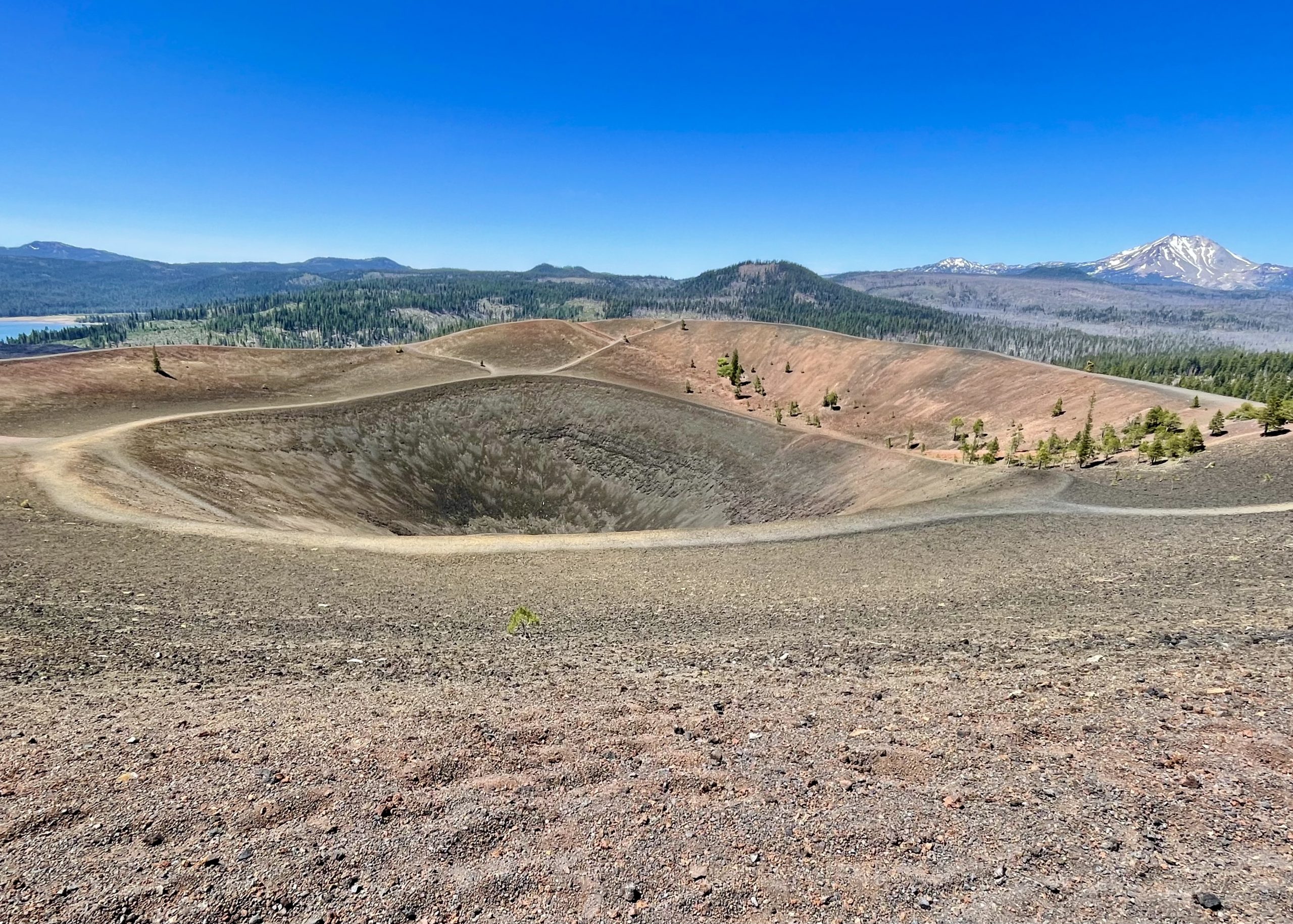
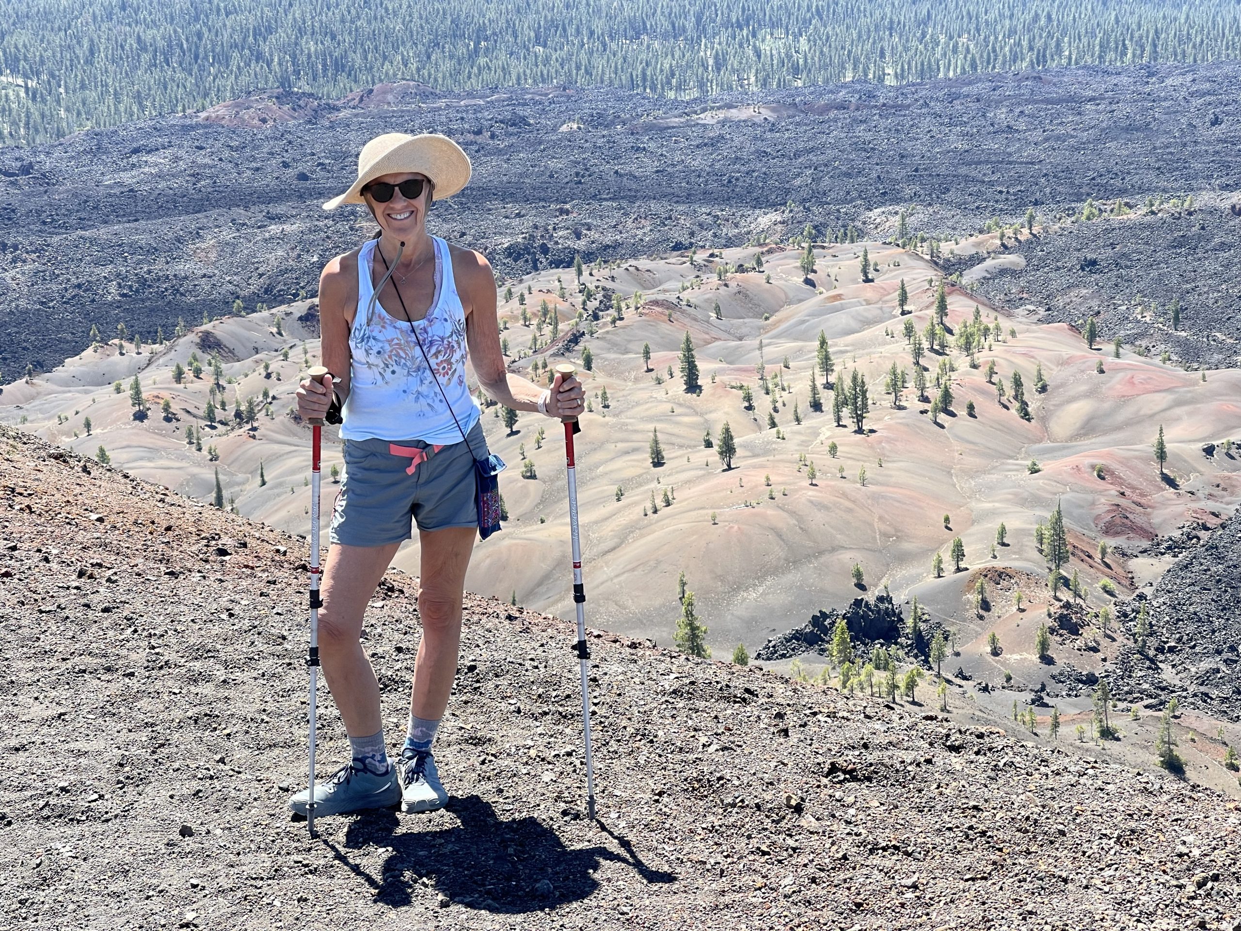
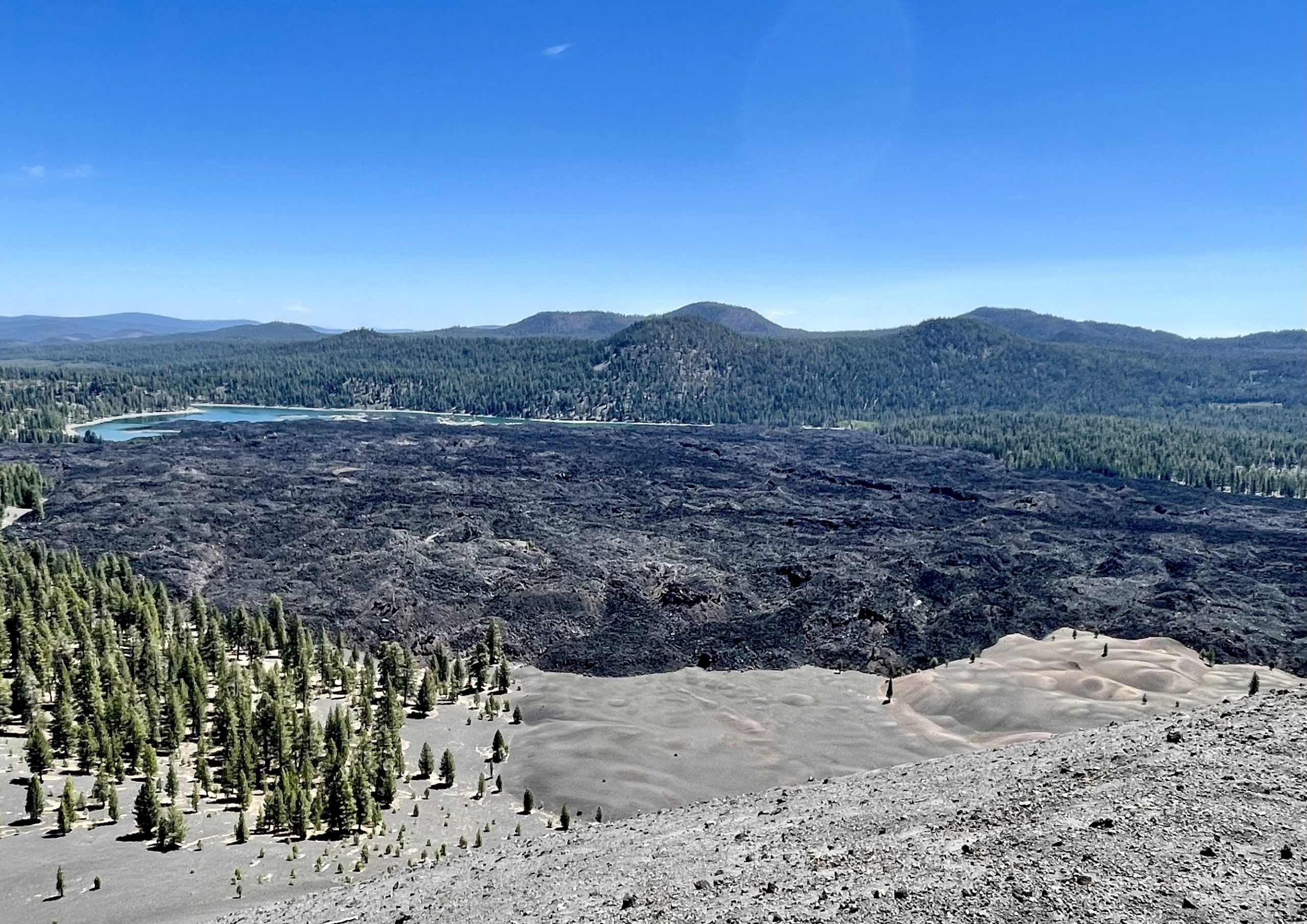
I chose the short but difficult trail leading to the bottom of the crater. At the bottom it was eerily quiet with no wind. Looking up from the crater, I could see no one and a sense of desolation came over me. Four hundred years ago, right where I stood, destruction poured out of the crater, devastating the forest for miles around and building up the cone. I wasted no time climbing back up the 200-foot high trail to the rim.

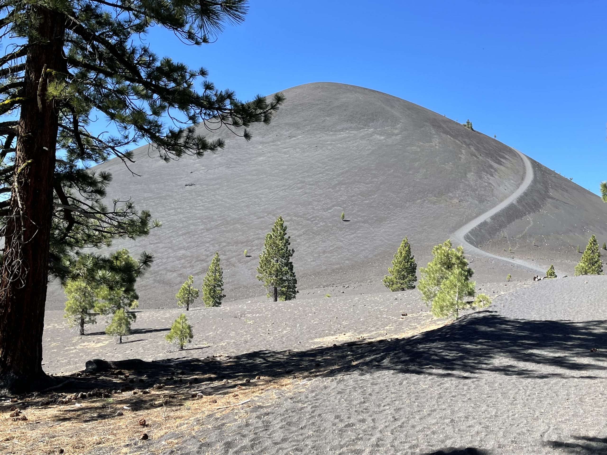
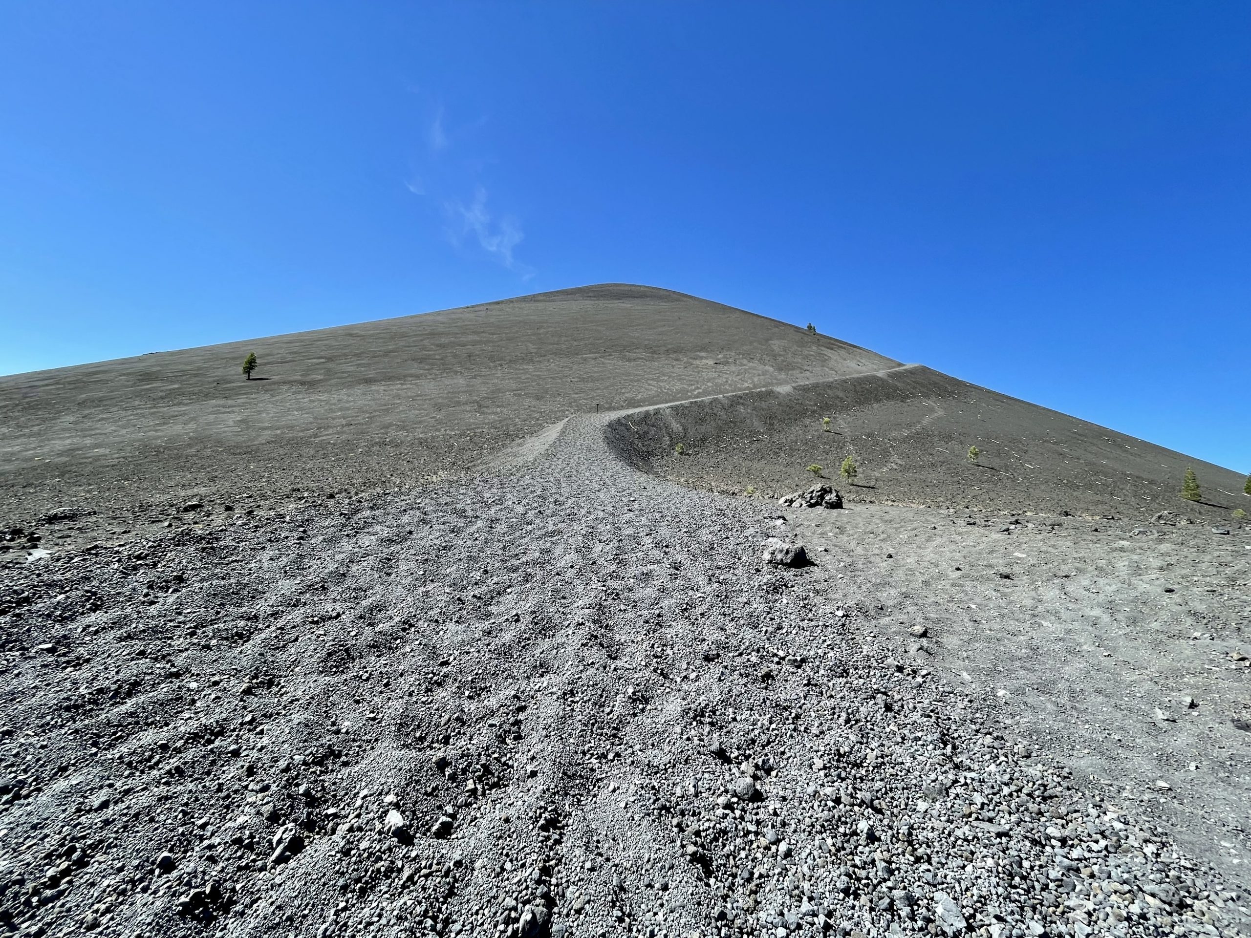
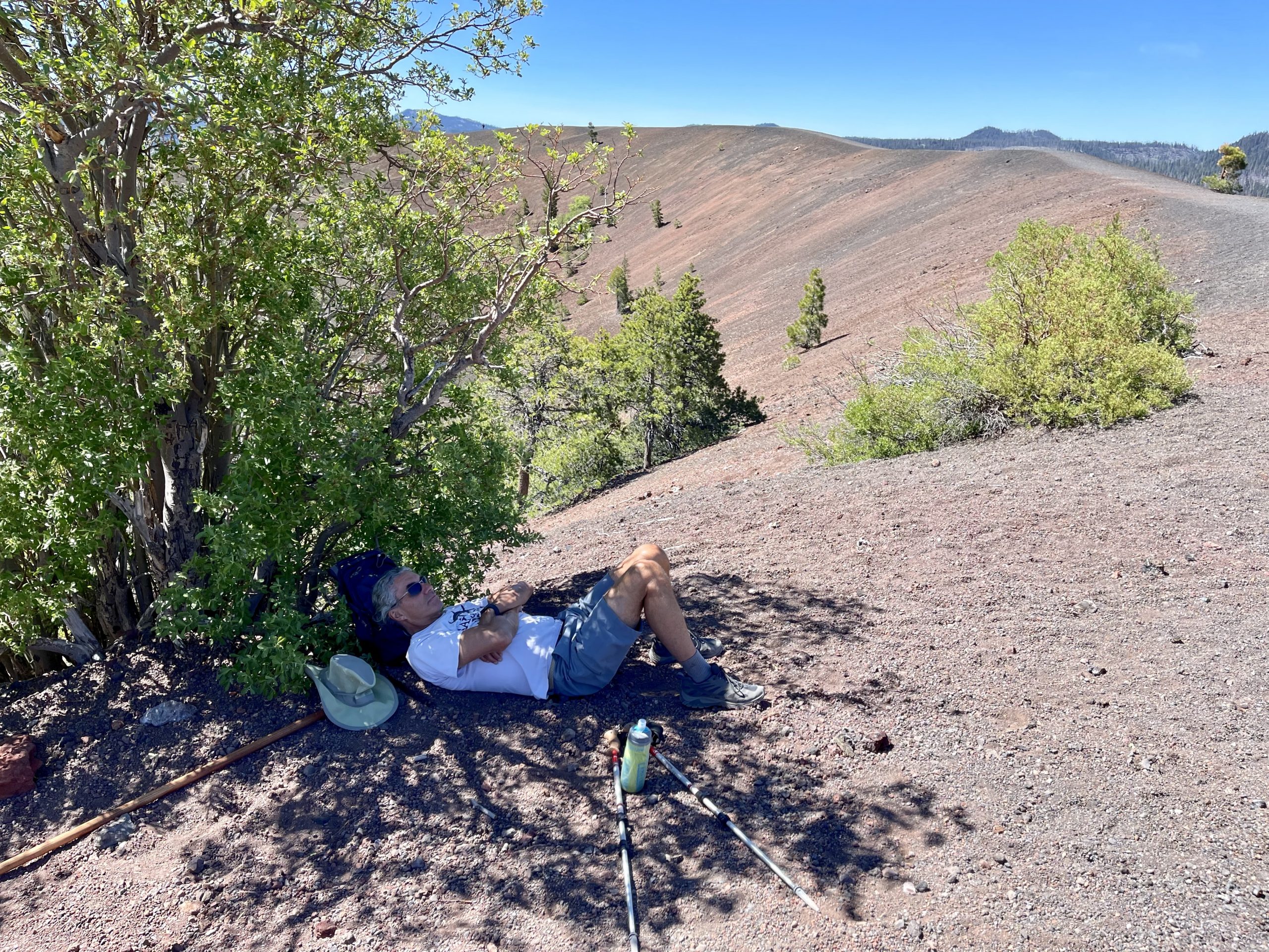
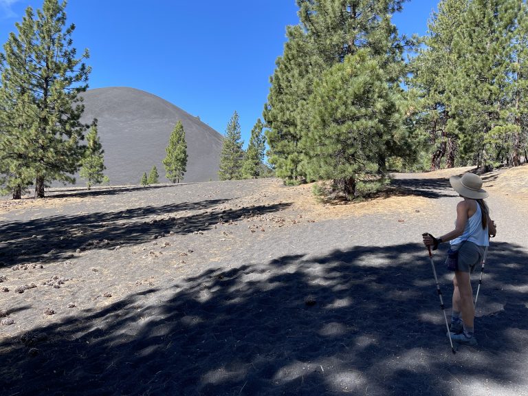
Eventually, we started back down from the top but this time it was two steps forward and one (more) step forward sliding in the cinders. Then we started running like kids, taking huge steps and sliding down as much as we were stepping, making the trip down in minutes instead of the hour or so it took to climb. We stopped near the base at a shady ponderosa pine for a water, a snack and to rest. We watched the late hikers heading up, most with a look of concern after seeing the steep barren trail ahead and feeling the noon day sun. Some took one look up at the cone trail and turned back.

Once back at the campsite, we rested and drank lots more water while relaxing under the giant pines. Like the day before, we did the “shade shuffle” moving our chairs into the shade to keep cool as the sun moved across the sky (in the morning, it was the opposite as we moved our chairs into the warm sun). Then we trekked the quarter mile or so to Butte Lake, which was several feet low due to the drought. We picked our way around the dry lake bed to some jumbled black rocks from the lava flow and found a place to wade and wash the dust of the trail off. Being clean felt wonderful. The rest of the day we spent at camp, relaxing and planning the next day’s adventure—kayaking on the lake.

Leave a Reply

Share this post