Post #78: A shaggy oasis

February 13, 2021

We both woke up by 7 groggy from lack of sleep. The loud couple got up and waved to us and we grudgingly waved back. As I walked by them on the quarter-mile path to the only outhouse around, the man struck up a conversation about the similarities of our trucks—both 2006 Yukons. He was so friendly it was hard to be mad at him for the noise the night before and we chatted for a while. They (like many visitors here, I suspected) were from the L.A. area. The night before they had hiked Ladder Canyon in the dark with headlamps, which would explain their late arrival. I could tell they were fellow adventurers and that we had a lot in common. Later, we’d tell them of the slot canyon hike nearby we’d found that they were eager to try.

Our goal was to stay put for the entire day, something we find hard to do. We like the journey at least as much as we like to be at our destination. 

We made coffee and oatmeal and waited for the morning sun to warm us. Then we sat in our camp chairs and managed to do nothing for a good hour.

Warming up in our huge campsite
Man surveying his domain

We decided to climb up a small sandstone mound next to our campsite to survey the area. At the top, we were amazed to find a weak and sporadic cell signal that enabled us to check the weather forecast (very strong winds were heading this way by sometime in the afternoon). Soon the air was warming and we decided it was time to explore our newly-surveyed neighborhood.

Sand under our feet and purple morning sky above us as we headed down the dry wash

We decided to follow the nearby ridge where a dozen small canyons fed into the dry wash where we were camping. Downhill from our campsite, near where other people were camping at the base of the canyon wall, we discovered a mostly-abandoned gravel jeep road that wound back into the canyons. 

We followed a side trail where the canyon walls cast large morning shadows

Of course, we followed the jeep road back into the canyon. It went at least a mile, turning into an ATV trail, then a foot trail, and was surrounded by sandstone walls and side trails where we could easily get lost. 

This would be a great shelter in a storm
Hard to tell from the photo, but this was a nearly vertical 75-feet high "shortcut" back from the jeep road to the sandy wash. We opted not to attempt the steep and narrow climb down
Even though the artist violated the Leave No Trace principle, we had to admit their guitar and fiddle carvings in the sandstone wall were first rate

After exploring the trail, we headed back along the ridge and through the wash, turned up another canyon and were able to scramble a half mile up through fine sand and sandstone ledges before we were stopped by a giant boulder. We explored a few narrower canyons as well, but none went very far back. 

Massive metamorphic boulders aoppeared to have fallen off the cliffs and were strewn about one of the trails

Finally, nearer where we camped, we entered a larger slot canyon that we’d seen when we came to Mecca Hills two months before and had vowed to explore better. 

I think this is as far as we go
Heading back down the (dry) waterfall
It was great fun and by the end of the trail we were grinning like little kids

The final canyon was like an adult playground with boulders to scramble on, level sandy washes, narrow foot-wide slots and steep climbing with some convenient handholds mixed with rotten sandstone that crumbled when we grabbed it, making the going challenging. We twisted and turned up the small canyon until we were met with a massive pile of impassable boulders. 

By now, more and more people were streaming in to Mecca Hills. It was a three-day weekend with warm weather. When we were here a few weeks ago, there were maybe a half dozen campers in the whole area, but now there were dozens streaming in for the weekend, several with loud ATVs—and the wind was coming. We’ve had our share of camping in wind, and the thought of a dusty, gritty night wasn’t appealing. 

We started looking at our map and our iOverlander app for interesting places nearby to explore and camp. There was a an area of BLM land not far away with a view of the Salton Sea that seemed worth checking out and, because we’d pretty much explored all of our surroundings, we shoved off. We really can stay two days somewhere. Someday.

Dead fish are scattered along the shoreline
The Salton Sea is now a resort ghost town

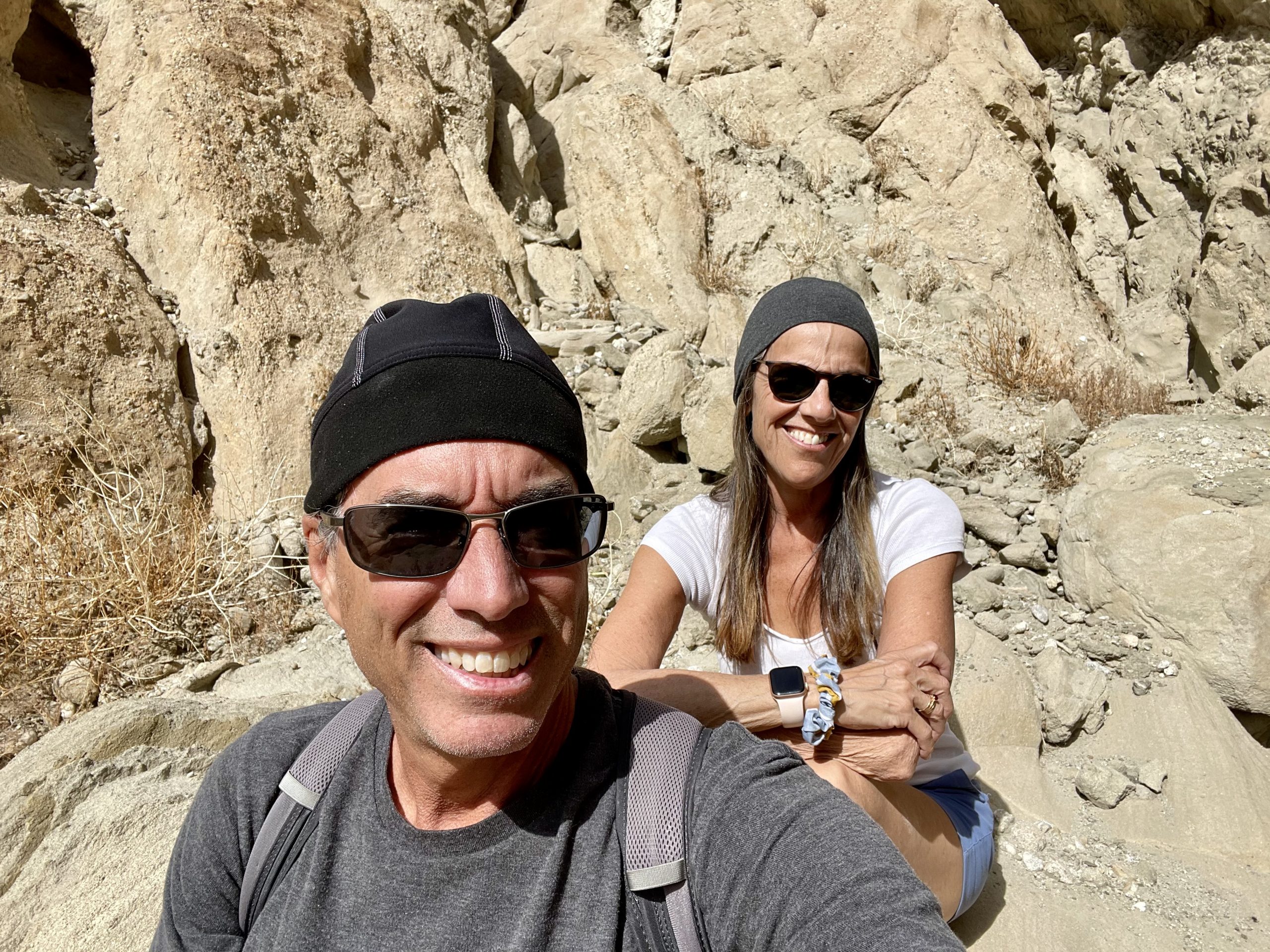
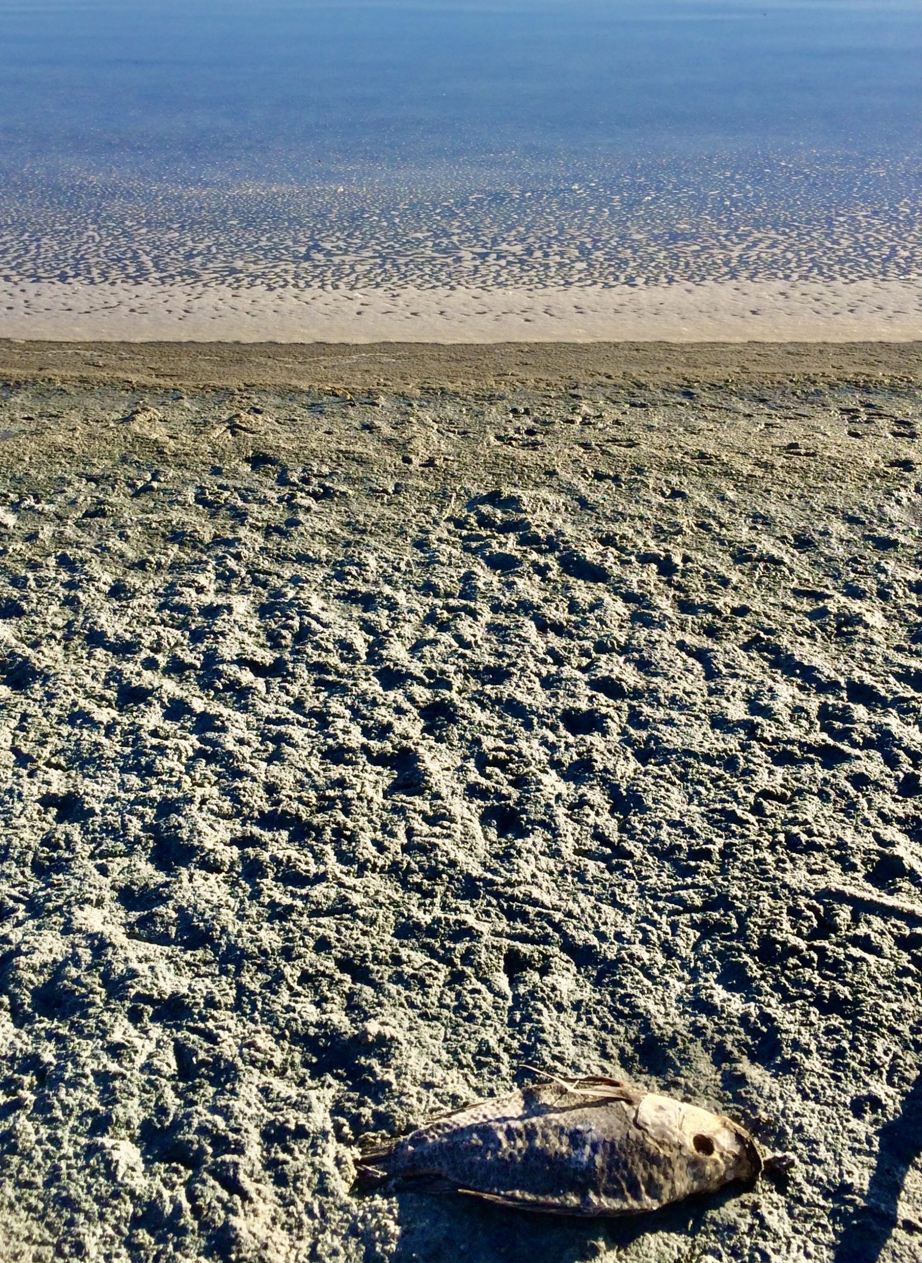
Susan had visited the nearby Salton Sea area about five years ago and warned me there wasn’t much “there” there. She also recommended that we keep the windows closed–the sea’s shores were littered with dead fish. 

In the early 1900’s, due to a misguided effort to irrigate the land, the Colorado River overwhelmed the too-small canals meant to divert part of it. The river flooded a huge area of the San Andreas fault that became the Salton Sea. By the mid-1900’s, resorts sprang up in the desert around this new inland sea. But with the canals closed, little water coming in and lots of water being used for irrigation, the Sea began shrinking, becoming more saline and killing wildlife.

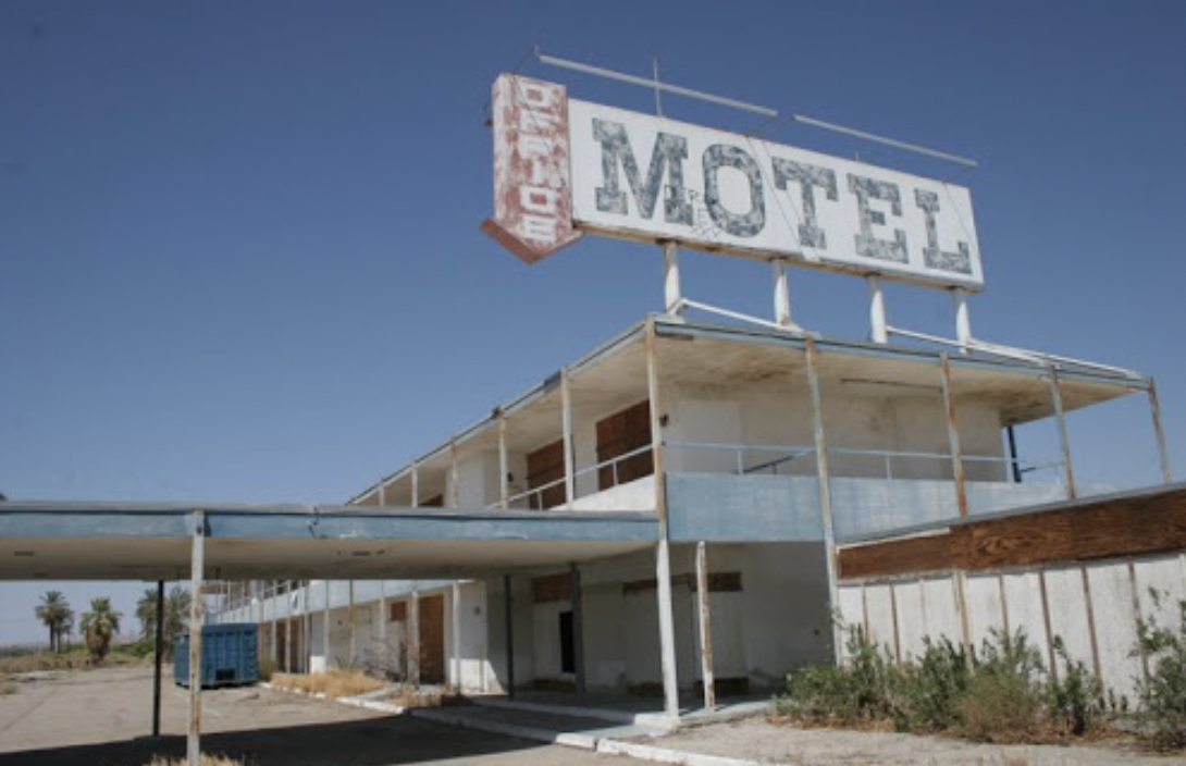
Eventually, winds blew toxic dust to nearby communities and sometimes residents of Los Angeles, 150 miles away as the crow flies, could smell the dead fish and whatever else we were smelling. The remains of the old resorts have been rusting away for years and the Salton Sea has been called the biggest environmental disaster in California history.

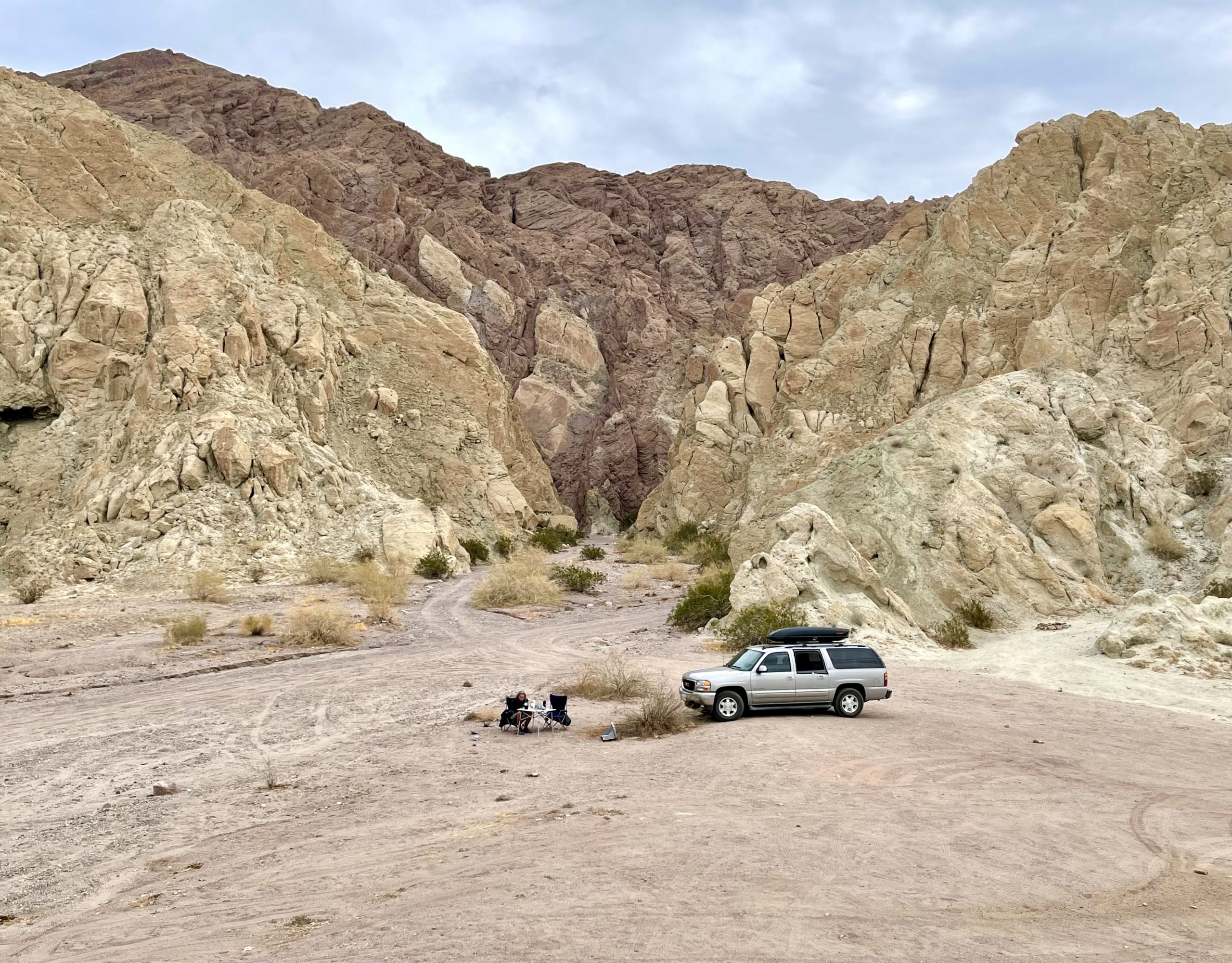
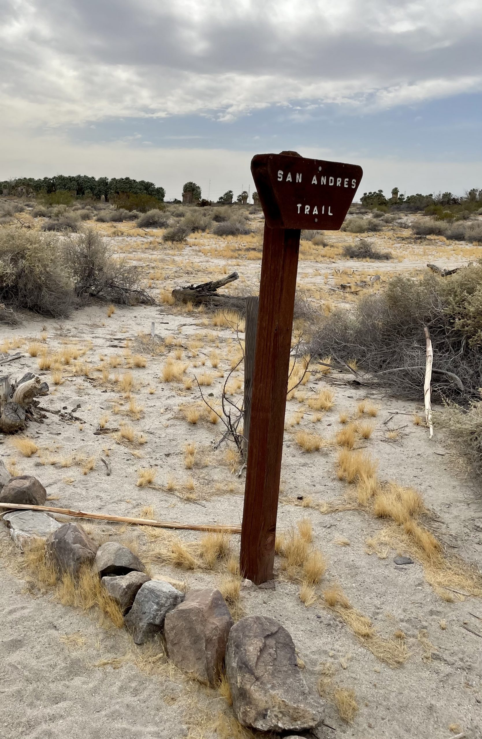
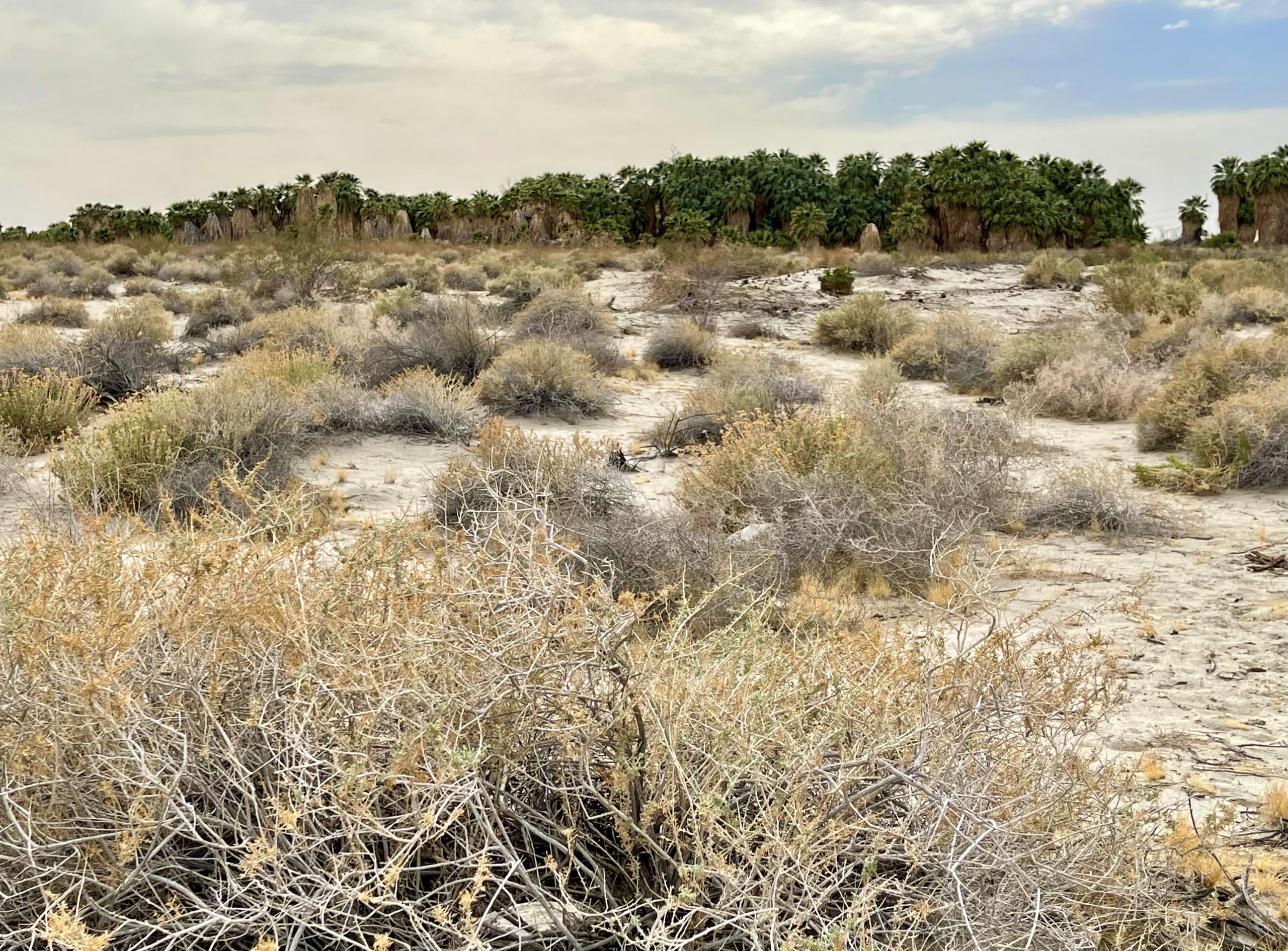
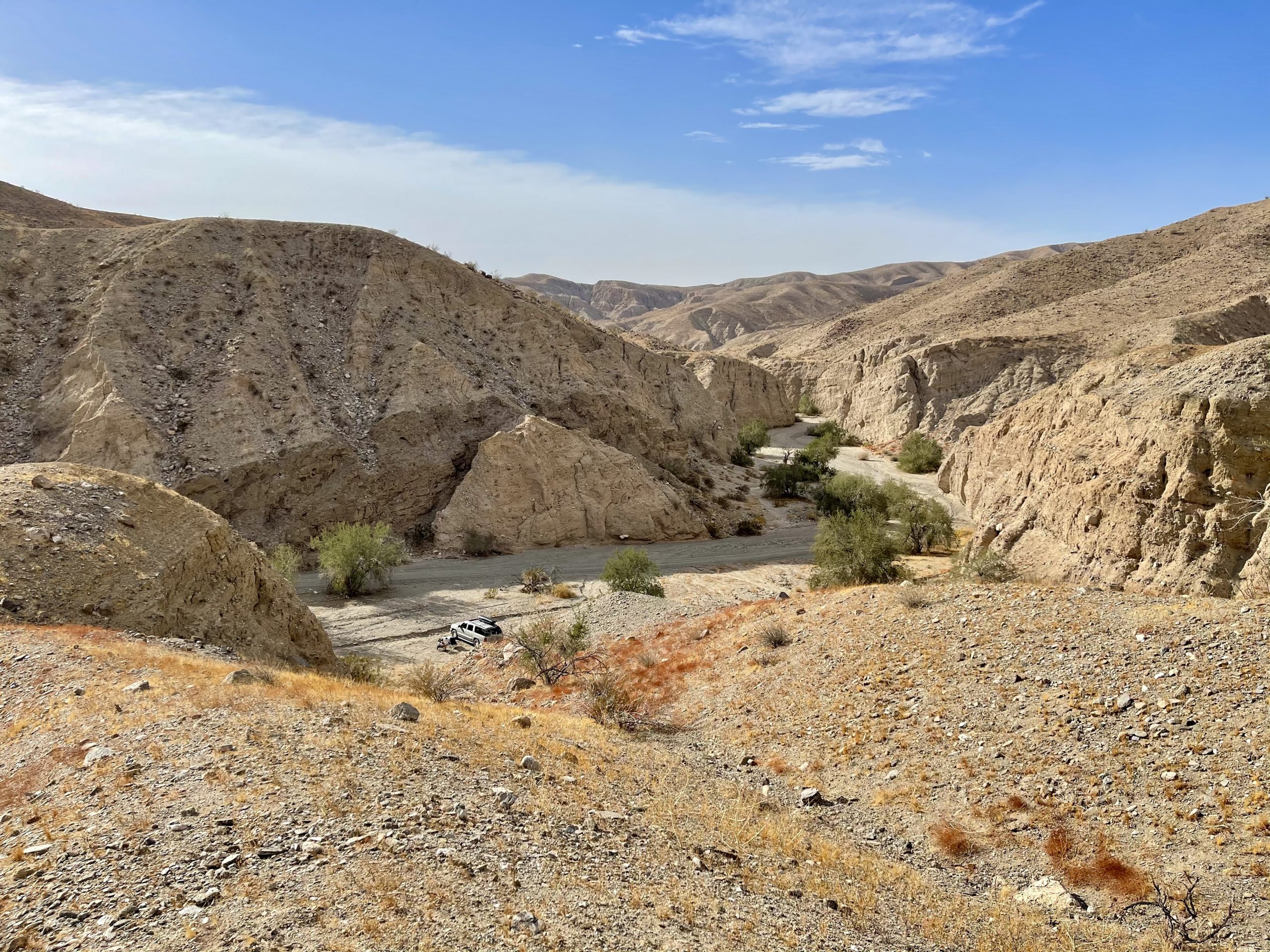
We continued past the sea to the BLM area nearby, only to discover that it consisted mainly of a gravel lot with a distant view of the not-particularly-attractive sea, and quickly decided that it was not someplace to spend any time, let alone the night with strong winds coming.  

Just as we started heading off, we noticed a palm oasis in the near-distance. So instead of leaving, we pulled off into a nearby parking lot (with a restroom!) and spotted a trailhead for the San Andreas Trail.

Appropriately named, given we were right at the fault
The green of the palm trees contrasted with the yellowish brown of everything else
The swaying palms gave us a hint of the wind headed our way
Palms in their natural state were more interesting than well-groomed ones
The spring responsible for the oasis pooled beneath the unkempt palms
There was something Disney-esque about the trail

We strolled through the ancient shaggy desert palms along an easy half-mile trail that led around and into the towering trees. Tucked under the fallen palms we discovered a small spring that feeds the oasis. It was wild and in its natural state and we thought it interesting that some of the smaller fan palms were identical to the ones we have at home, just not as “groomed.”

The wind was already picking up as we left and headed back in the direction of and then past the Mecca Hills dirt road turn-off. We headed down fittingly-named Box Canyon Road, searching for a more secluded place to camp in the surrounding BLM land. We’d come down this road two months ago en route to Joshua Tree and knew there would be boondocking opportunities. All along the side of the beautiful, twisty road were sandy pullouts adjacent to towering sandstone canyons. Many spots along the initial stretch of the road already were occupied by holiday weekend (Presidents Day) campers, so we kept going. As usual, we hoped to find something more remote. 

After a few miles we spotted a narrow sandy jeep road (actually an old wash) and followed it back into a narrow canyon. Immediately, I had to engage 4wd due to deep sand. Few campers would likely be out this way, as most had 2wd RVs or vans. We struggled a little even in 4wd and I was a little nervous, having had recent (and hopefully repaired) 4wd issues and knowing there was no way out without it. But by now we were in the sandy wash and had to trust the truck. We eventually came to a very remote spot where the canyon widened and where we’d be protected from the strong forecast winds. It was perfect.

Tucked away from the wind in the box canyon
View of our campsite from the hilltop
Braving the wind at the top of the hill in an attempt to learn more about the weather heading our way

After adjusting the truck in the best spot for wind protection, I scurried up the steep wall behind us with some difficulty until at the top I could see a far-off tower that must have only been for microwave transmission, not for cell service. There was no internet weather or calling for help back here.

The sky changed from a blue and white painting
To a pink and orange one

The wind was blowing hard by the time we’d prepared dinner, so we ate inside the truck while we watched the changing colors in of the desert sky as the sun dropped behind the canyon walls. We hoped it would be a quiet night, aside from the strong wind.

One Response

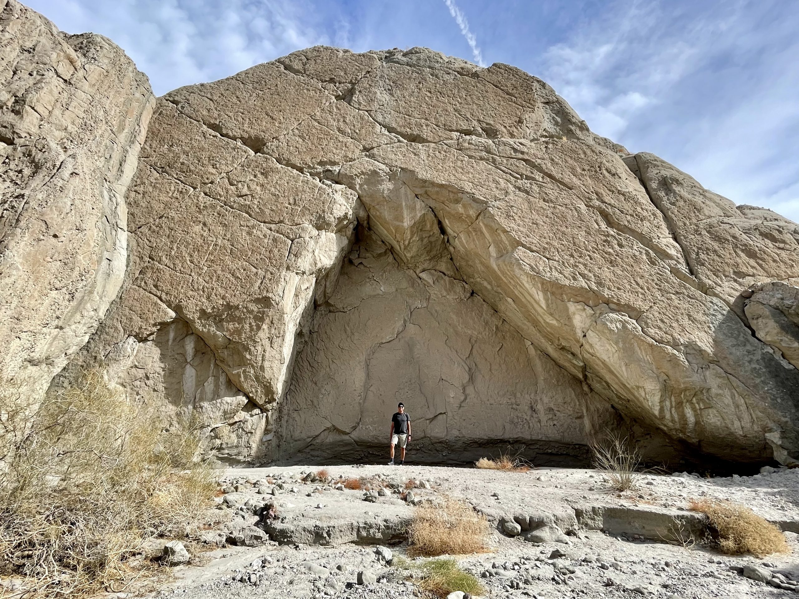
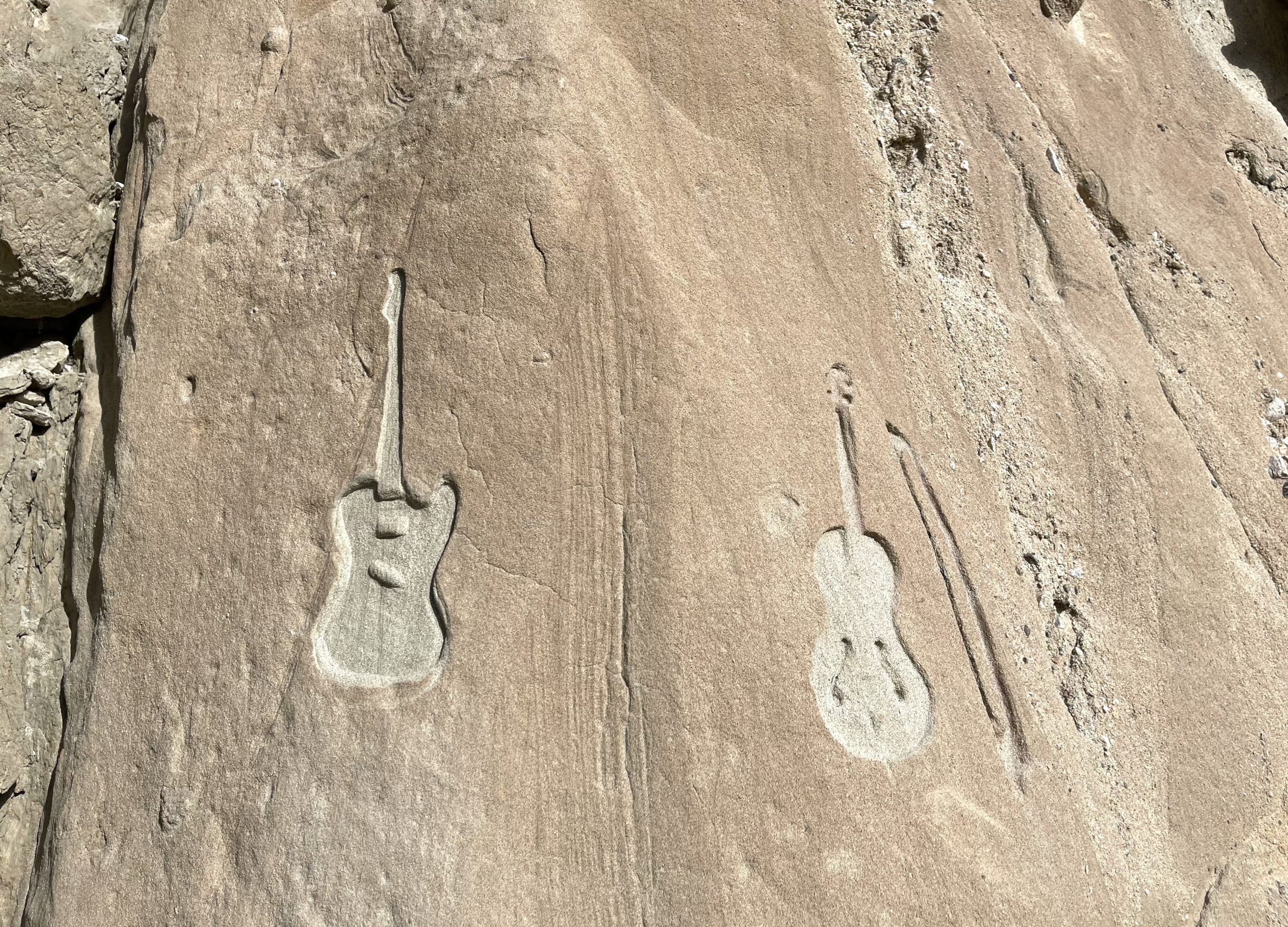
  1. Beautiful post, gorgeous campsite and rock formations. Speaking of rock, I love how the images of guitars emerge naturally on the walls. What are the odds of that?!

Leave a Reply

Share this post