Post #116: The North Rim

September 5, 2021

Last night was chilly and clear and with the new moon the sky was very dark and about as full of bright stars as we’d ever seen. When we woke at 8,500 feet elevation, it was a crisp 45 degrees. During the night I was pleasantly awakened by first local, then long distance coyote howls.

Just after getting up, we headed off to our destination—the North Rim of the Grand Canyon, a place not many people get to see. Even though the distance between the North Rim and South Rim is just 10 miles as the crow flies, the drive from one rim to the other is 220 miles, takes 4½ hours of driving through remote areas with no gas stations, restaurants or stores pretty much the entire way, and culminates in driving for an hour down a national forest road that goes nowhere else. Plus, the North Rim is open only for five months per year due to snow, further limiting opportunities to visit. By comparison, the South Rim is easy to get to, is located only a little over an hour from Interstate 40 and is almost always crowded—it would be especially crowded today because this was the Sunday of Labor Day weekend. We’ve been to the South Rim before and were really excited we’d be seeing the Grand Canyon from a different, and less crowded, perspective.

The drive to the North Rim entrance from our campsite in the adjacent Kaibab National Forest took only about an hour. The road to the park goes through pretty forested mountains and the occasional meadow. We stopped briefly by one of the meadows when we noticed a herd of bison grazing in the early morning sun.

Bison grazing in the Kaibab National Forest

Because the North Rim has far fewer visitors, when we entered the park at 8:00 am there was no line. We parked near the visitor center and were surprised when we stepped outside and even though the temperature was still only in the 40’s, it was oddly warm. The morning sun was intense at our high elevation.


We started off our exploration of the park by following the one-mile Bright Angel Point Trail. The paved but steep trail leads to multiple amazing overlooks of the canyon. It’s the most popular trail in the park but it was only 8:00 am and we had the trail almost completely to ourselves.

First view of the canyon, with early morning light and shadows
It was only in the 40's out but felt warm enough that even Susan (who easily get chilled) removed her jacket
Incredible views and dramatic drop-offs along the Bright Angel Point Trail

Within less than 10 minutes, the immensity of the Grand Canyon was before us. It’s hard to describe just how enormous this mile-deep gash in the earth is, more so from the higher elevation on the north side of the park. The North Rim averages about 12 feet of snow each year versus the South Rim which gets about 5 feet. As a result, the North Rim experiences much more spring runoff, which means more erosion, which means many more canyon offshoots to gaze into.

Magical morning view

The trail begins along a side canyon and winds its way along the rim to promontories with views extending along the rim of the main canyon. From our vantage point at nearly 8,300 feet, we could see across the canyon a good seven or eight miles to the South Rim, which is at about 7,000 feet. 

On the way back along the trail, we stopped at the Grand Canyon Lodge North Rim, where we gazed at the canyon with the same view as the $2-300 a night rooms, plus Susan scored a free coffee in their lobby.

View from the balcony at the lodge. Photo credit nps.gov
Not often you can fry eggs while looking out at a view like this

Back at the truck, we drove about ½ mile back down the road to a picnic area we’d seen on our way in and made a substantial breakfast at a table overlooking part of the canyon. We’d worked up an appetite from our morning hike and we’d need the calories for the challenging hike ahead of us.

Soon, we were on our way to the North Kaibab Trail, which, if you were to take it all the way to the bottom of the canyon, passes through every ecosystem to be found between Canada and Mexico. It’s the most famous trail on the North Rim and it’s the trail that connects with the South Kaibab Trail to reach the South Rim.Unlike mountain hikes, canyon hikes require hiking down first, then a slog back up. 

Unfortunately, as we soon discovered, this is the same trail mules use to take paying customers the 1,300 feet down toward Supai Tunnel where we were going. The mules themselves weren’t the problem, rather the few pounds of mule crap and gallons of mule piss each mule deposited on the narrow dusty trail.

The trail often was too narrow for hikers to stand on the side of the trail when the mules passed, forcing us to climb onto rocks and sometimes loose gravel on the edge of the trail

If you’ve never smelled a 15-foot long stream of mule piss fermenting in the sun, you don’t have the vocabulary to compare how horrible something stinks. To add insult to injury, the mules have the right of way over humans, and hikers are forced to cower against the steep mountainside while they brush by, mule nearly touching human. Fortunately, most of the piss was only in a few places, but the crap could be anywhere on the trail and it smelled almost as bad.

View from Coconino Overlook about one mile down the trail. Most hikers (and mules) turn around here
It was midday and the sun was intense as we hiked

Still, the views were breathtaking as we descended down switchbacks through pinyon pine and aspens at first, then as we got lower, through ponderosa pine and junipers. 

Roaring Springs Canyon, as seen from the trail

In front of us, a side canyon, “Roaring Springs Canyon,” worthy of being called grand in its own right, opened up with steep sides of browns and red with some vertical and some horizontal striations of grays, whites and reds. 

The trail descended steeply past the colorful cliffs
This was one steep trail
Crazy drop-offs alongside the trail

The trail was ominously steep with and we both worried about going back up. Hikers returning up along the trail had glazed eyes that said never again. We asked one returning hiker if it was worth it and she hesitated before unconvincingly saying “yeah.” 

Charles checking out the view below
Supai Tunnel

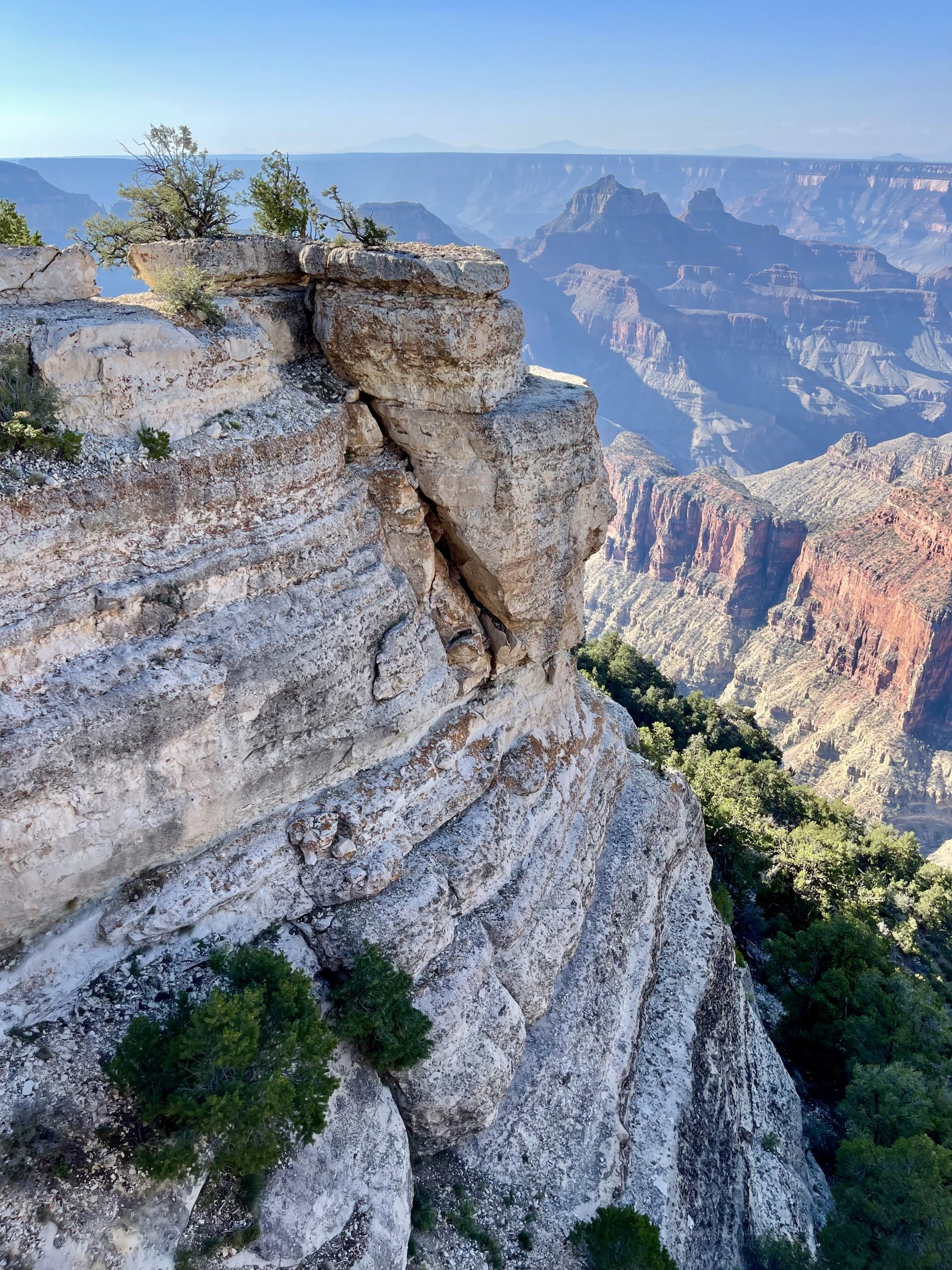
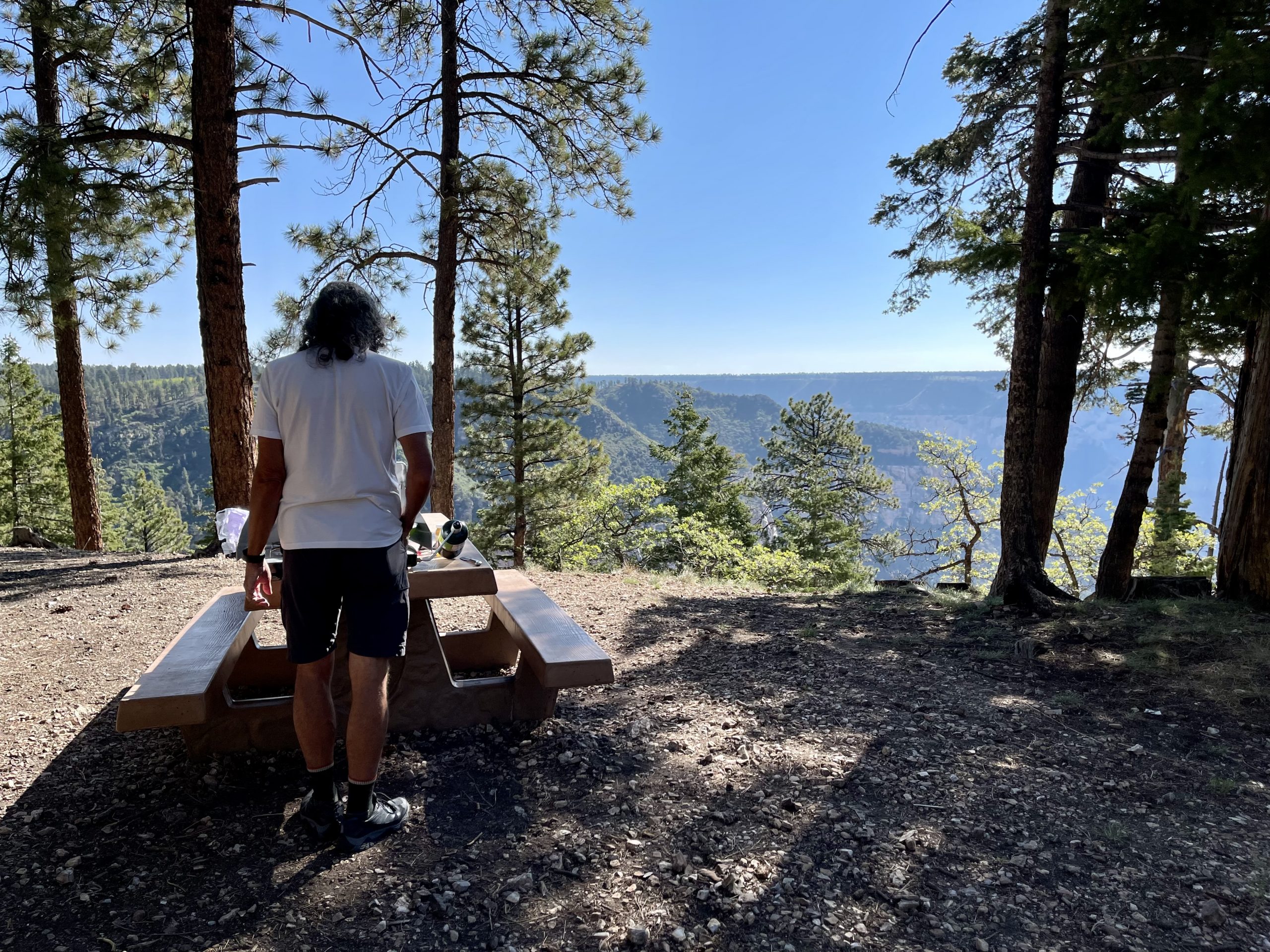
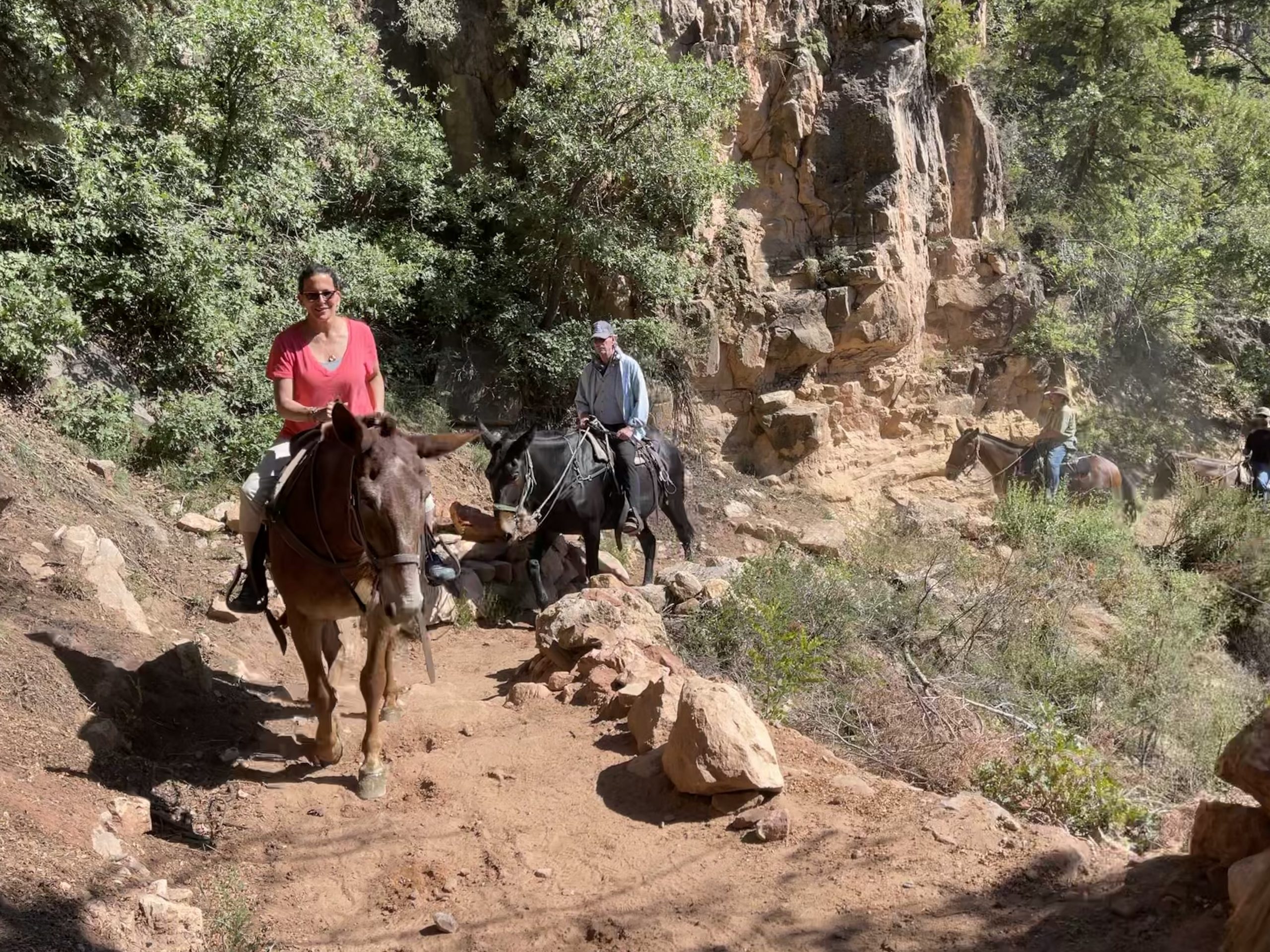
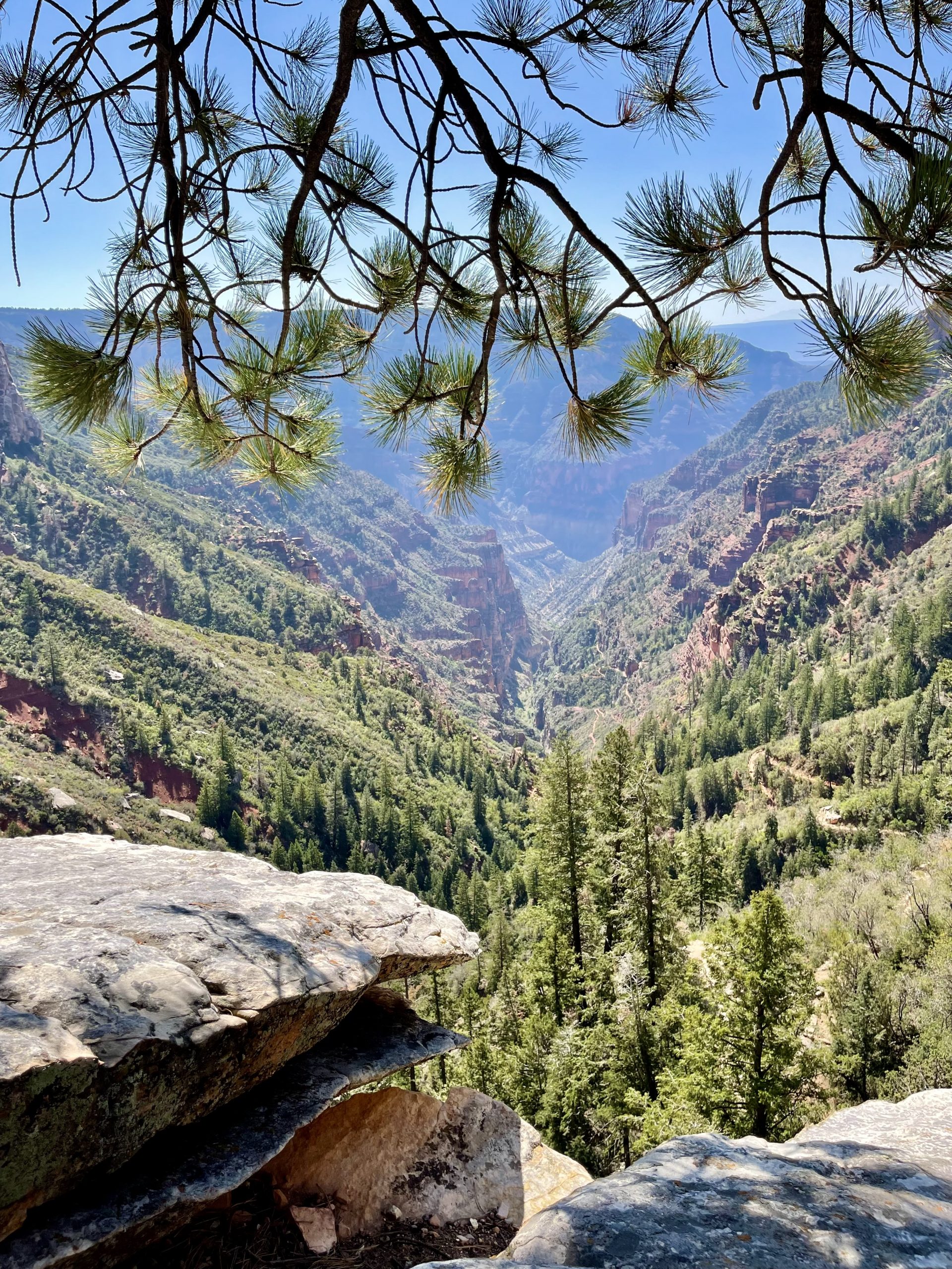
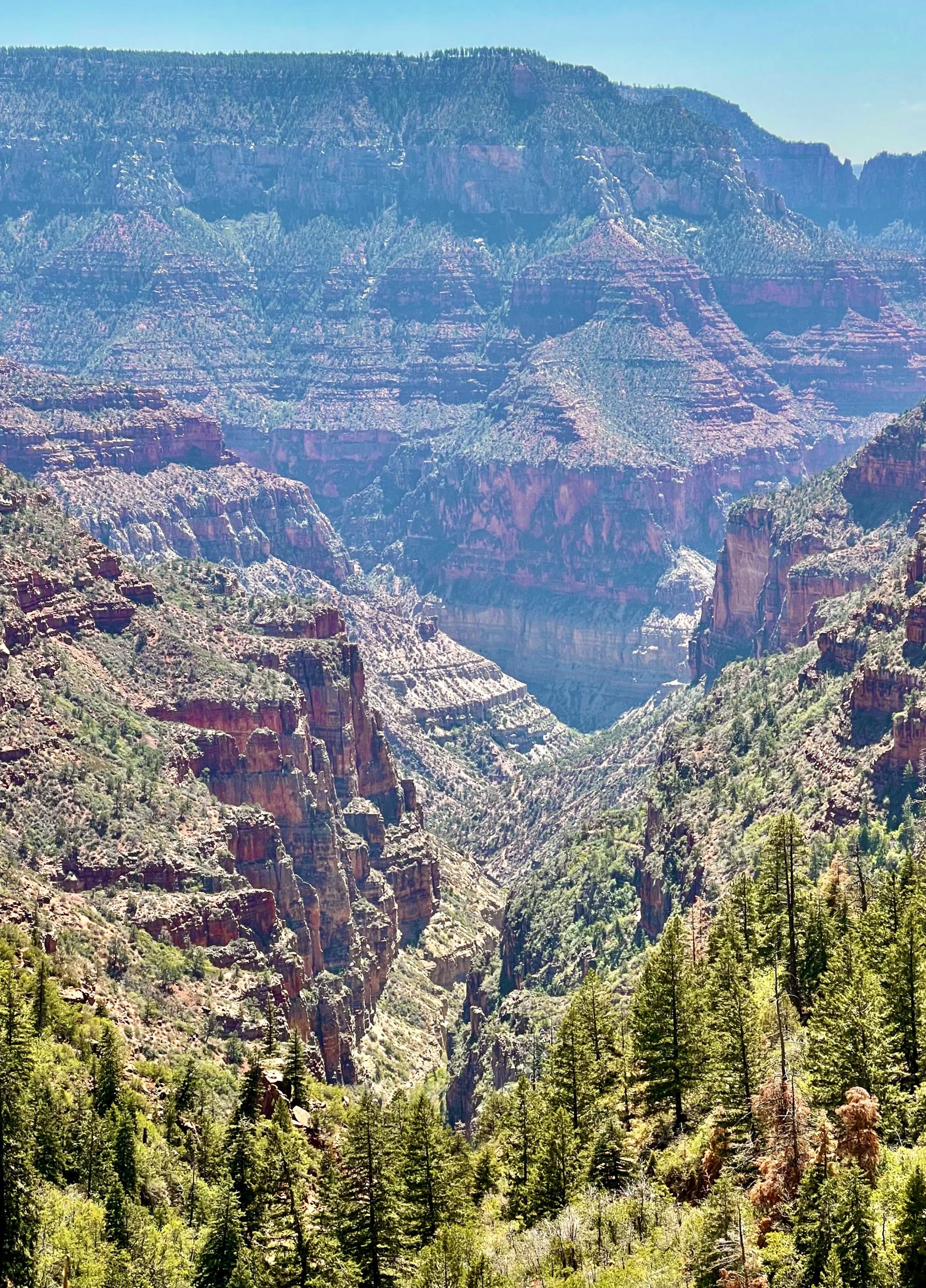
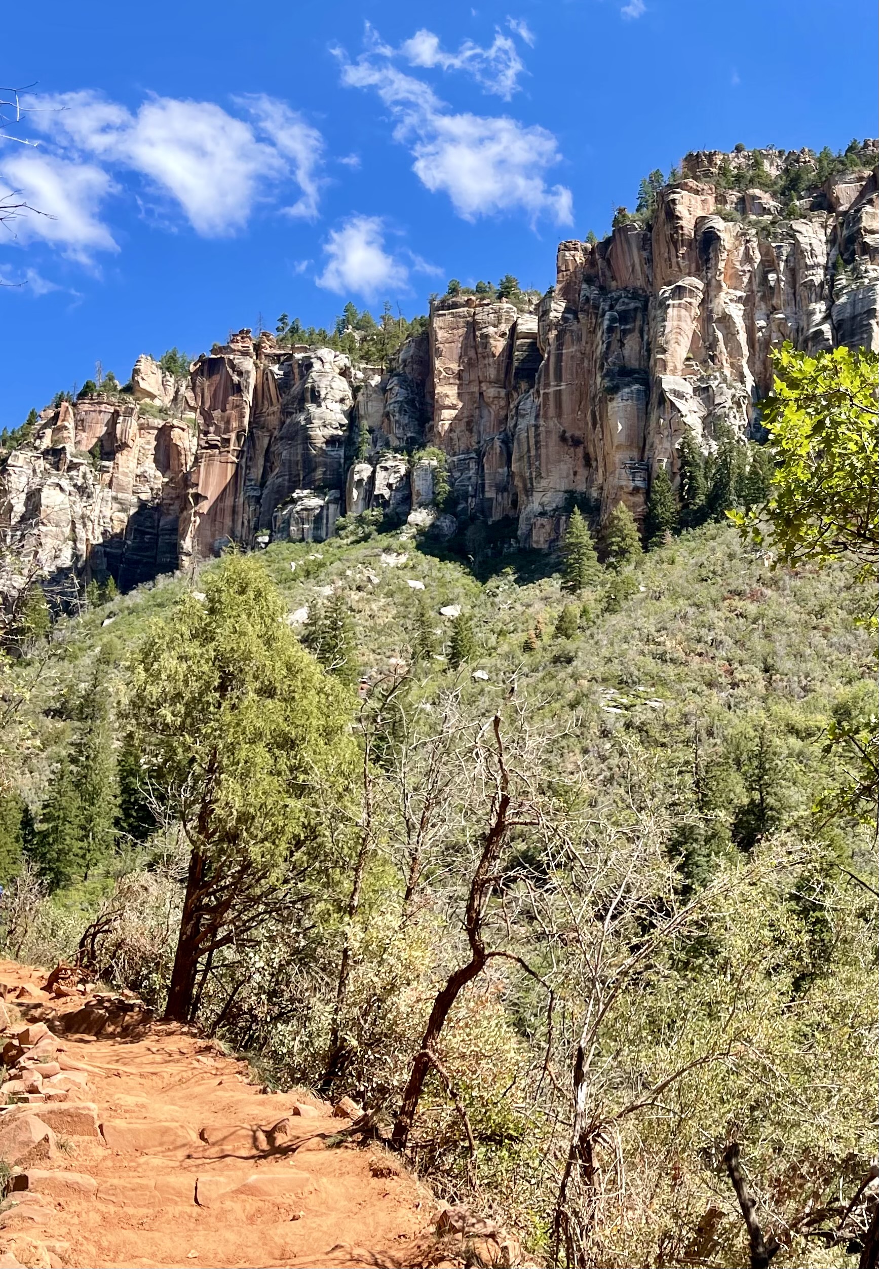
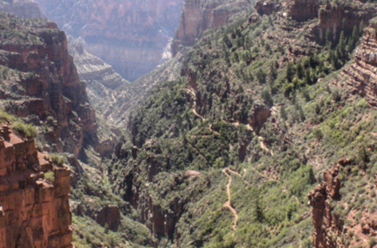
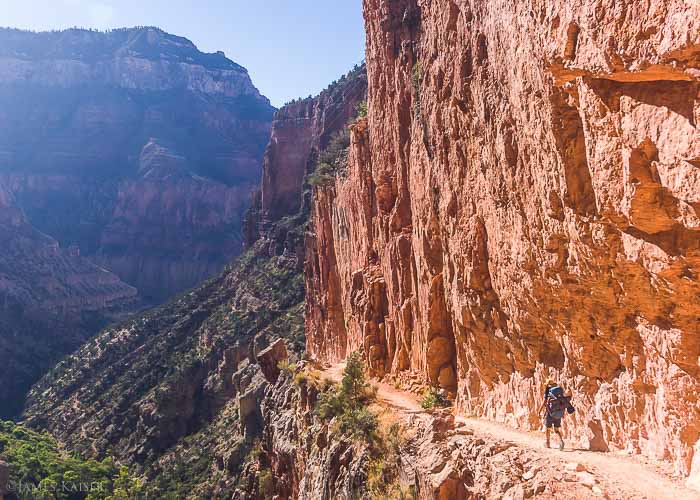
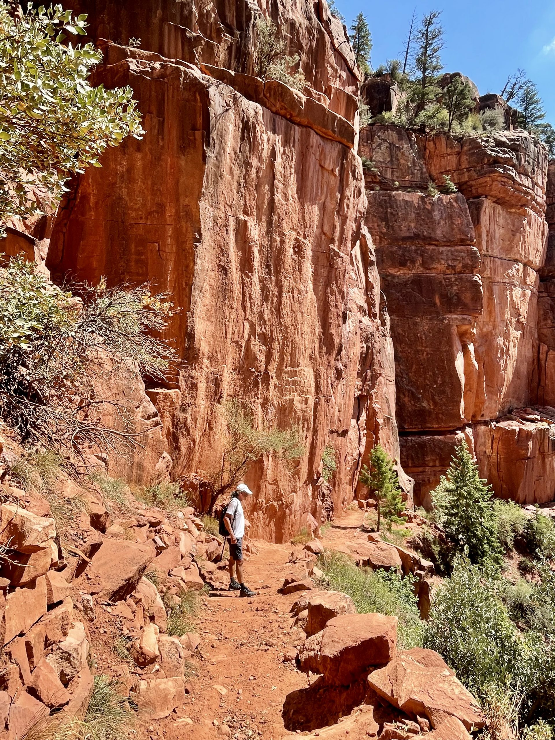
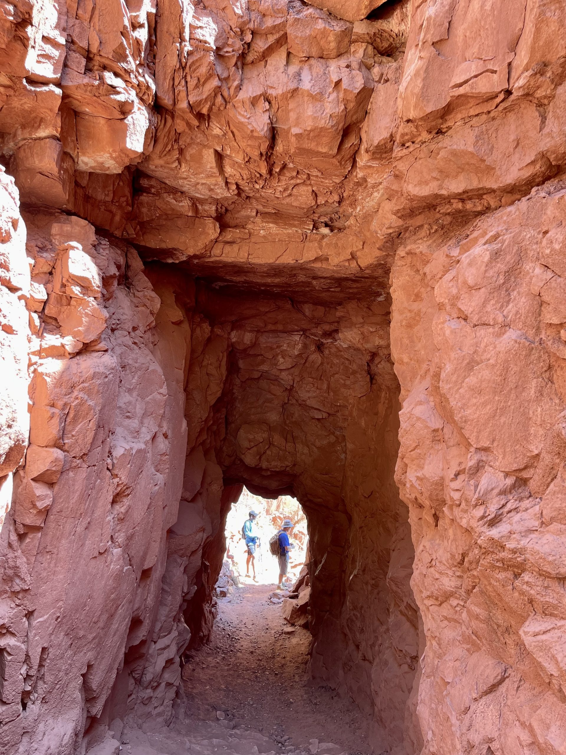
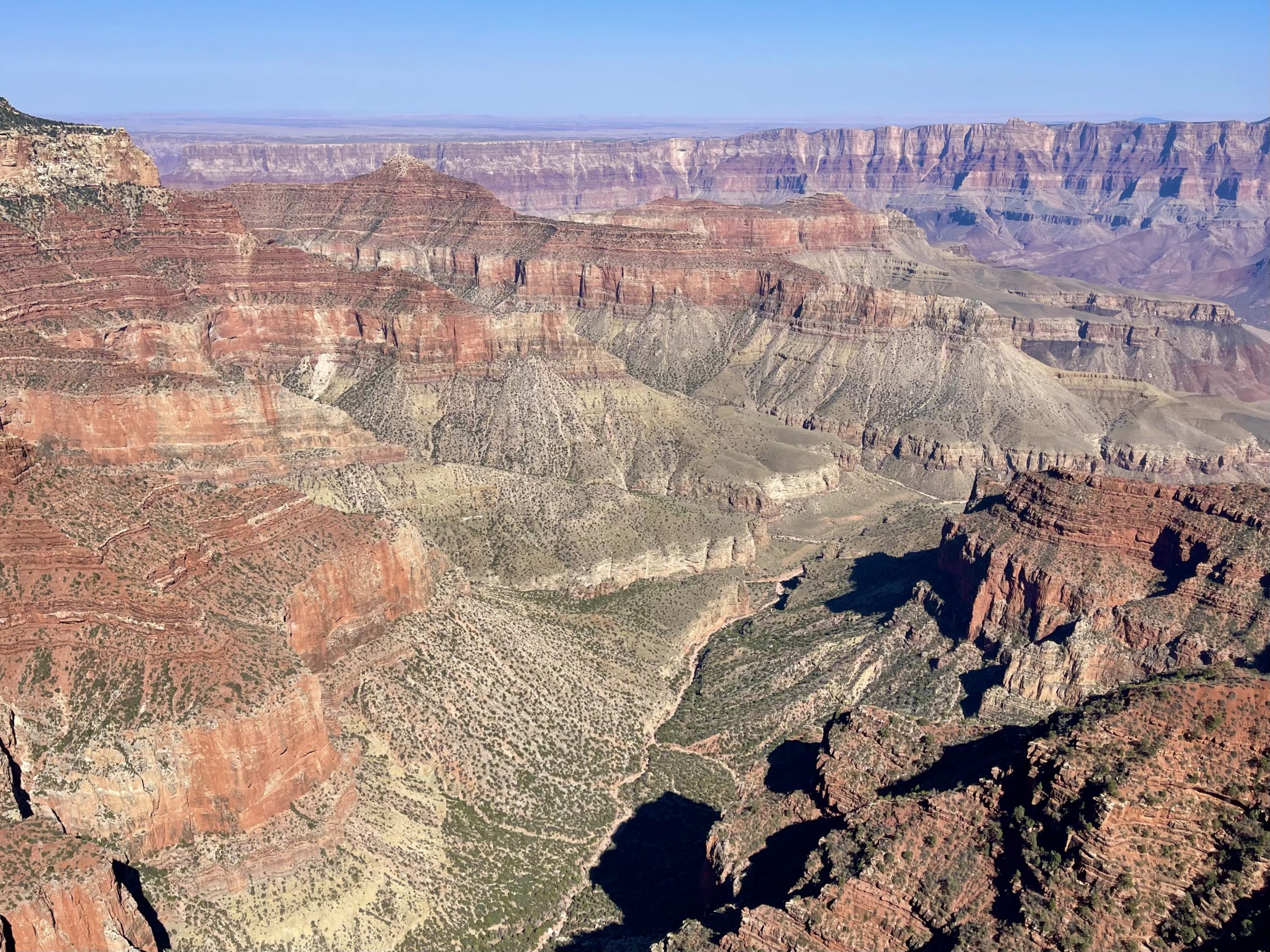
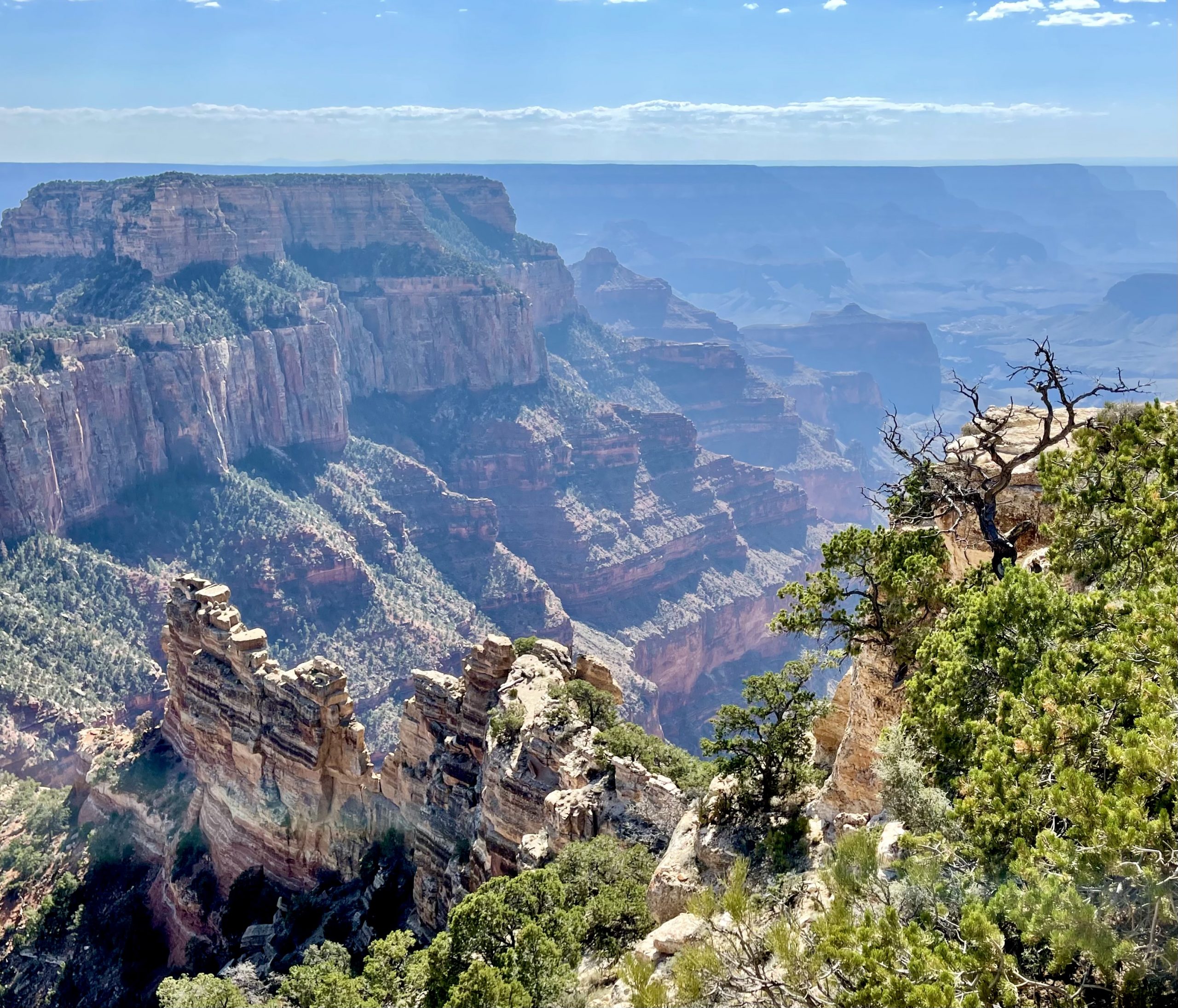
But we continued our descent, dodging a few mule trains with their assorted disgusting smells along the way. The farther down we went the more the trail and the adjacent rock walls transitioned completely to red sandstone. Eventually we reached our terminus, the Supai Tunnel—a twenty-foot-long hole in the rock blasted through by the National Park Service in the 1930’s during the construction of the trail. There, it was shady and cool with a breeze blowing through the opening. Nearby there was, surprisingly, a water spigot where we were able to refill our empty water bottles. Also, the mules didn’t go as far as the tunnel so we had a break from their deposits.


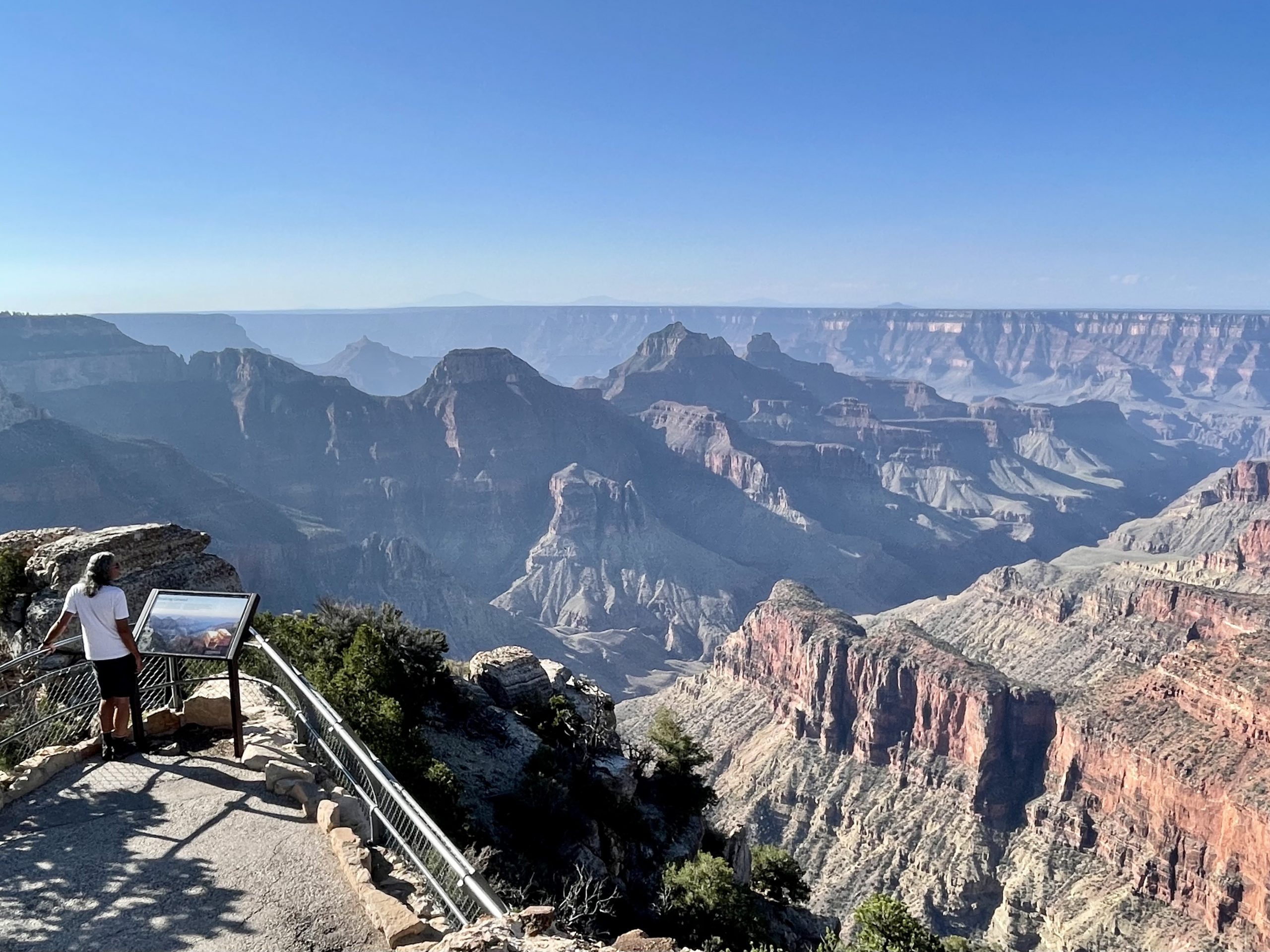
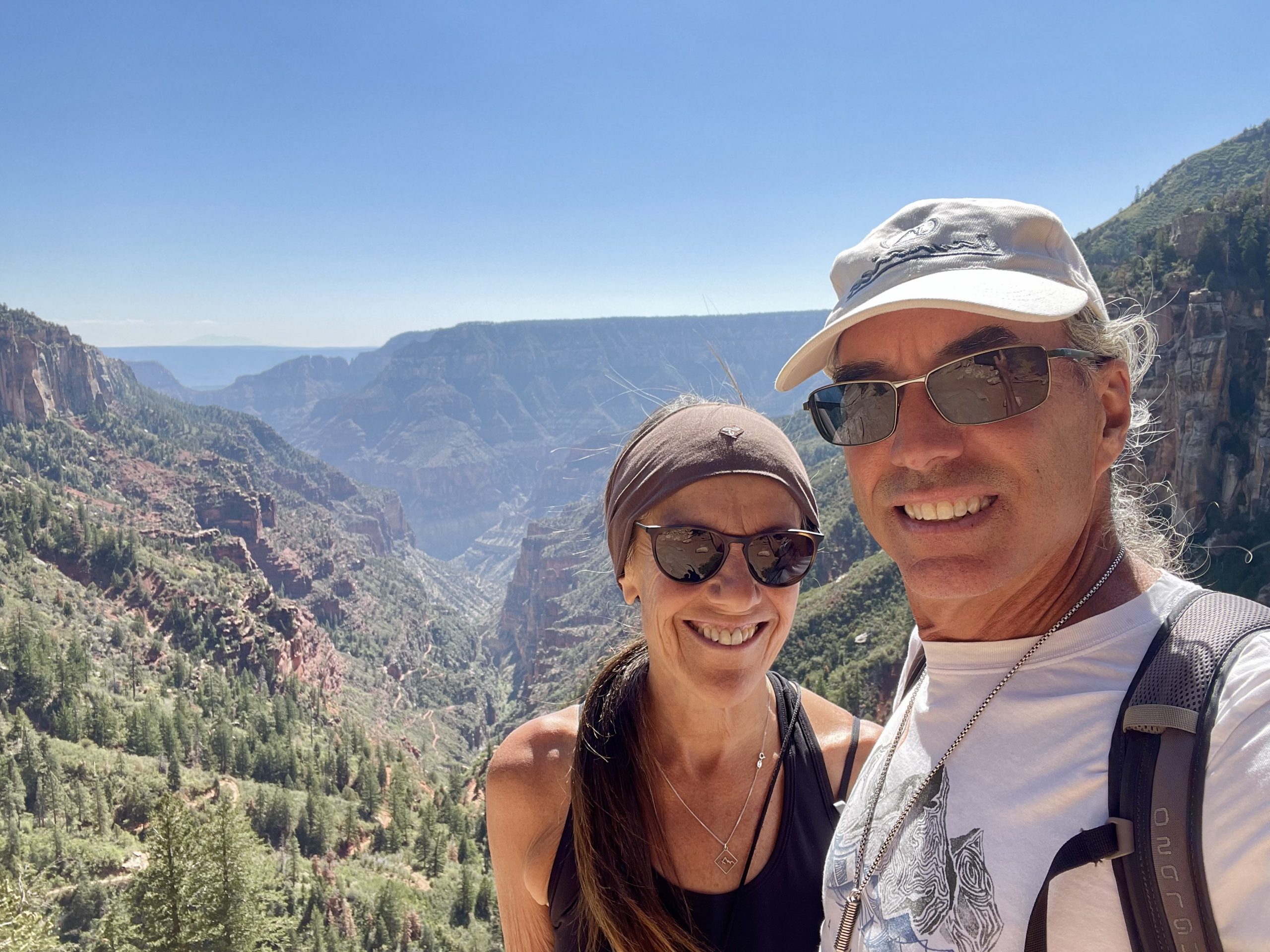
As we rested on some rocks in the cool shade, we chatted with a few other hikers, most of whom were backpacking, had hiked down to the canyon floor the day before, camped there, and now were returning. One lone hiker who appeared close to our age was doing a 48-mile round-trip rim-to-rim hike. He explained that he’d descended from the South Rim, was hiking up to the North Rim, planned to rest for an hour when he reached the top, and then descend the same day back to the canyon floor again before taking the trail back to the South Rim where his car was parked. We assumed he was camping in the canyon in between but even so his plan meant at minimum he’d hike 28 miles with 6,000 feet of elevation gain in one day. Hard core!

We cherished the few even partially shady spots along the trail

Suitably rested, we started back up and soon realized the hour it took to hike down was going to be more like two to three hours to get back up. It wasn’t hot – only 75 degrees – but the baking sun beat on us and the elevation took its toll as we trudged slowly back up, stopping often to catch our breath or when we found rare shady spots, especially after passing through the smelly mule areas.

Toward the end of our ascent, we saw the now-rested rim-to-rim hiker again, this time on his descent. He obviously hiked at a much faster pace than we did. Eventually, we made it back to the rim and reveled in more running water at the trailhead where we washed some of the dust off of us and drank our fill again. 


After we left the trailhead we drove along a slow 24-mile road with several turnouts to view the incredible North Rim vistas. We stopped at several.

The edge of the canyon felt like the edge of the world
The highest overlook in Grand Canyon National Park
View of the protruding pointed rock that gives Point Imperial its name

We took a side road to Point Imperial, the highest of the overlooks at nearly 9,000 feet, where we could see the Vermillion Cliffs, at least 50 miles away.

To get a sense of how massive the Angels Window arch is, look closely to where the arrow points and you'll see there are people (we joined them) checking out the view from the top of the arch
From the Cape Royal Trail there's a good view of the Colorado River far below. The water level of the river was so low that it looked completely dry from above.

When we reached the farthest point on the main road, we parked and followed Cape Royal Trail, which runs along the canyon ridge and provides incredible views. The trail went past Angel’s Window where a giant chunk of rock had fallen out of a tall narrow ledge, leaving a gaping hole through the rock to view the brown Colorado River, miles away.

We stayed for awhile gazing at the views

The trail culminated in an amazing viewpoint across the canyon from the top of the arch. We were surprised that we had the energy for this one-mile out-and-back trail after the strenuous North Kaibab Trail and knew this would be our last hike today. All day there had been only a few people on the trials and roads and it felt like a completely different national park from the South Rim that we’d explored three years before.

Thoroughly hiked-out, we left the park to find a place for the night. We’d be heading southwest for the next part of our trip and were a little frustrated because leaving the remote North Rim required us to head due north for a couple of hours first. 

Back in the Kaibab National Forest, we eventually found a dirt road off the highway, followed it for a mile or two, then turned onto a much smaller one until we found a level spot with our own small canyon view. We’d been looking for a spot that would be in an open area, rather than covered by trees, so we’d have a better view of the stars in the moon-less sky. We’d found just the spot!

About ten feet ahead of us was a small canyon with a an open view
Once again, the Milky Way

Exhausted and hungry, we cooked dinner then watched the sky grow dark as the temperature fell. We gazed at the glowing Milky Way before turning in for the night. We’d sleep well.

2 Responses

  1. Sounds amazing. I mean, other than the mule piss. Second time today that I read about the North Rim as we think about a Grand Canyon visit in the spring.

  2. Sounds like an amazing trip. We hope to do the South Rim soon. We probably won’t be as adventurous as you, but we hope to get below the rim.

Leave a Reply

Share this post