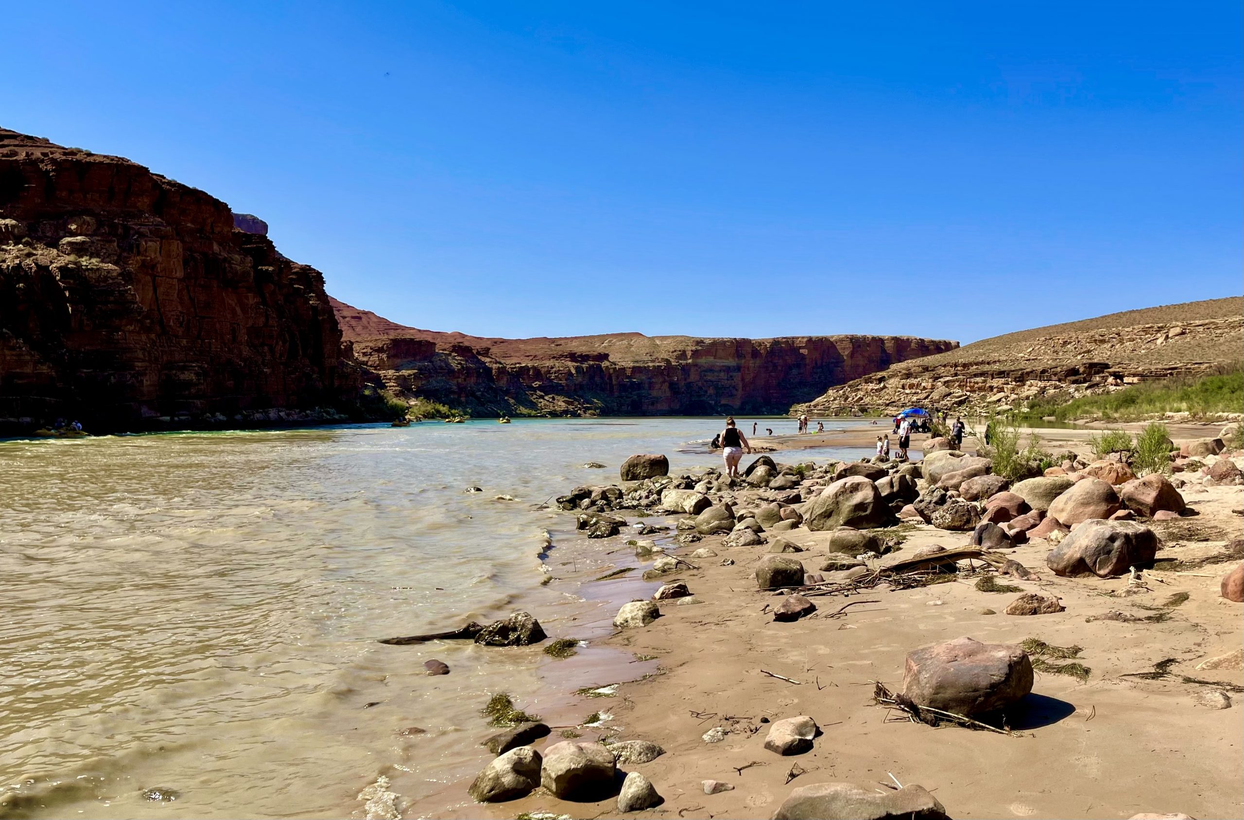
Post #117: Vermilion Cliffs are nature’s gifts

September 6, 2021


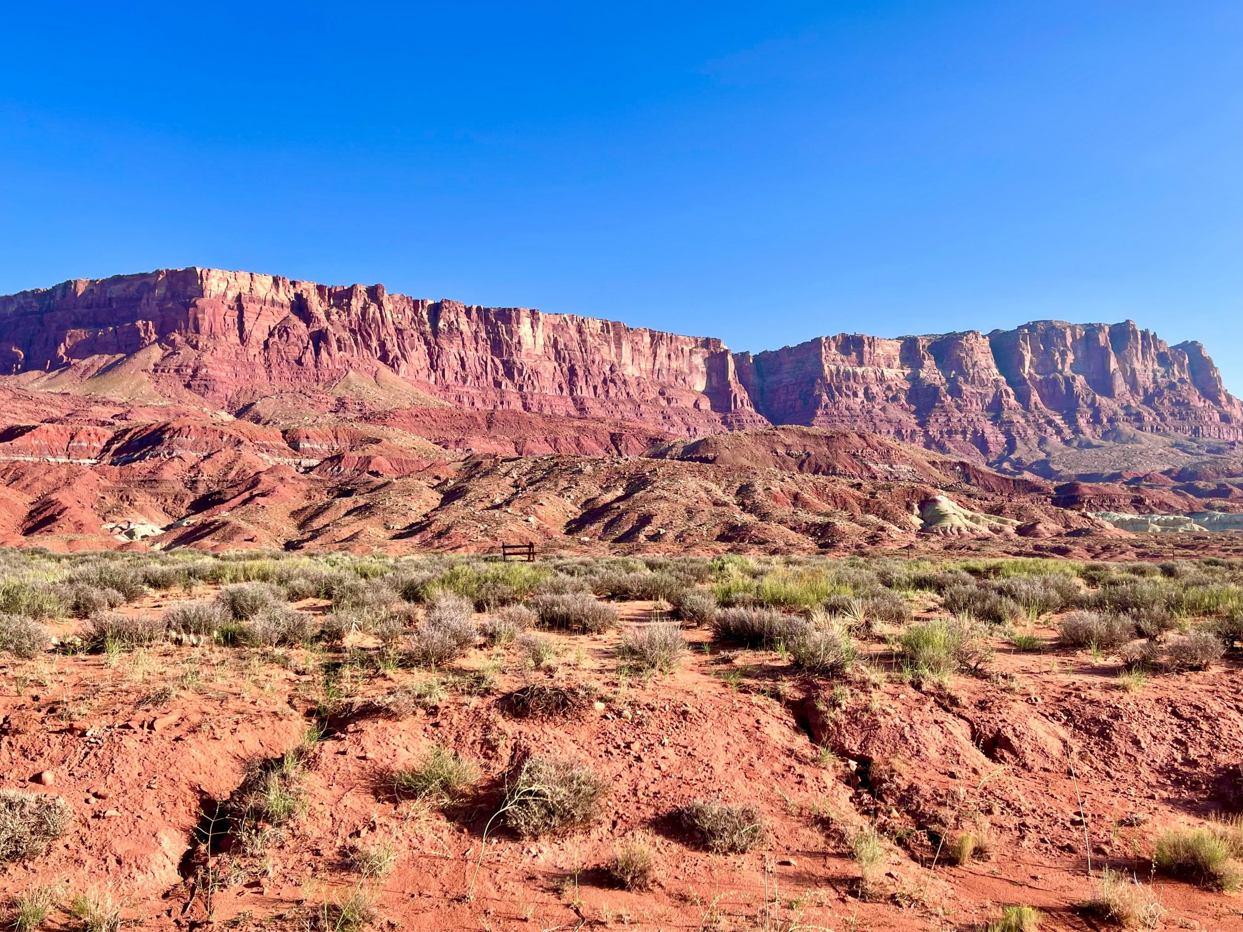
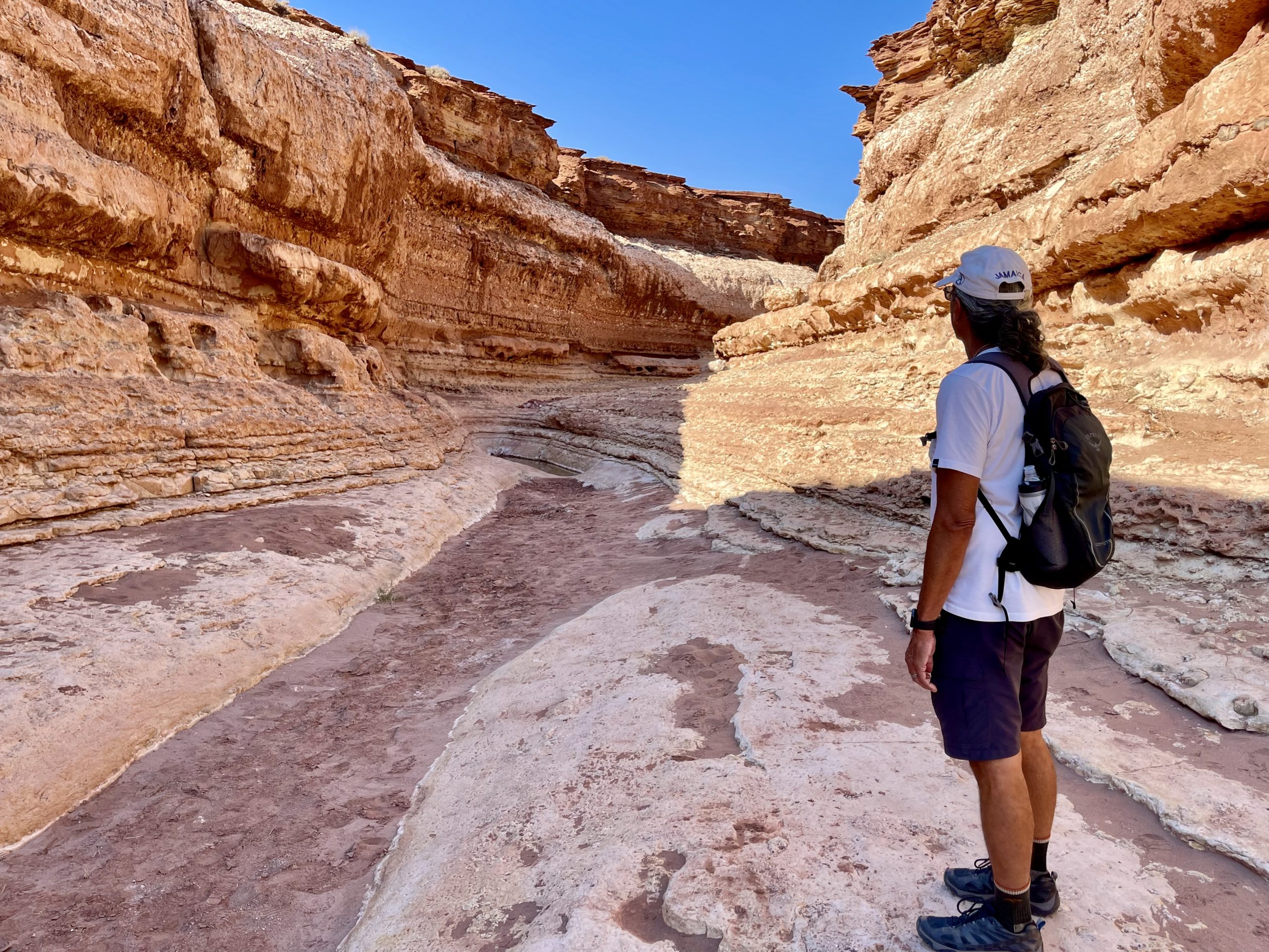
As with any couple, Susan and I each have our strengths and weaknesses. When it comes to navigating, Susan is usually better at roads and routes and I’m typically better with trail navigating. Things get a little fuzzy when we’re on seldom-traveled narrow dirt roads like the ones we came in on the evening before; part road, part trail.


Certain I knew where I was going, we left our campsite and headed back, turning onto several unmarked dirt roads until I was sure we’d find the highway. Susan was not so sure (see above about roads) and thought we needed to make an additional left turn when we started out, but I kept going where I thought the myriad double-track dirt roads would take us out of the forest. After not passing the landmarks we’d come by on the way in, eventually Susan persuaded me to look at our Gaia GPS app, where I found that I was wrong all along but—I smugly noticed—the faint dirt road we were on would still take us to the highway via a different route. My sense of wilderness navigation was vindicated. 


By now, we’d driven for a good 20 minutes along several different rough tracks and I was glad I wouldn’t have to backtrack. Finally, we were only a quarter mile from the highway according to the map (see, I told you I’d find it!) when just around a sharp rocky turn, a huge tree had fallen across the dirt road, hanging up about seven feet off ground. With the roof-top carrier, the truck was about seven-and-a-half feet high. Damn. I thought about taking everything out of the carrier and then removing it (not an easy thing), but it would be my luck another deadfall would be around the next corner and I’d have to do it again. I reluctantly turned the truck around on the narrow road and realized that we had at least twenty minutes to get back the way we’d originally come in. I’d wasted close to an hour thinking that I was infallible on trails and sort-of-kind-of apologized for not listening to the road navigator three minutes after we’d left the campsite.

Out of the woods and into no-man's-land
A small section of the Vermilion Cliffs

Finally back on the highway, we drove a long downhill slope out of the forest toward Vermilion Cliffs National Monument. We stopped at an overlook and were taken aback by the complete change in scenery from the green mountain scenery of the Kaibab National Forest to the vast desert scenery edged by the Vermilion Cliffs in the distance.

We wound our way down the mountain into the vast nothingness and headed in the direction of Marble Canyon, Arizona. We were hoping to find a picnic area to make breakfast but instead stumbled upon the only restaurant for perhaps a hundred miles, the funky Cliff Dwellers Restaurant perched against the red cliffs. We pulled off and enjoyed the view and a somewhat overpriced breakfast on the patio.

The only restaurant for many, many miles
Looking like a sci-fi movie set on Mars, this was just off the highway
A bit of a fixer-upper, but sturdy...

After the decent meal, we drove for just a few minutes until strange rock formations appeared by the side of the road, along with a couple of Navajo women setting up tables to sell their trinkets, and we stopped to walk around. The place looked like it should have been a small national monument with all the strangely-balanced rocks as well as the remains of stone houses built right into some of the rocks, which apparently were built in the 1930’s by travelers seeking shelter en route to the Grand Canyon. There were no fences, no signs and, thankfully, no graffiti. 

Afterward, we stopped for gas and, not surprisingly, saw a group of Orthodox Mormon women, looking more Amish in their long dresses — this was still Arizona but we were only 10-15 miles from the Utah border.


Sadly, we didn’t have the hard-to-get permits to explore “The Wave”—the most famous feature of the area—but we found other treasures to discover, one of which was the trail for the Cathedral Wash slot canyon, which went all the way to the Colorado River.

Cathedral Rock

At the head of the canyon, we looked up at enormous Cathedral Rock, then hiked through a tunnel under the road that led us into the wash.


The trail started in the wide sandy wash and quickly went into a wide slot with high sandstone cliffs alongside. 

Looking back at the tunnel under the road from the entrance to the wash
"This doesn't look too bad"
Okay, so there'll be some scrambling

The slot soon narrowed and a few places required some athletic maneuvering to get around some large pools from the recent rain as well as small dry waterfalls, and the trail soon climbed up the side of the wash. It was slow going.

We climbed over boulders and onto ledges
A couple of days before, this was a flooded wash rather than a trail. We had to be careful not to sink into the mud as there was no easy way around
There were deep crevices in the not-quite-dry mud underfoot

In some sections it was evident the trail had been a raging torrent not long before, but now was crackled mud with deep crevices. We carefully maneuvered through it, avoiding stepping in the squishy sections of mud.

Eventually, we came to a 20-foot-high dry waterfall that would have required ropes and skill to descend, of which we had neither. There was no way around it so we went back, content for the beautiful section we were able to see. As a bonus, we were the only people on the three-mile round-trip trail.

"Hmm. I tried going up and over but that won't work. And the lower route doesn't go anywhere"
Climbing along the ledge of this final section to reach the river was just too dangerous, even for us

At one point, I barely avoided stepping on the smallest frog either of us had ever seen, no doubt recently a tadpole hatched in one of the pools created from the rain. 

The frog was barely the size of a fingernail
Loading up the rafts for a trip through the Grand Canyon

After returning to our truck, we drove up the road  to Lees Ferry, just a few minutes away in the Glen Canyon National Recreation Area. At the end of the road at the fast-moving Colorado River, we saw groups of people loading up onto rafts for trips on the river that went through the Grand Canyon—another activity that requires permits long in advance.

We wandered down to the shoreline, glad to have found another way to get to the Colorado River since we couldn’t make it down to the river from the slot canyon. We hung out there for awhile watching the rafts heading down the river and the families frolicking on the rocky beach.

Small clusters of families enjoyed the beach and swimming in a shallow (and muddy) section of the river

Just as we were about to leave, we stumbled upon a sign informing us, much to our surprise, that we were somehow walking within the boundaries of the Grand Canyon National Park . . . again.

As the arrow in the upper right corner shows, there's a narrow strip, including Marble Canyon and the Colorado River, that's part of Grand Canyon National Park

Leaving the area, we crossed over historic Navajo Bridge. The first of the pair of high bridges (each is called Navajo Bridge) was built in the 1920’s to replace ferry service across the Colorado, and is now just for pedestrians and horses. The second bridge was built in the 1990’s to meet modern highway standards. 

Navajo Bridge. Photo credit azdot.gov

Once we crossed the river, the road finally started started heading south and then west. We’d been traveling north and east for some 85 miles ever since we left the North Rim, even though we ultimately wanted to head south and west—as this was the only route out.

26-foot tall Marilyn statue in downtown Palm Springs
Just hangin' in the park

It was time to head back to California. We made a stop in Palm Springs, where we got a great deal on a nice cool hotel—it was 111 degrees and definitely off-season there. Even in the heat, we enjoyed an evening out exploring the town and before departing in the morning we even spotted a herd of big horn sheep at a local park. From there we stopped in Los Angeles to see some of our kids before the long slog back home to Northern California.

Leave a Reply

Share this post